Another dreary day coming Thursday in Chicago
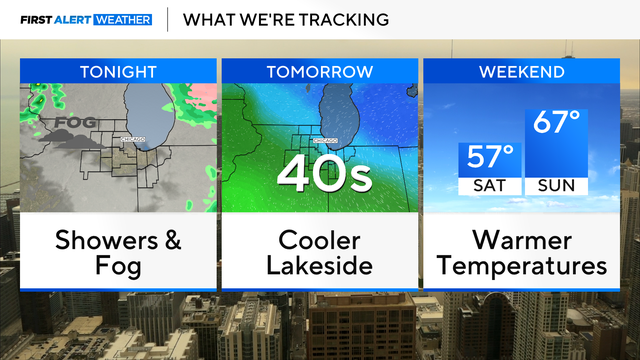
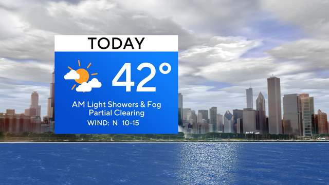
Cooler-than-average temperatures continue in the 40s Thursday
Watch CBS News
Cooler-than-average temperatures continue in the 40s Thursday

Highs will be in the middle 40s, with slightly cooler readings near the lake.

Temperatures are becoming more spring-like but there's also the chance for some light snow Wednesday morning turning into rain and storms in the afternoon and evening and into Thursday morning.

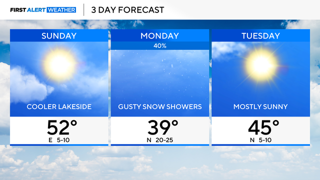
Scattered snow showers much of the day on Monday.

It's a colder and blustery day to start out the work week in Chicago.
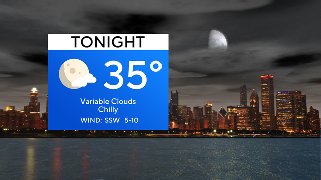
A cold front will activate sporadic snow showers and gusty winds. Visibility may be low at times throughout the morning and afternoon.

Any snowfall accumulations will be minor, up to 0.2 inches on grassy surfaces.

A strong cold front arrives Monday, bringing a chance for gusty snow showers.
Highs are in the 50s, but cooler lakeside temperatures are in the 40s.
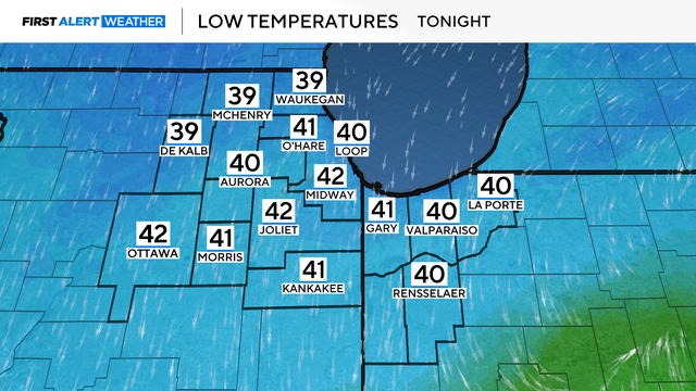
Both days of the weekend will feature a cool lake breeze.

Some early sunshine starts the day on Friday, but clouds will increase quickly ahead of our next weather maker.

Thursday will be a breezy day with highs in the 50s.
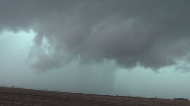
In Iroquois County, crews on the ground said an apparent tornado blew apart barns and brought down power lines.

Strong storms are racing toward the Chicago area, prompting a tornado watch for much of the south suburbs and Northwest Indiana. But there are also snow chances in our future.
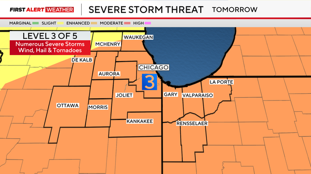
A warm front may spark numerous severe thunderstorms Wednesday afternoon into the evening hours.
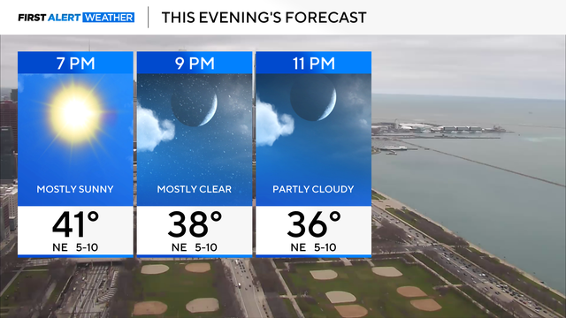
We will be in alert mode on Wednesday, with all modes of severe hazards are possible.

Chicago and Northwest Indiana are already under an enhanced risk, level 3 out of 5, for severe storm potential Wednesday.
Stronger storms are possible Tuesday night, and more rounds of showers and storms move into the area Wednesday.
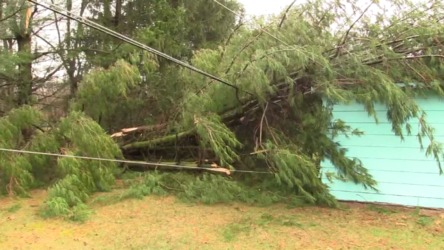
Wind gusts of 81 mph were reported in Valparaiso, Indiana.
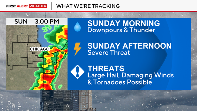
If the morning round of storms clears out quickly on Sunday, the severe storm threat is higher for the afternoon.

Breezy and very mild tonight, with lows in the upper 50s and low 60s.

Friday morning starts out with thunderstorms, bringing downpours and small hail.
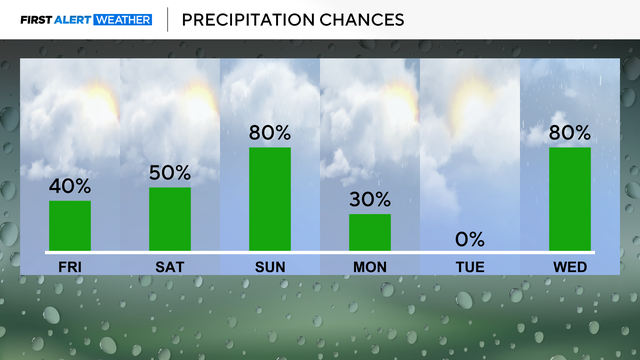
Rain showers pass through the morning and early afternoon.

A warm front Friday will bring rain and thunderstorms with daybreak.
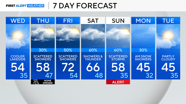
Showers are expected to return on Thursday, and this weekend could see the potential for strong thunderstorms.