Severe storms race through Chicago area, prompt tornado warnings in NW Indiana, Central Illinois


Severe storms raced through the Chicago area Wednesday evening, prompting a tornado watch for parts of the area well into the evening and multiple tornado warnings in Northwest Indiana.
A tornado warning was issued in the early evening for southeastern LaPorte County, Indiana, as well as central St. Joseph, eastern Starke, and northwestern Marshall County. A tornado warning was also issued earlier for Jasper County, Indiana, but has since expired.
No tornado warnings were issued in any Illinois counties near Chicago, but there was a tornado warning issued in Iroquois County south of the Chicago area earlier in the afternoon.
In Iroquois County, crews on the ground said an apparent tornado blew apart barns and brought down power lines.
This happened during the tornado warning there, but the National Weather Service has not confirmed a tornado yet. There was no word late Wednesday on any injuries.
A tornado warning was also issued in the Bloomington area in McLean County downstate.
A tornado watch was issued for Ford, Grundee, Kankakee, Livingston and Will counties in Illinois and Jasper, Lake, Newton, Porter and La Porte counties in Indiana for several hours. Severe thunderstorm warnings were also issued for parts of the area.
Storms began intensifying to the south as a warm air mass moved north along a warm front. The storms blossomed along the collision of the two air masses.
Individual storms raced northeast at about 60 to 70 miles per hour through the afternoon and early evening.
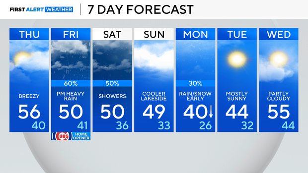
Lows drop to the 40s Thursday
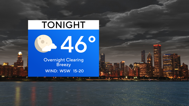
Since the evening storms, the rain and clouds have pushed out. Lows Wednesday night will drop into the 40s with the winds still staying breezy.
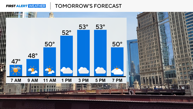
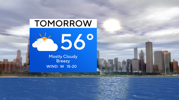
Thursday looks pleasant across Chicago with rays of sunshine to start the day, before ending the day with more clouds. Highs Thursday will be near-normal in the 50s.
Cooler air arrives for the end of the week and over the weekend with highs near 50.
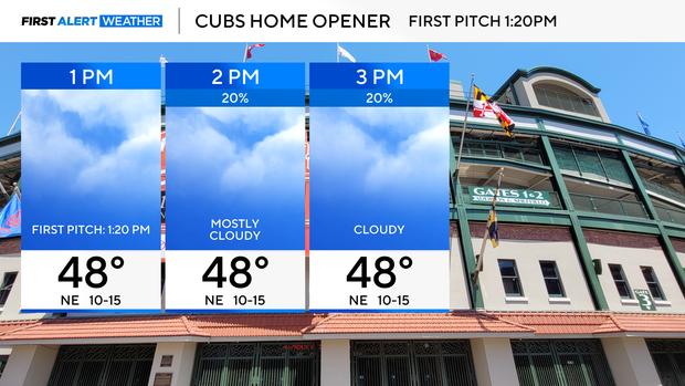
Scattered showers return by the afternoon in Chicago on Friday, so for the Cubs Home Opener with its 1:20 p.m. first pitch, cloudy skies will eventually lead to scattered rain by 3 p.m.
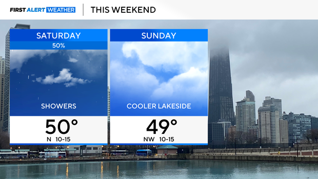
Temperatures will be chilly too, in the 40s at Wrigley Field. Scattered rain showers continue for the day Saturday.
On Sunday, drier air takes over before a rain-snow mix chance early next week.
Forecast at a glance
Wednesday night: Overnight clearing, breezy. Low of 46
Thursday: Increasing clouds. High of 56. Breezy
Thursday night: Cloudy skies. Low of 40.


