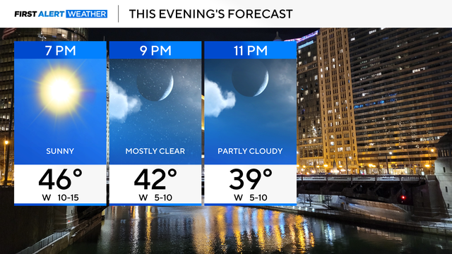
Partial clouds with relaxing winds Monday evening for Chicago area
Winds will relax with highs in the 40s.
Watch CBS News
Winds will relax with highs in the 40s.
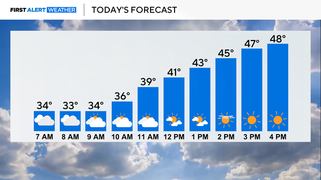
Cloudy skies eventually clear to sunshine, and highs reach the upper 40s. Gusty winds subside Monday night, and temperatures fall near freezing.

A Wind Advisory is in effect from 6 p.m. Sunday evening until midnight for the potential for wind gusts as high as 50 miles per hour.
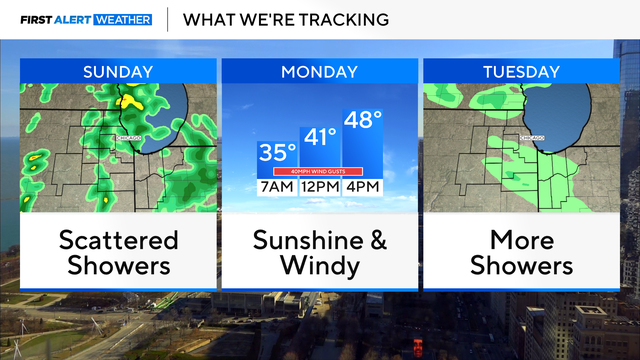
Rain showers arrive by dawn Sunday, with a few rumbles of thunder being possible in the afternoon.

The day will become mostly sunny, with temperatures settling in at a cooler-than-normal 43.
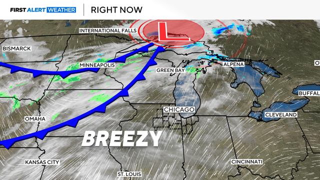
Building clouds ahead of the next system will bring scattered rain showers tonight, especially between 10 p.m. and midnight. These will be light and not well organized.
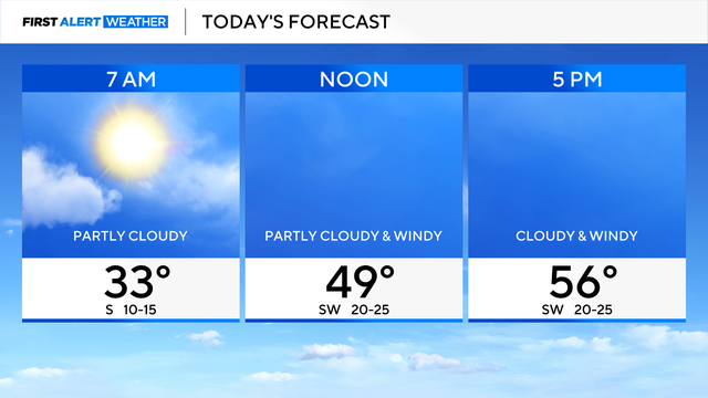
A calm and mild finish to the week.

Friday's highs will reach the upper 50s in the city and the low 60s in the south suburbs.

Wet snow showers will increase after midnight and become widespread overnight.
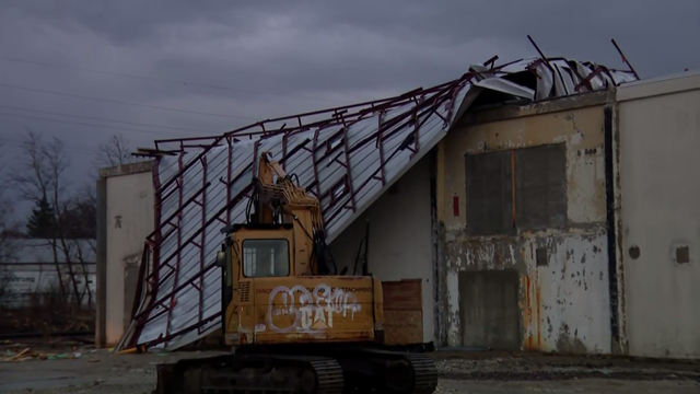
A line of severe storms triggered multiple tornado warnings in the Chicago area Wednesday afternoon.

Chicago weather Wednesday includes the threat of severe thunderstorms with damaging winds starting around 1 p.m. The south and southwest suburbs also have a tornado risk.
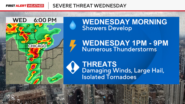
Strong to possibly severe storms move into the area on Wednesday evening.
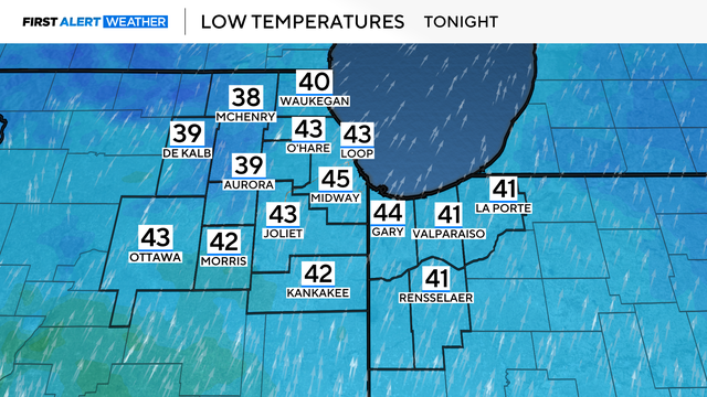
Tuesday will be mostly cloudy, breezy and warmer.

Clouds gradually clear tonight, with lows dropping in the 20s.

This morning, light snow is possible, with an inch or so of accumulation.
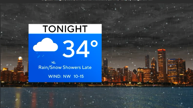
A warm and very windy day ahead, but a cold front brings falling temps.

The Kansas Highway Patrol reported Saturday that eight people died in an interstate pile-up after a dust storm caused a 55-car pile-up.
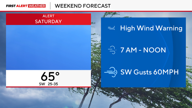
A high wind warning is in effect from 7 a.m. to noon on Saturday.

The risk of severe thunderstorms will increase Friday night with an enhanced threat southwest of Chicago between 9 p.m. and 3 a.m., bringing winds of over 70 miles per hour and potential tornadoes.

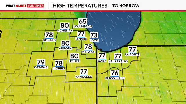
Friday's warmth gives way to severe storms overnight, then the usual up-and-down temperatures of early spring in the Chicago area in our First Alert Forecast.

An unseasonably warm day, with highs in the upper 70s, gives way to a stormy night as a line of severe thunderstorms races across the Midwest.
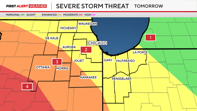
A severe weather outbreak could hit the Chicago area Friday night, bringing damaging high winds and the possibility of isolated tornadoes.
A sunny and milder day is ahead on Thursday with highs in the 60s.

From 8 p.m. Friday until 3 a.m. Saturday, expect the strongest to possibly severe storms to roll through.

Partly cloudy skies continue through the week, until we get to late Friday.