Chicago First Alert Weather: Last dry day of the holiday weekend
Low chance again for a shower later in the evening.
Watch CBS News
Low chance again for a shower later in the evening.

Those storms linger in the forecast for most of the next week.

A dry and sunny start to the weekend.

A sprinkle or shower in the evening.
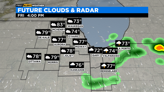
Showers and thunderstorms through 4 p.m.
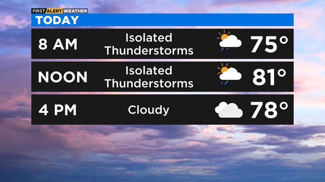
Showers to start the day.

According to CBS 2 Chief Meteorologist Albert Ramon, a front will move into the area on Friday, allowing for a chance of showers and storms.

Expect a wide range of temperatures on July 4th. Mid 80s well inland, while a dominant lake breeze holds shoreline temps in the 70s. Scattered showers & storms.
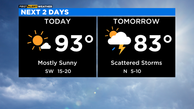
Temperatures are climbing.

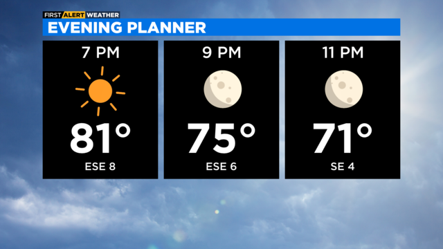
Clear skies tonight with temperatures in the 70s and 80s this evening.

90-degree temps make a return Thursday. Clear skies in the evening.

Morning showers will come to an end and sun will return with temperatures climbing to the 80s and 70s near the lake.
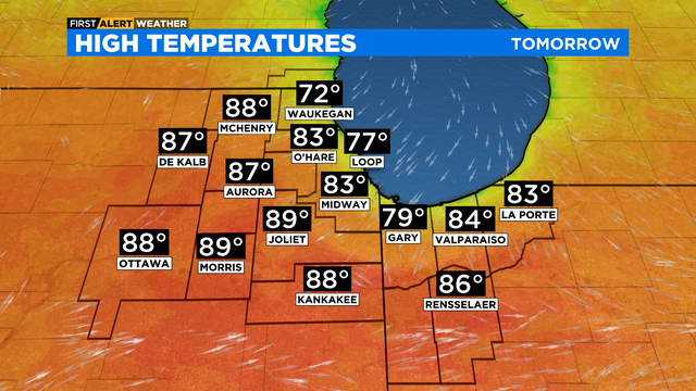
Sunny skies for Wednesday afternoon with highs ranging from mid 80s in the western suburbs, to mid 70s near the lake.

According to CBS 2 meteorologist Mary Kay Kleist, as the clouds drift southward Tuesday night, it runs into our dry air mass.

here's a chance for showers Tuesday night, especially for areas north of Chicago.

According to CBS 2 meteorologist Mary Kay Kleist, scattered storms develop Friday along a cold front.

Monday's temperatures will be in the upper 70s.

Plenty of sun to start the week.

This is the better half of the weekend!

A beautiful day is in store Sunday following Saturday's storms.

Showers in the morning that will last into late afternoon. After a break, more rain returns with possible thunderstorms tonight.

Two rounds of storms possible for Saturday.
With a dry ridge of high pressure locked in place, skies will be clear on Thursday night and Friday morning.
With high pressure in control, skies will be clear tonight and start of tomorrow.
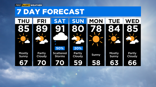
Summer temperatures but lower humidity through the end of week.