Warm, foggy start to weekend in North Texas with showers and storms expected
After a foggy Friday morning, temperatures in DFW are set to climb into the 60s and 70s, with a chance of showers and storms on Saturday.
Watch CBS News
After a foggy Friday morning, temperatures in DFW are set to climb into the 60s and 70s, with a chance of showers and storms on Saturday.

Sherman police are intensifying the search for 8-year-old Clara Robinson, who was swept away by floodwaters on Christmas Eve after her family’s vehicle veered off the road.
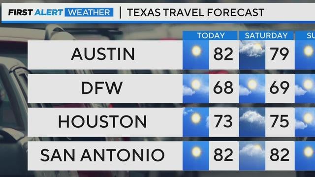
North Texas can expect mild temperatures this weekend with highs in the 60s and 70s, but showers and thunderstorms are likely.

Researchers say human-caused climate change dealt people an average of nearly six weeks of extra extreme heat in 2024, while also fueling more destructive storms.
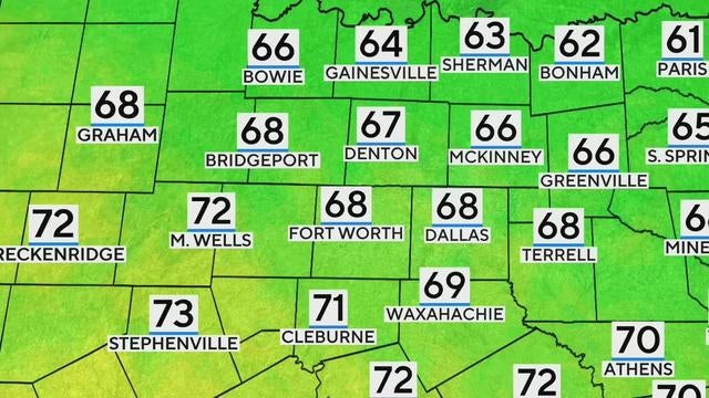
North Texas is waking up to temperatures in the 40s and dense fog, reducing visibility to a quarter-mile in some areas.
Once the fog clears, fine weather is expected to set in to close the week and continue into the weekend.

Thursday is a First Alert Weather Day with scattered storms bringing heavy rain, strong winds and a risk of tornadoes to North Texas.

As storms continue through Thursday morning and into the afternoon, parts of North Texas remain under flash flood warnings, with small hail possible.

Severe weather, including storms, hail and a slight tornado risk, are headed to North Texas on Thursday.
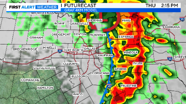
Storms are expected to cover the Metroplex by mid-morning. Large hail and damaging winds are the main threats.

Thursday is a First Alert Weather Day due to another round of rain and storms with the potential for severe storms.
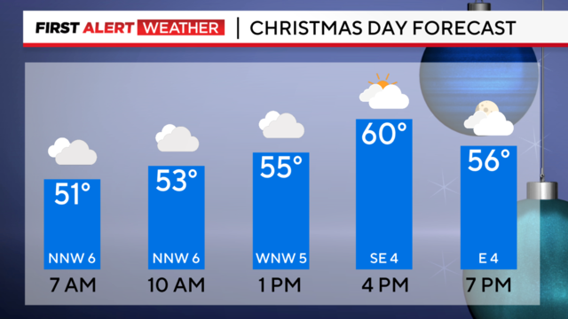
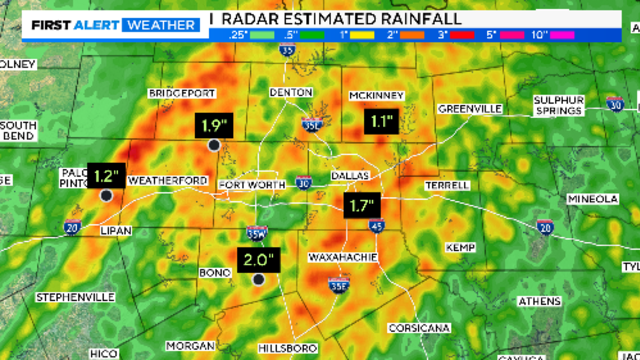
After a wet Christmas Eve, that even saw a tornado warning in our southern counties, we dry out and cool down on Christmas Day.
Christmas Day travel looks much better if driving out of this area in any direction.
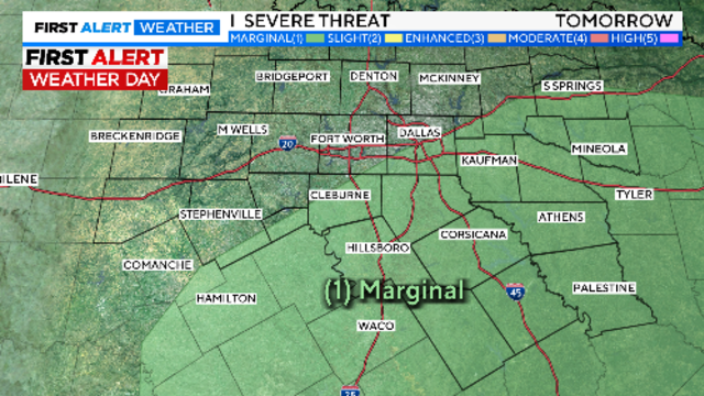
Travel plans in North Texas could be significantly impacted this week as First Alert Weather Days have been issued for Tuesday and Thursday.

It's been a beautiful weekend! However, big changes are in the forecast moving into the holiday week.

North Texas will enjoy mild weather on Sunday and Monday, but a First Alert Weather Day is in effect for Christmas Eve.

While Sunday and Monday will bring mild conditions, rain and storms are expected to move in by Christmas Eve, with a 70% chance of showers and the potential for severe weather.
It will warm back into the upper 50s on Saturday, another typical winter day to start the season.

North Texas is set to see rain moving in by Christmas Eve with scattered storms and heavy downpours, though severe weather is unlikely.
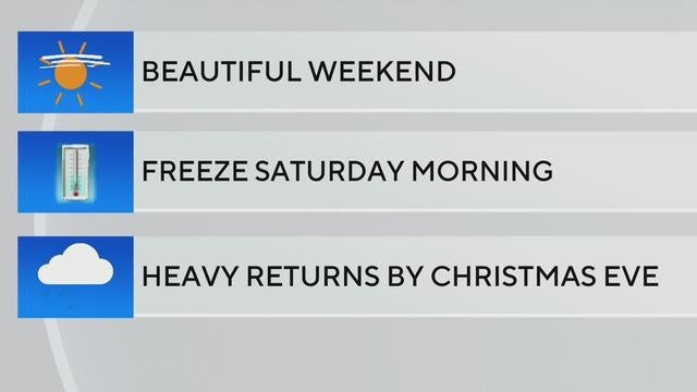
A pleasant weekend awaits North Texas with mild temperatures and sunny skies, though expect a chilly start Saturday morning as temperatures dip near freezing.

Saturday is the official start of Winter Solstice, which is the shortest day and longest night of the year.

Waking up Thursday morning will be chilly and nearly freezing for some folks.

A First Alert Weather Day is in effect for North Texas on Wednesday.

A First Alert Weather Day is issued for Wednesday morning as gusty winds and rain could impact the morning commute.

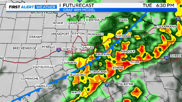
Tuesday night, another cold front will move into North Texas and this one will be stronger in nature as far as a temperature change.