
Bitter cold, gusty winds create dangerous wind chill in North Texas
A Cold Weather Advisory is in effect until 10 a.m. Monday.
Watch CBS News
A Cold Weather Advisory is in effect until 10 a.m. Monday.

More than 900 cots were set up inside the Grand Place building in Fair Park on Sunday.

First Alert Weather days are in effect through Friday as wind chills dip into the teens, with the potential for wintry weather later this week.

The storms that blew into North Texas on Christmas Eve challenged airline passengers at DFW International Airport.
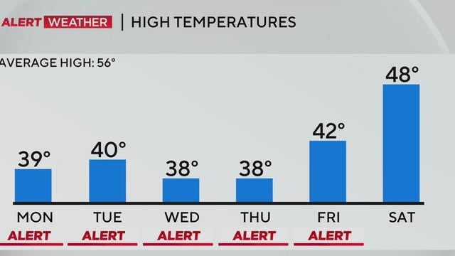
A cold front is bringing light rain and powerful winds to North Texas on Sunday, followed by plunging temperatures and single-digit wind chills overnight.
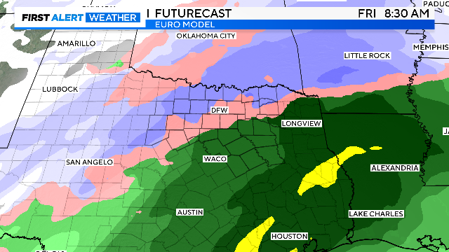
An Arctic front brings bitterly cold wind chills in the teens; another potent system ushers in the risk of wintry precipitation for Thursday and Friday.
After a mild Saturday, residents in North Texas will wake up to the coldest air of the season starting Sunday, with wind chills dipping into the teens and single digits.
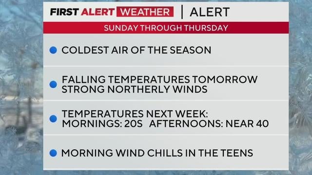
After a mild Saturday, residents should brace for a sudden drop in temperatures as an arctic front sweeps through North Texas next week.
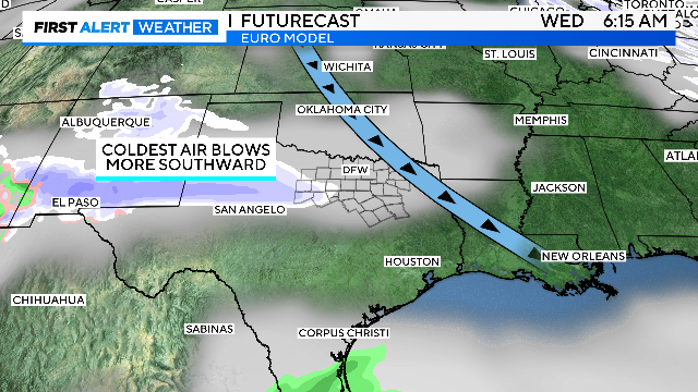
For all of us, the frontal passage should occur from mid-morning to midday Sunday, bringing gusty winds and rapidly dropping temperatures.

Another nice day is ahead in North Texas with partly cloudy skies and afternoon temperatures in the lower 60s.
A potent Arctic front on Sunday will crash temperatures and enhance rain chances for the eastern counties.

Another beautiful day is ahead with mostly sunny skies and morning temperatures in the upper 30s across North Texas.
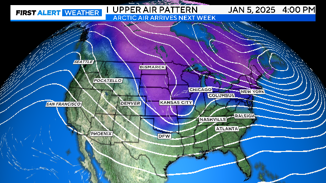
Thursday will start chilly, with lows in the 30s, but highs will warm into the 60s by the afternoon.

The New Year began with temperatures in the 30s across North Texas.

Chilly temps and clear skies for New Year's Eve celebrations followed by a beautiful start to 2025.

Grab a jacket if you're heading to a fireworks show Tuesday night.
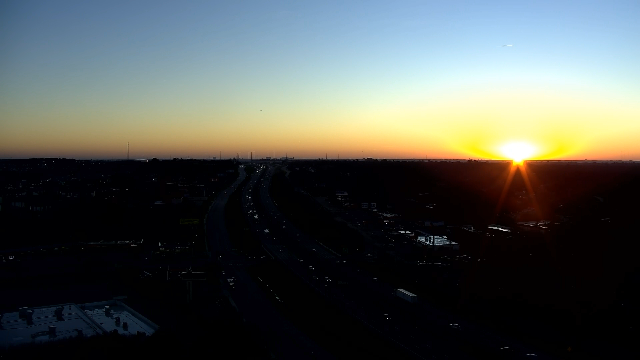
A sunny Monday is in store across the Dallas-Fort Worth Metroplex with mild temperatures on the way.

After the dry cold front moves through on Monday night, Tuesday temperatures will be much cooler.

Temperatures will climb into the upper 60s Sunday, with strong winds and a warm-up ushering in chillier conditions for the start of 2025.
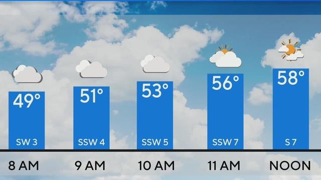
North Texas can enjoy clear skies and sunshine on Sunday and temperatures reaching 80 degrees on Monday.
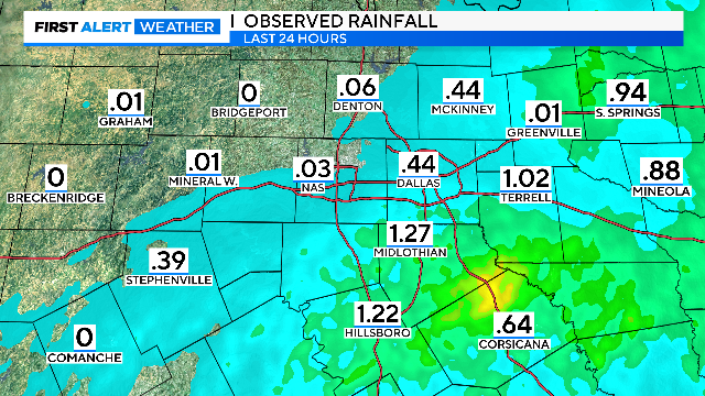
"First Alerting" for fog tonight through Sunday morning.

Dense fog is possible overnight into Sunday morning. North Texas begins warming up through Monday. A seasonal and much cooler start to 2025 ahead.

The First Alert Weather team is tracking rain and storms across the Metroplex.
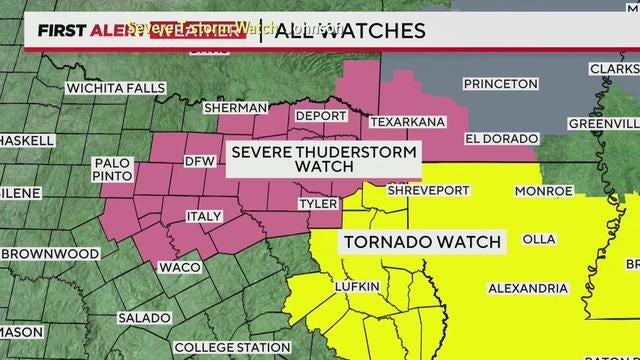
After severe storms with hail and lightning move through North Texas, expect clearing skies and warmer temperatures Saturday afternoon, with highs reaching the mid-60s.
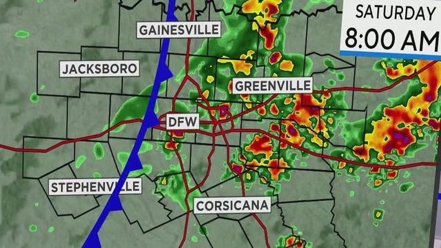
While the Metroplex will see rain and has the possible severe weather, stronger storms with hail, lightning and gusty winds are expected east.