Sunny Start To The Day, But Storms Possible Friday Night
Friday certainly is starting out nice for the Chicago area, but a rainy afternoon and evening are on the way, ahead of a chilly weekend.
Watch CBS News
Friday certainly is starting out nice for the Chicago area, but a rainy afternoon and evening are on the way, ahead of a chilly weekend.
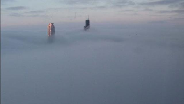
Dense fog blanketed the Chicago area overnight, making for a slow morning commute.

It's going to be a rainy day for Chicago, with showers and storms expected to continue through the afternoon and evening, especially for the southern suburbs.

Chicago will see showers and storms on and off through the middle of the week, but the end of the week should be sunny and mild.
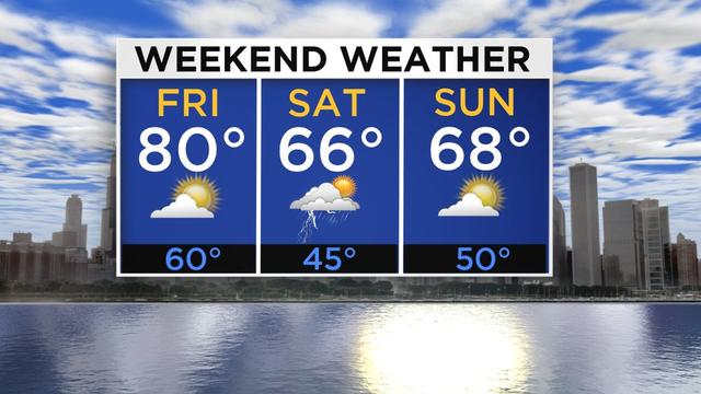
Temperatures have been soaring across Chicago all morning, and could reach a high of around 80 by Friday afternoon, but more rain is in store this weekend before we get to Mother's Day.

Wednesday will be a cool and blustery day across the Chicago area, but a significant warmup is on tap in time for the Mother's Day weekend.

It will be an up and down week for weather in the Chicago area, but it should be sunny and warm by the weekend.

A wet afternoon and evening is ahead for the Chicago area, as a large storm system moves in from the Great Plains.

It was a cold and foggy start to the day for Chicago on Tuesday, and while the fog has mostly cleared out, chilly temperatures will be sticking around for a while.
A very warm start to the day on Monday will give way to showers and storms by the evening, and temperatures will linger below normal for the rest of the week after that system moves through.
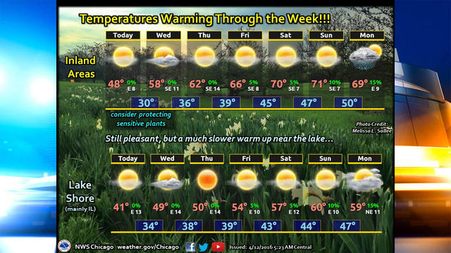
Enjoyable spring weather might have been a bit late in arriving in Chicago, but thankfully it's going to stick around for a while.
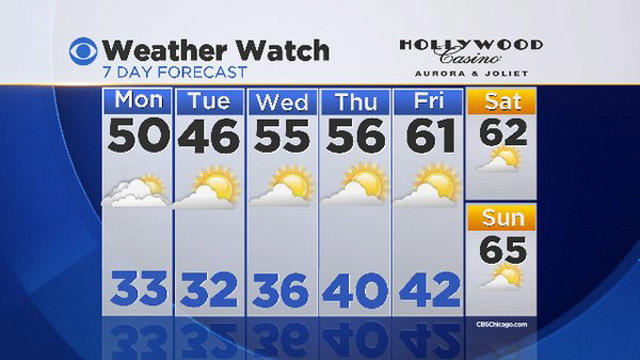
After enduring a week of chilly temperatures and rain almost every day, Chicagoans can look forward to plenty of sun and warmer spring weather this week.
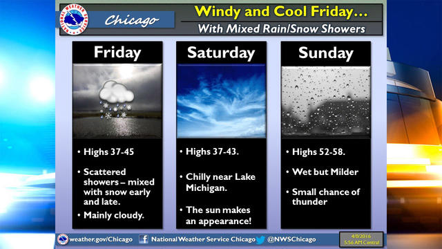
Some parts of the Chicago area could actually see minor accumulations of snow on Friday, ahead of a mixed bag of weather this weekend.

Temperatures were making a big improvement in the Chicago area on Tuesday, but scattered showers will move through in the afternoon, and Wednesday will have rain on and off throughout the day.

A 45 degree temperature swing on Sunday was the 13th largest one-day change on record in Chicago, according to the National Weather Service.

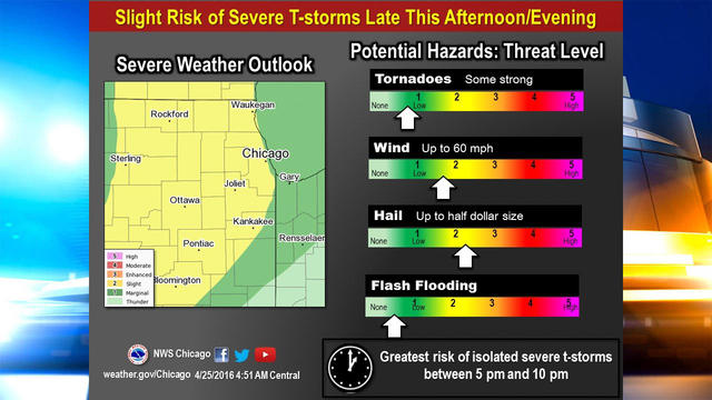
Though it will be warm, it's not going to be the prettiest day in Chicago on Thursday, as more showers and storms will be rolling through, with a slight risk of severe weather.

Chicago can expect to see rain and thunderstorms continuing on and off for the next couple days.

Sunshine and milder temperatures should return to the Chicago area early this week, but rain will become a factor from midweek through the weekend.

More showers and thunderstorms were expected across northern Illinois and northwest Indiana Thursday afternoon, and as temperatures continue to grow colder, the rain could shift to snow by evening.

How warm it gets the next couple days will vary greatly depending where you live in the Chicago area, but either way, expect to see rain and thunderstorms Wednesday night and Thursday morning.

Temperatures should soar into the 60s on Tuesday, giving a bit of relief from the recent chilly spell, but only a temporary one, as cooler temperatures will return mid-week, along with rain.

The first full day of spring arrives Sunday, and Chicago could get a few flakes of snow before old man winter breathes his last gasp of the season.

Hold on to your hats, Chicago. On the heels of Tuesday night's thunderstorms, strong winds have started blowing through Chicago, and were expected to continue buffeting the area through Wednesday evening.

Severe storms are expected to hit the Chicago area Tuesday night, and could produce large hail and damaging winds.
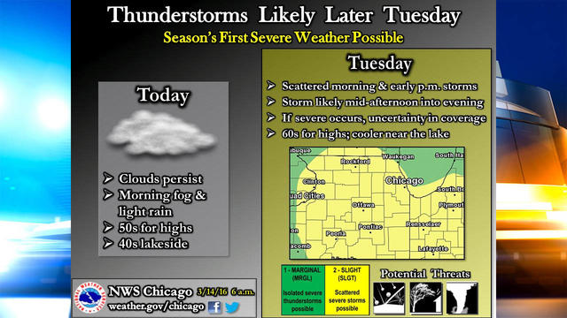
Thunderstorms could roll through the Chicago area on Tuesday, bringing the first severe storms of the year.