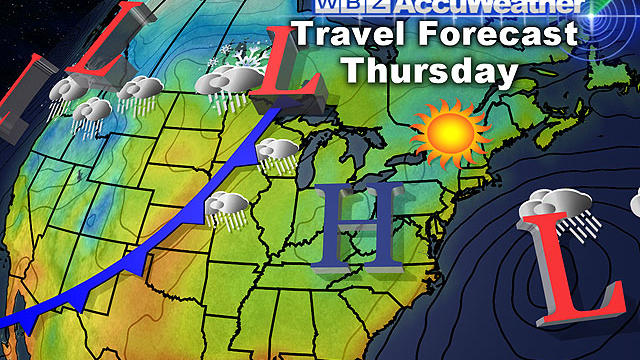
Thanksgiving Travel Week Forecast: A Beauty Coming Up
I am happy to report that all is quiet in the weather department this week not only in New England, but for the majority of the country.
Watch CBS News
I am happy to report that all is quiet in the weather department this week not only in New England, but for the majority of the country.

High pressure sits over us today with light NE winds and abundant sunshine. Highs climb to 46-50 this afternoon. Another stellar day for this time of year.

Quiet weather is expected not just in New England but across the majority of the country.

David Arnold has spent the past decade documenting Climate Change through pictures. Some of his photographs document climate change over the past several years.

I think everyone would agree the Northeast could use a break and it appears that is exactly what is in the cards to kick off the holiday travel season.
Towards afternoon some high clouds will approach from the west associated with an approaching warm front. Regardless, lots of sun will be found with seasonal high temperatures around 50 degrees.
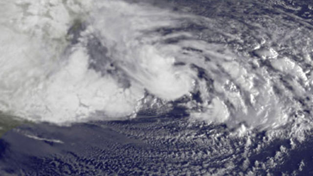
Lately, conditions have been perfect for an explosive weather pattern. Hurricane Sandy was followed by a November nor'easter bringing the season's first snowfall.

With each and every snow event there is almost certain to be an area or areas where Mother Nature goes rogue and fouls up our nice and neat snowfall forecast map.

The first true nor'easter of the season is bringing snow along with strong coastal wind gusts to Massachusetts.

This will be more of a typical New England early winter-type storm - snow to the north and west and strong northeast winds at the coastline.

If this trend continues and this nor'easter tracks well offshore this would be a good news-bad news situation.

The Nor'Easter will reach Cape Cod and the Islands around midday on Wednesday in the form of rain.

The peak of the storm will be overnight Wednesday into Thursday morning.
We do have a string of nice weather to enjoy with sun filled skies. Highs today will be near 50 under slightly breezy and brisk conditions. The coldest air of the season is sliding into New England late tonight behind a weak cold front and light NW winds. Clear skies with diminishing wind will allow most areas outside of the city and away from the coast to drop below freezing overnight.

Another storm will be making a run at New England Wednesday, according to WBZ-TV meteorologist Joe Joyce.
With breaks of sunshine, temperatures will be cool in the upper 40's northwest suburbs to lower 50's southeast Mass, Cape and Islands. An active and blustery wind at 15-25mph from the northwest will add some extra chill to the air making it feel more like the middle 40's. November is here!

There is likely to be some sort of storm off our coastline by the middle of next week. How close it comes and what its track and strength will be remains to be seen.
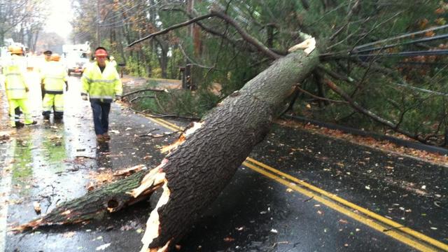
Here are the latest power outages in Massachusetts and New Hampshire from Hurricane Sandy.

The worst of Sandy has passed. Here is what we saw and what we could have seen.
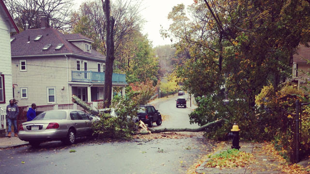
Sandy is hitting southern New England with Hurricane and Tropical Storm force wind gusts.

A severe high tide could rival that of Hurricane Bob back in 1991, and could be the most serious and severe blow from Hurricane Sandy when all is said and done.

WBZ-TV has reporters and photographers out in the elements, tracking Hurricane Sandy's approach.
We are now approaching the peak of what Sandy has to offer for New England.