Chicago First Alert Weather: Last day of warmth before cold returns
It's going to be a warm November day!
Watch CBS News
It's going to be a warm November day!
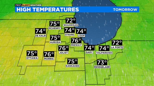
A strong cold front arrives Thursday night and will make for a much colder Friday.

By Thursday, temperatures soar to the mid 70s.
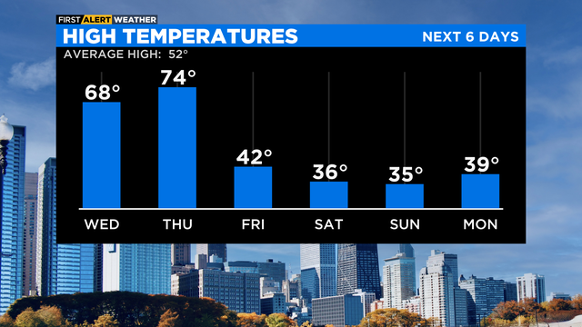
Highs this weekend will be very cold, with temperatures in the mid 30s during the day and mid 20s at night.

According to CBS 2 meteorologist, the record high for Thursday is 75 degrees set in 2020. We will probably reach that level.

A gradual warmup to the 60s Wednesday and then 70s by Thursday.
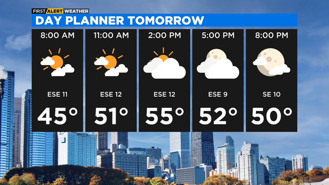
After a mostly clear morning, we'll have increasing clouds in the afternoon on Tuesday with highs in the mid to upper 50s.

Monday's temperatures will be in the low 50s.

Expect sunny skies and a high of 55 Monday.

We'll experience high temperatures that are still above the norm for early November.

A Wind Advisory until 7 p.m. Southwest wind could gust to 50 mph.
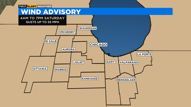
Gusts could be as high as 55 miles per hour.

A Wind Advisory has been issued through 4 p.m. with gusts up to 55 miles per hours.
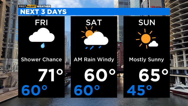
Saturday will also be very windy, with wind gusts at times around 50 mph in the morning and early afternoon.

CBS 2 Chief Meteorologist Albert Ramon has the 5 p.m. forecast for Nov. 3, 2022.

It will turn cloudy tonight as our next system gets closer.

Clouds increase by nighttime, and it'll stay mild with lows in the 50s.

Headed back into the 70s underneath a sun-drenched sky.
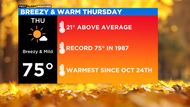
High temperatures Thursday will be running 20 degrees above average in the mid-70s.

Warm winds will carry temperatures into the 70s the next 2 days.
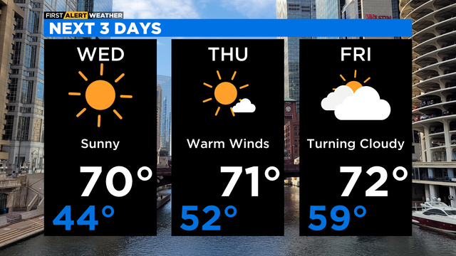
Lots of sunshine for Wednesday afternoon with highs around 70 degrees.

Dry conditions with winds flowing from the south/southwest, pulling in unseasonably warm air.

Temperatures near 70 degrees continue through Friday.

The low for Monday night is 44.

According to CBS 2 meteorologist Mary Kay Kleist, skies will clear Monday evening.