
Boston Marathon Forecast: Terrific Day For Runners And Spectators
The weather forecast remains unchanged for Marathon Monday. Why mess with perfection!
Watch CBS News
The weather forecast remains unchanged for Marathon Monday. Why mess with perfection!

If you're going to run 26.2 miles, you can't ask for much better weather than this!

This year's conditions may very well end up be near ideal for runners.

Cautiously optimistic. That is how I would describe our forecast for Marathon Monday at this point.
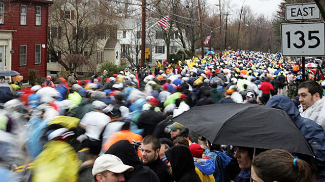
As with every weather story in New England, there is typically some good news and bad news. And while it is still early, it appears this will be the case for Marathon Monday.

Weather-stalking Marathon Monday's forecast already? Here's a look at the long-range forecast.
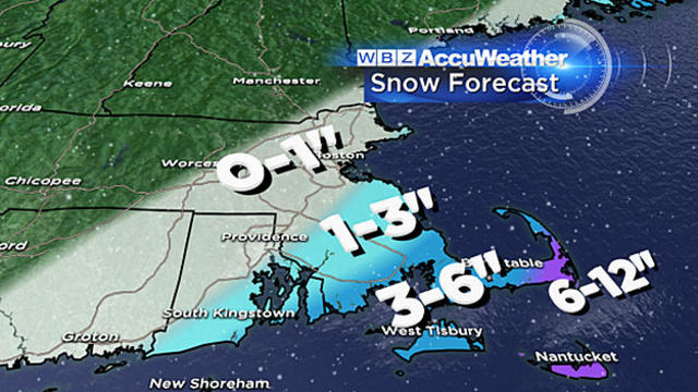
The snow has arrived on schedule, it is going to be a messy morning commute over southeastern Massachusetts, Cape Cod and the Islands.
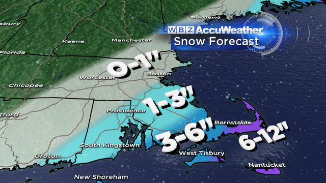
Here is what you should expect, inch-by-inch, hour-by-hour.
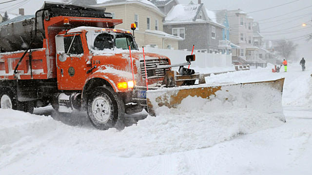
There is a storm in the works and it has the potential to be major, perhaps even historic, IF it is steered closer to New England Tuesday night into Wednesday.
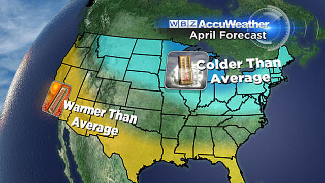
Ok, so enough is enough. when do we get warm?
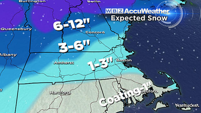
In just the next 24 hours, most of you will see rain, ice, snow, street flooding and strong winds. It sounds like a classic springtime storm in New England!
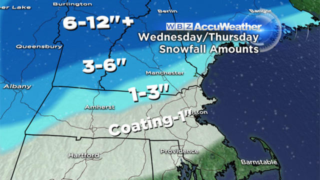
Mother Nature is about to serve up a classic taste of March in New England this week, complete with all the fixings - rain, snow, warmth and cold, all in the next few days.
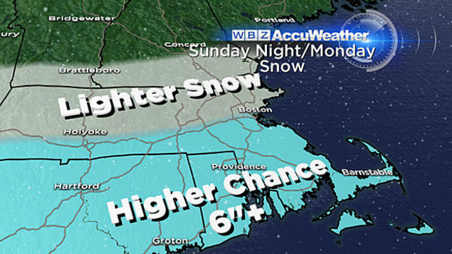
What I think is certain at this point is there will be a large swath of 6-to-10, perhaps up to 12 inches of snow somewhere in the vicinity of southern New England.
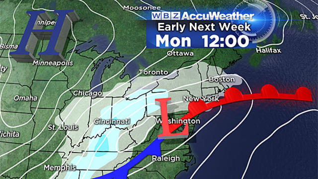
By now you have probably heard, there is a fairly good chance that Monday will be another snow day here in southern New England. While it is still a bit early for specifics, I think we can make some early assumptions.
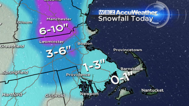
This should be our last significant snow accumulation for a while.
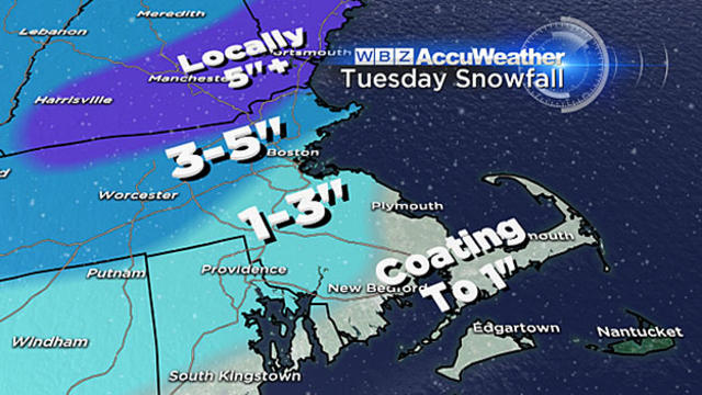
Another snow storm is coming, and while this one isn't very large, it will pack a quick little punch on Tuesday afternoon, hitting southern New England square in the face.

This will be a fast moving, intense burst of snow focused during Saturday night along our coastline, essentially, a 6-to-8 hour window where we will accumulate snow very rapidly.
Here is the latest timeline for the storm, inch-by-inch, drop-by-drop.
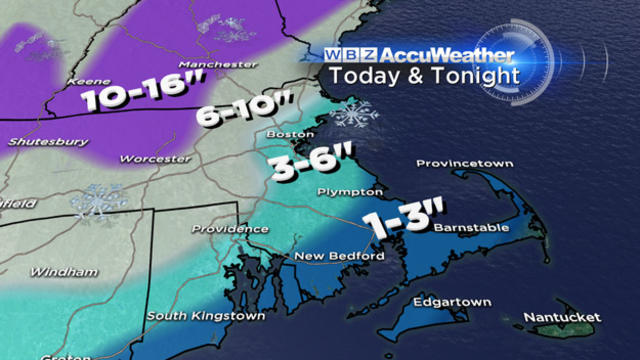
So it looks like a 3-commute nightmare - beginning during the Thursday morning commute, peaking during the Thursday evening commute and ending just before the Friday morning drive.
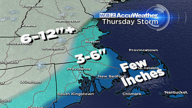
If the snow does arrive mid-morning on Thursday as we expect, this could be a situation where schools are forced to let out early in the middle of some very heavy snow.
It is much too early to project where this rain-snow line will setup and who will stay all snow, but, those areas that do not mix with rain could easily see 6-to-12 inches of snow or more.
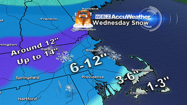
Most areas will get 8-to-12 inches of snow Wednesday and several towns will be reporting 9, 10 and 11-inch amounts.
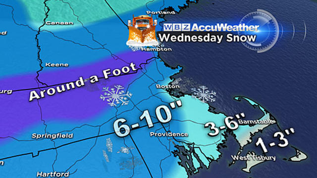
It will encompass all of New England, dump significant amounts of heavy, wet snow and impact both the morning and evening commutes.
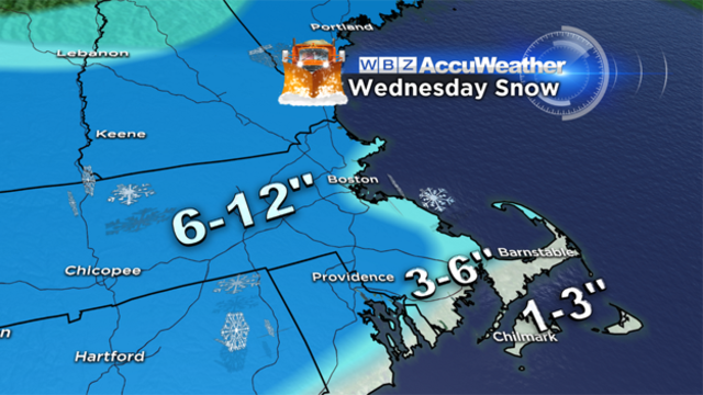
Here are the details about three storms that could hit the region this week:
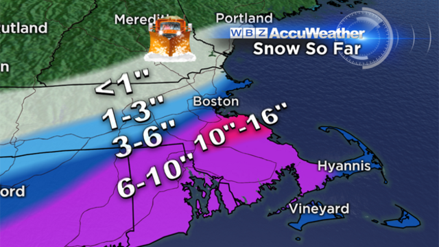
Location is everything…If you happen to reside about 5-10 miles south of Boston, you are looking at a winter wonderland with between 10-15" of new snow. On the flip side, just 5-10 miles north of Boston and you can clean your driveway with a broom, only a dusting to a few inches.