Cold front headed for North Texas won't disrupt spring-like temperatures

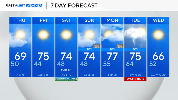
Temperatures won't be quite as warm Thursday thanks to a cold front moving through North Texas on Wednesday, but temperatures will still be above normal.
A few showers will be possible overnight behind the front, but the rain will be light and most will stay dry.
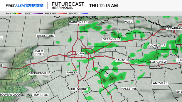
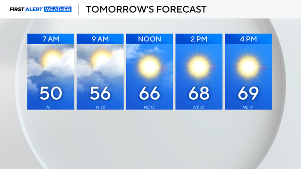
The rain is done by 7 a.m. Thursday, but clouds will linger for a few hours. We do expect more sunshine into the afternoon though, and highs should top out in the mid and upper 60s.
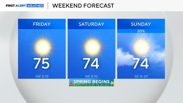
By Friday, we're back to the 70s and should remain in the 70s through the weekend. Clouds build back in on Sunday though, with low rain chances for the afternoon and evening.
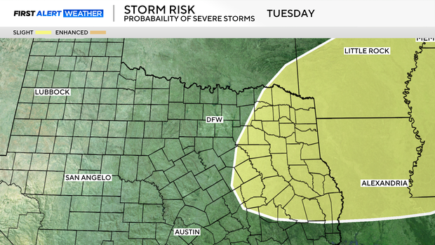
More concerning are the rain chances by late Monday and Tuesday of next week. A few stronger storms will be possible, and the Storm Prediction Center is already monitoring parts of east Texas for severe weather next Tuesday.
For now, we are watching Tuesday's forecast. We do expect the front to knock highs back into the 60s by next Wednesday.