Very slim cooldown coming to North Texas as a cold front moves in overnight
Most of North Texas will remain dry as these storms likely fall apart as the front moves south, but there is a low risk of a strong-to-severe storm overnight.
Watch CBS News

Most of North Texas will remain dry as these storms likely fall apart as the front moves south, but there is a low risk of a strong-to-severe storm overnight.

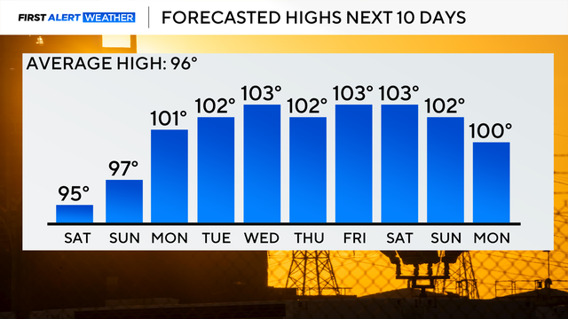
Looking ahead to Friday, the heat peaks, with highs around 104° and feels-like temperatures as hot as 109°.

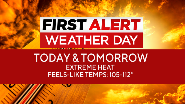
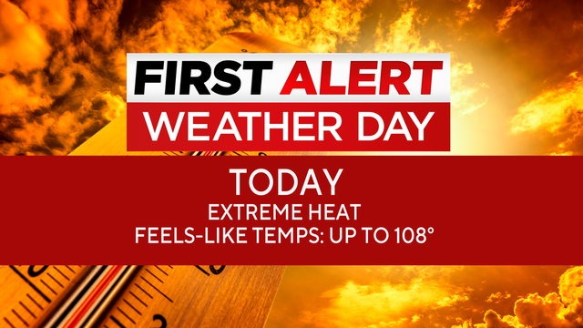
The heat continues, with a heat advisory in place and feels-like temperatures as high as 109°. Those conditions are likely to continue on Thursday.

The triple-digit heat will intensify as we move through the end of the workweek.

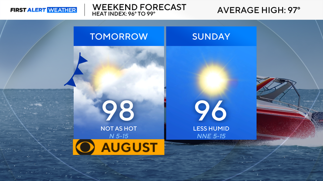
By the weekend, we'll have a slight pattern change as high pressure shifts just far enough west that a weak front moves through.

A heat advisory is in place for Friday afternoon.
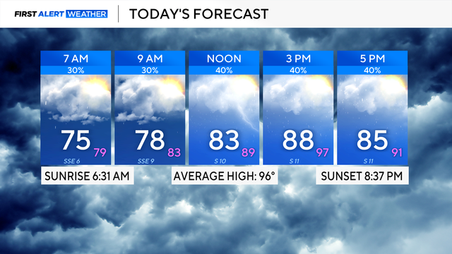
Air temperatures across the region will range from 98-100 on Thursday afternoon.

Wednesday, July 22, is a First Alert Weather Day as an extreme heat warning remains in place.
We won't see much of a change in our weather pattern throughout the workweek and into the weekend as the triple-digit heat sticks around.
A heat advisory is in effect Monday from noon through 8 p.m, with feels-like temperatures to soar over 100.
Expect partly cloudy skies on Friday with highs in the lower 90s and feels-like temperatures close to the triple digits.
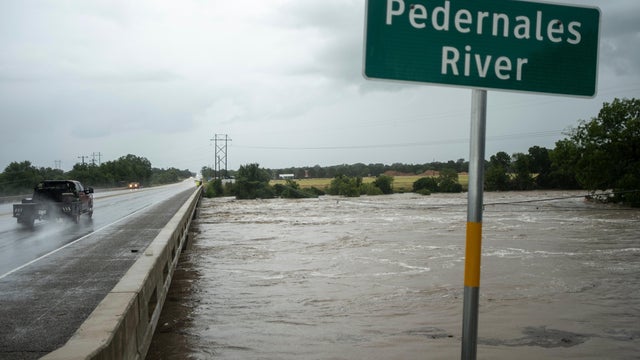
The National Weather Service has a flash flood emergency in place, meaning an imminent threat to life.
Temperatures will climb back into the triple digits into next week.
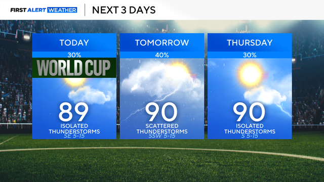
We'll see our storm chances continue on Thursday, and some showers and rumbles may build in as early as the back half of the morning commute.
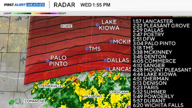
Shower and thunderstorm activity will be better south of the Dallas-Fort Worth Metroplex on Tuesday afternoon.