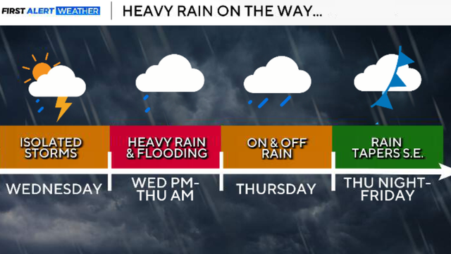
Threat of rain, hail and flooding returns to North Texas this week
Thursday and Friday are both First Alert Weather Days due to strong storms and heavy rain.
Watch CBS News

Thursday and Friday are both First Alert Weather Days due to strong storms and heavy rain.
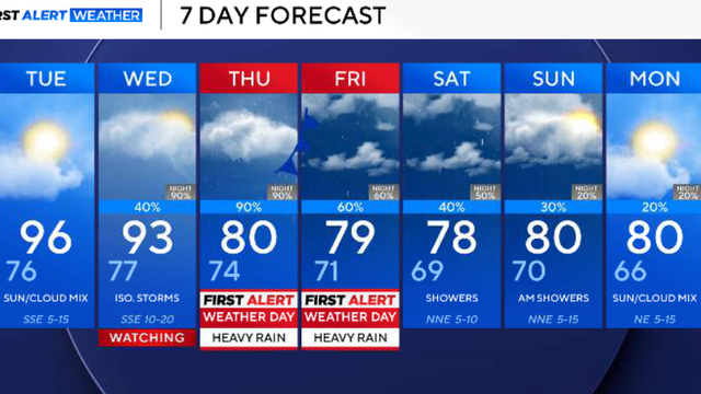
As of Sunday, DFW has had 100 consecutive days at 90° or higher, the longest streak ever. However, some big changes are on the way this week.

Temperatures stay warm this weekend for the State Fair of Texas, with highs in the 90s each day and plenty of clouds.

Expect a mix of clouds and sunshine later Wednesday, with a slim 10% chance of a shower or rumble mainly toward the western counties.

There is only a slim 10% chance of an isolated shower or rumble, mainly south of the Dallas-Fort Worth area, into Tuesday evening.

This cold front won't cool us down much, but it will drop our temperatures by a couple of degrees and slightly lower our humidity by Tuesday afternoon.

In fact, DFW will be very close to tying or setting new records as we move throughout the week.

Looking ahead to the rest of the week, we'll barely drop into the 90s by Thursday, but the 90s look to stick around into this weekend.

Meteorologists warn that hail may damage vehicles, while strong winds could bring down tree limbs and cause damage to roofs and siding.

Rain chances rise to 30% in DFW and increase to 40% by Thursday night.
There is a slim 10% chance of an isolated shower or rumble on Thursday afternoon west of the Metroplex, but this changes tomorrow.

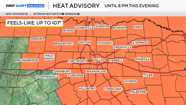
A heat advisory remains in effect through 8 p.m. Wednesday for much of North Texas.

Feels-like temperatures will be as hot as 107° on Monday.
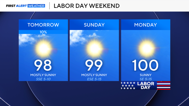
Looking ahead to Labor Day weekend, expect mainly dry but hot conditions.
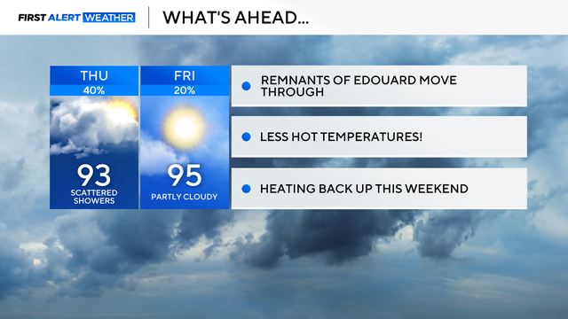
While temperatures will be less hot, the humidity remains elevated, so feels-like temperatures may reach 100-105°.