Clear skies, cool temps for tonight, possible frost in some areas
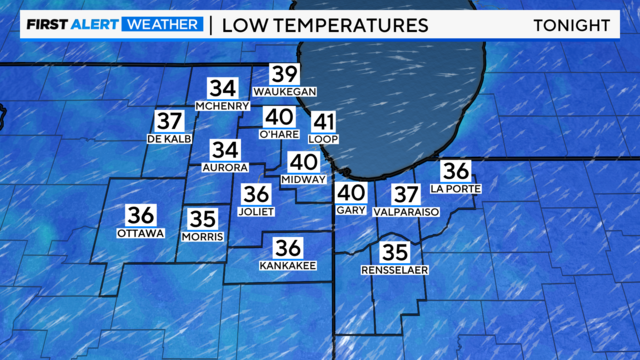
Lows in the 30s in the western suburbs, but staying in the low 40s in Chicago.
Watch CBS News

Lows in the 30s in the western suburbs, but staying in the low 40s in Chicago.
Other than a few rumbles of thunder and brief downpours, the severe weather risk is expected to remain south of the Chicago area.

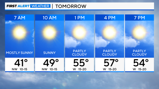
Behind the front, windy conditions are in the forecast for Friday, with highs in the mid-50s.

CBS 2 is tracking a storm closely following the last system's heels. The storm is expected to bring rain and even a few thunderstorms on Thursday.
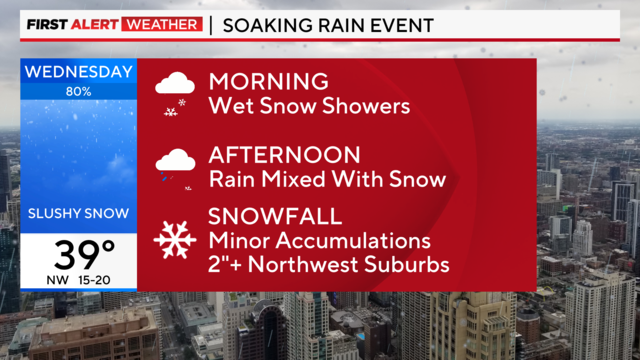
A small chance of showers and storms persists Wednesday morning.

The greatest threat for tornadoes in the Chicago area will be in the far western suburbs.
Waves of showers and thunderstorms are likely Monday night through Tuesday night. Some storms may become severe on Tuesday afternoon and evening.
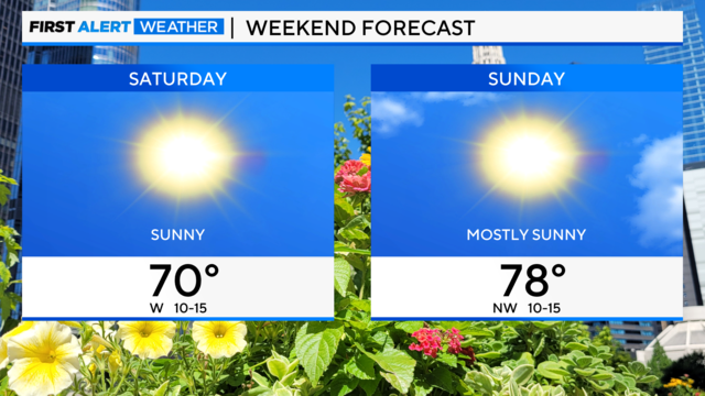
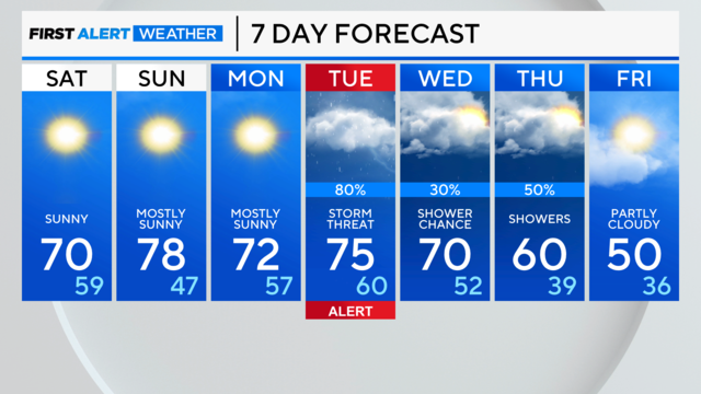
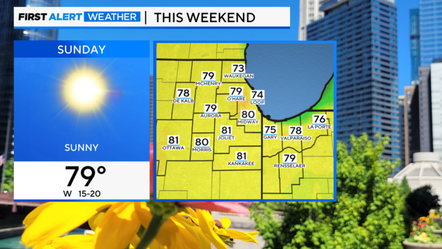
It will be in the low 70s on Saturday under a sunny sky and mostly sunny and warmer on Sunday, in the upper 70s.
After a brief early morning shower on Friday, expect a clearing sky and winy conditions. Gusts up to 40 miles per hour will be possible, and the high will be around 60 degrees.
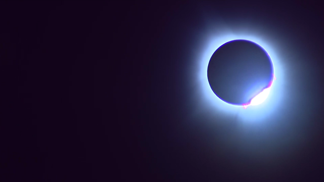
Cheers erupted as the last bit of sunlight wrapped around the moon and turned the skies pitch dark.
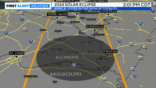
The best places to see the solar eclipse depend on where you are. Chicago is not going to see a total eclipse this time around, but where you are could still offer something impressive to see.
Clear and chilly tonight with lows in the low 30s. Sunny skies for Saturday with highs in the 50s inland, but staying in the 40s lakeside.
Data indicates a partly cloudy sky in the afternoon with highs in the mid-60s for the much anticipated Solar Eclipse.

The funnel cloud was seen in Union Hill, about 15 miles west of Kankakee. It was captured on video amid pounding rain.
Temperatures will warm into the 50s Friday and Saturday and 60s by Monday.