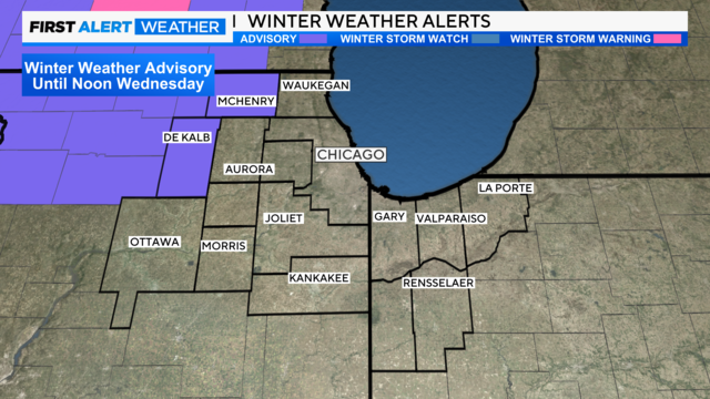
Winter weather alerts for areas near Chicago
After some lingering snow and rain showers Thursday, drier weather returns Thursday evening through Saturday as high pressure builds over the region.
Watch CBS News

After some lingering snow and rain showers Thursday, drier weather returns Thursday evening through Saturday as high pressure builds over the region.
Windy conditions Tuesday night and Wednesday, with gusts potentially as high as 50 mph.
There's a chance for strong to severe storms in northwest Indiana in the afternoon, as storms producing hail and damaging winds will be possible.
The main concern will come from storms producing hail and gusty winds.
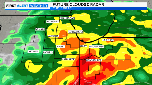
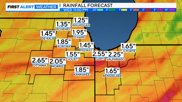
Numerous of showers and storms are expected Sunday evening through Tuesday as a storm system moves through the region.

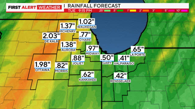
Some of the thunderstorms on Friday night have the potential to produce heavy rainfall, which could lead to minor flooding.

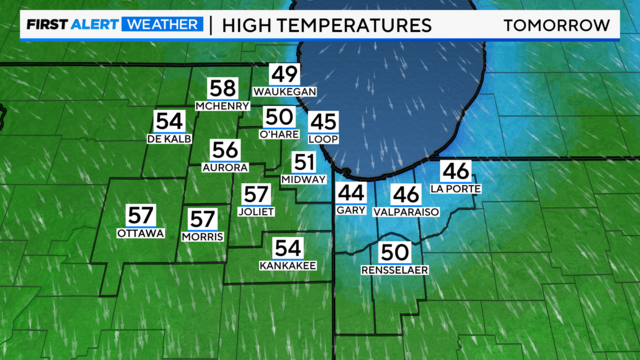
Clouds increase Friday with highs in the low to mid-50s. The coolest readings will be near the lake in the 40s.

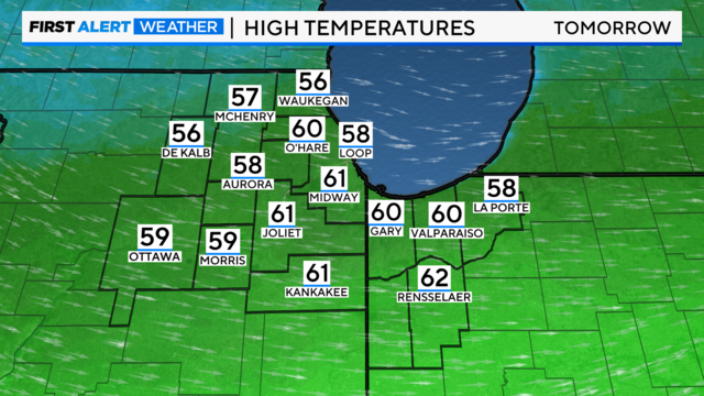
Highs on Saturday will be in the upper 50s to near 60 degrees. Rain chances return late Sunday, with highs around 50 for Easter.

We'll see additional showers late Sunday and through the day on Monday for the first day of April.
Although the severe weather threat is low, storms producing damaging winds and isolated tornadoes will be possible.
Sunday will be mostly cloudy, breezy, and milder, with highs in the mid-40s.
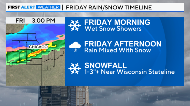
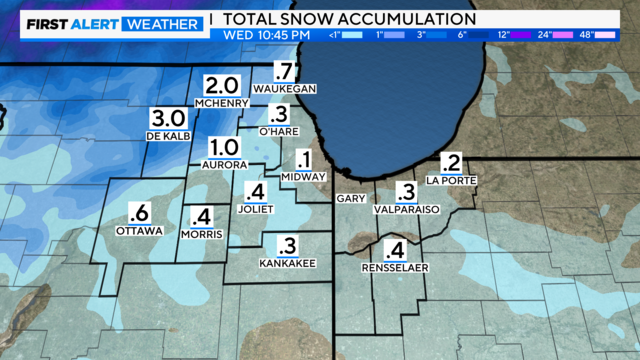
Snowfall amounts of one to three inches will be possible, with isolated higher amounts near the Wisconsin state line.
Snow accumulations will be possible, especially for areas north of I-88.
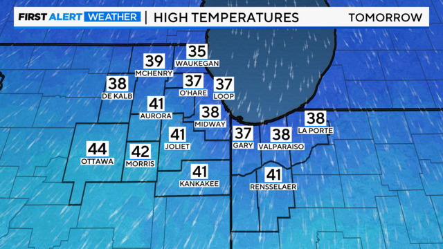
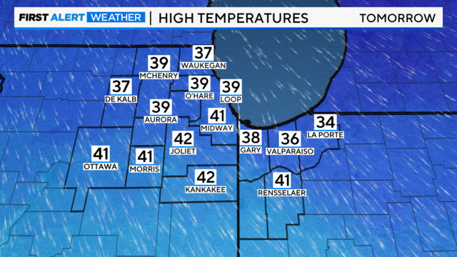
Highs on Sunday will struggle to reach 40 degrees, with wind chills in the 30s.
Skies will clear by Friday, leaving cloudy skies and temperatures in the 50s inland and the 40s lakeside. Skies will turn cloudy by Sunday.