Temps warm over the weekend, light snow returns
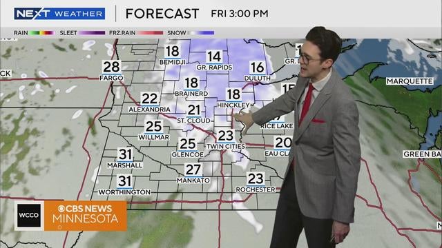
Warmer air is expected to make its return on Friday, along with some light snow in the afternoon.
Watch CBS News
Warmer air is expected to make its return on Friday, along with some light snow in the afternoon.
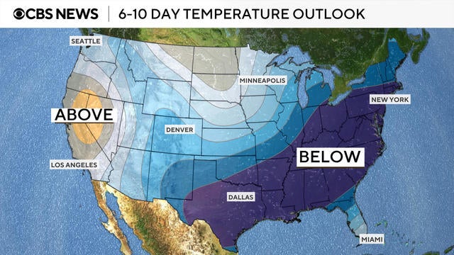
A polar vortex dipping down from Siberia is bringing a cold front with frigid temperatures to millions Americans. See maps of the arctic blast.
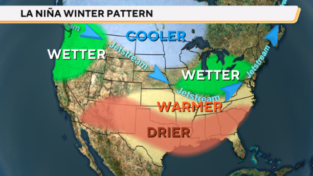
After a long wait, NOAA says La Nina is officially here. That's when the sea surface temperatures along the equator in the Pacific Ocean drop below average.
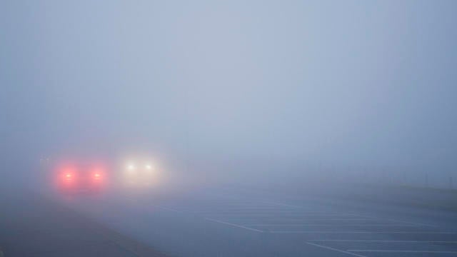
Warm air mixed with snow and rain have caused fog to spread throughout Minnesota over the weekend and into Monday.
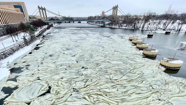
It's been a weather year of extremes in Minnesota, with a warm winter, floods and a drought to cap off the summer.

Minnesota and most of the country will be above average for the holidays this coming week.

WCCO weather alerts will help keep you in the loop when the weather takes a turn, with information regarding school closings.
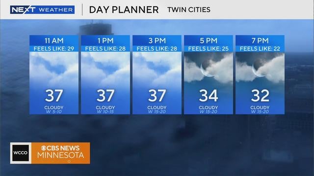
Monday will be another mild, overcast day in the Twin Cities with flurries in some areas.
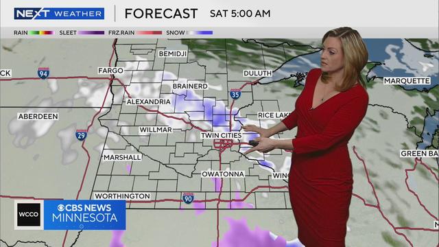
WCCO meteorologist Lisa Meadows says the roads may be icy Saturday with snow and sleet in the forecast overnight.
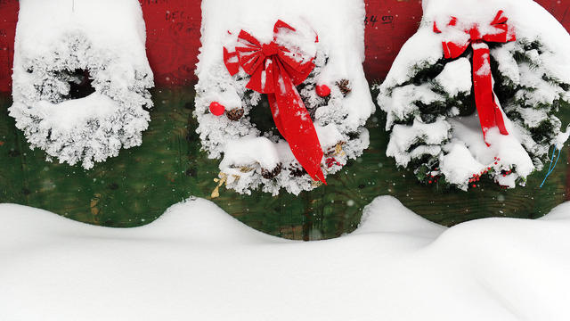
States across the northern United States have a high chance for a white Christmas this year, according to weather experts.
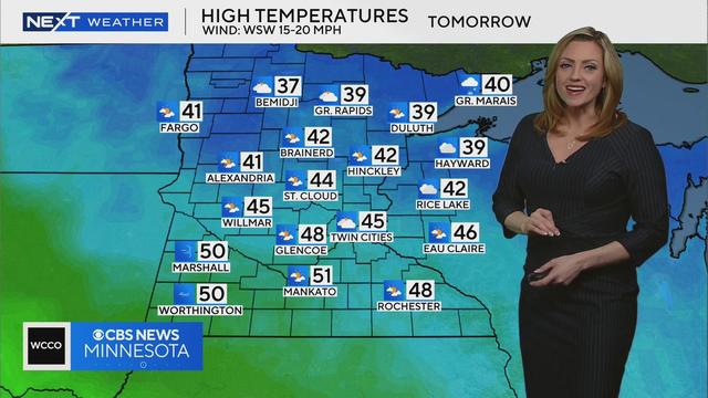
WCCO meteorologist Lisa Meadows says high temperatures will be in the 40s tomorrow in parts of Minnesota before another round of forecasted snow.
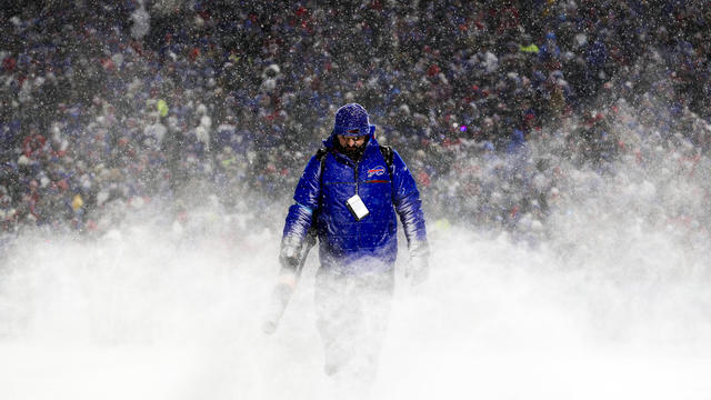
The National Weather Service said "travel could be difficult to impossible" in places where snowfall is forecast to continue into the beginning of the week.
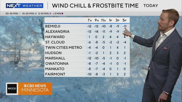
Despite forecasted sunshine, Black Friday shoppers should bundle up with high temperatures in the teens across Minnesota.

Winter storm weather is forecast to bring snow to different parts of the country in the days around Thanksgiving 2024, potentially interrupting travel.
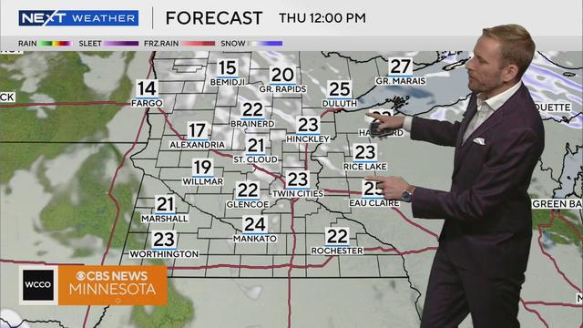
The cold is settling in over the holiday, and with the gusty winds, it'll feel especially chilly.
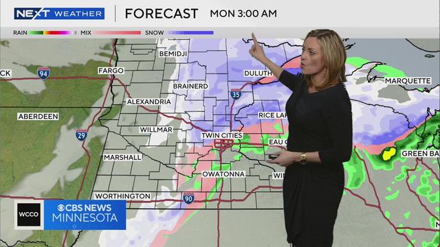
The National Weather Service says the metro may see half an inch of accumulation overnight, with most snow falling between 3 a.m. to 6 a.m. Accompanied by a flash freeze, conditions could "cause significant impacts to the Monday morning commute."
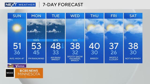
Sunday will be full of sunshine with high temperatures near 50 before things go downhill for the start of the work week.
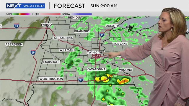
Expect light rain to fall on and off across Minnesota, including the Twin Cities, from Saturday evening through Sunday morning.
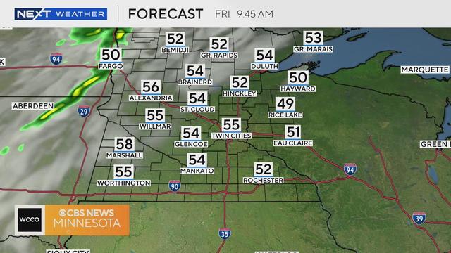
The metro could see some drops overnight into Saturday, though the rain will not be significant.

The temperatures have finally dropped, giving Minnesotans their first taste of cold air and their first reminders of the checklist to protect their home and save money.

Nearly 20% of Minnesota is facing severe drought conditions due to the jet stream and climate change, according to the National Weather Service.
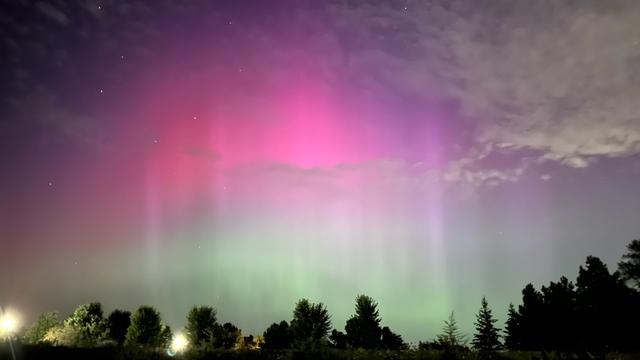
Minnesotans might have a chance to see the northern lights this week. Thursday looks to be the greatest chance in the latest forecast.

After a beautiful #Top10WxDay on Friday, Saturday will be slightly warmer, thanks to a weak cold front dropping into the northern part of the state.

A NEXT Weather Alert is in effect for the Twin Cities and greater Minnesota Thursday evening, with storms impacting the Minnesota State Fair and air travel in the metro area.
Visitors to the Minnesota State Fair are seeking relief from water misters because of soaring late summer temperatures that also prompted some Midwestern schools to let out early or cancel sports practices.