Vikings-Commanders weather forecast (and Chris Shaffer's score prediction)
Meteorologist Chris Shaffer has the Vikings-Commanders forecast for Sunday.
Watch CBS News
Meteorologist Chris Shaffer has the Vikings-Commanders forecast for Sunday.

WCCO meteorologist Mike Augustyniak says that more sunshine is expected Saturday with our highs into the mid 60s. It's enough to call it a #Top10WxDay. And the fall fun doesn't stop there.

Enjoy Saturday's mild, sunny conditions, because the weekend looks to end with a bout of potentially damaging thunderstorms.

Many residents still lack food, running water and electricity in the storm's aftermath.
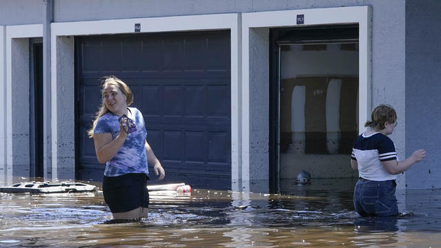
At least 28 people died due to the storm, and many more were left without a home.
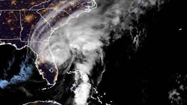
It made landfall over southwestern Florida as a major Category 4 hurricane and, while downgraded, was still packing a powerful punch overnight.

Governor Ron DeSantis has declared a state of emergency for the whole state, which is at risk of major flash flooding this week.

Nearly 50-foot waves and tides up to 13 feet are expected as the dangerous storm brings hundreds of miles of hurricane-force winds.

Sunday will feature a bit more sunshine, but will be relatively similar to Saturday's weather. Temperatures will warm into the 80s by mid-week.

It's starting to feel a bit like fall this weekend, with cooler temperatures and some drizzles to the south.

WCCO meteorologist Riley O'Connor says that Friday is going to be pretty uncomfortable in the Twin Cities.

In the Twin Cities, the high temperature on Saturday will hit 89 degrees, but there will be a gentle breeze and not much humidity.

WCCO meteorologist Riley O'Connor says the day should bring a high of 80, mostly sunny skies and light winds.

Saturday is a Next Weather Alert day, and the latest model runs have storms developing in the morning hours as well as the evening.

Director of Meteorology Mike Augustyniak has the latest forecast.

The main story of the next few days will be the heat. Starting Sunday, meteorologist Riley O'Connor says we can expect a number of days in the 90s,

Some morning showers will give way to a sun/cloud mix later Friday morning.

More showers and isolated thunderstorms are expected Thursday morning, with some dry time mixed in.

Riley O'Connor reports on the latest forecast.
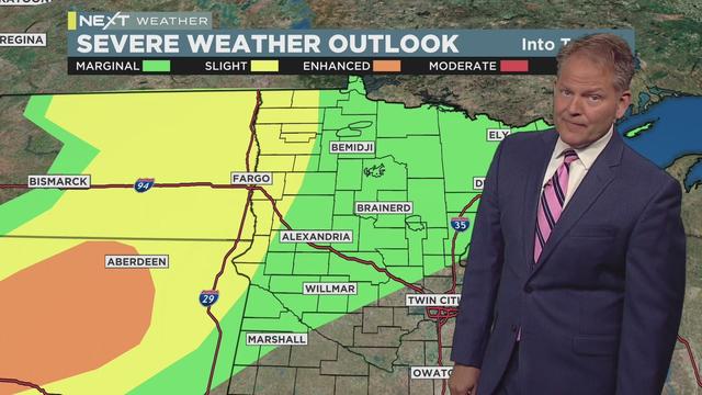
Severe storms rumbling over the Dakotas are expected to move into western Minnesota late Wednesday night through early Thursday morning.

Average temps and sunny skies to start out the week.

After days of stifling heat and humidity earlier this week, both are finally set to back off going into the crux of the weekend.
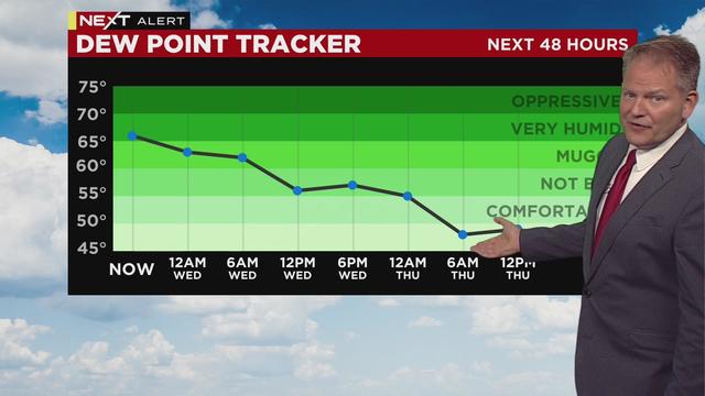
After enduring the hottest day so far this year in the Twin Cities, Wednesday will be far less oppressive.

Thunderstorms are expected to roll across Minnesota Monday morning.

Early morning showers will mostly clear up by the afternoon for a cool and muggy Saturday.