5 A.M. Next Weather Report
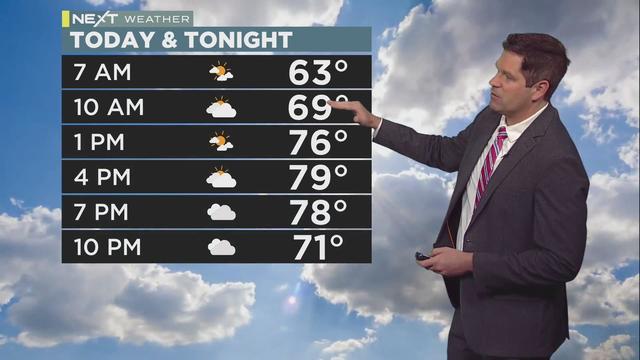
Riley O'Connor has the latest forecast.
Watch CBS News
Riley O'Connor has the latest forecast.
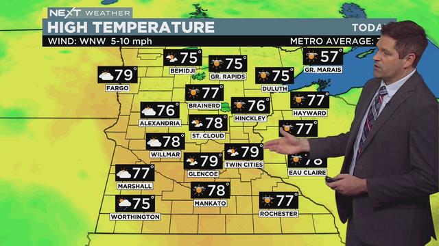
Temperatures will approach 80 degrees in the metro, and much of the state will be close to that mark as well.
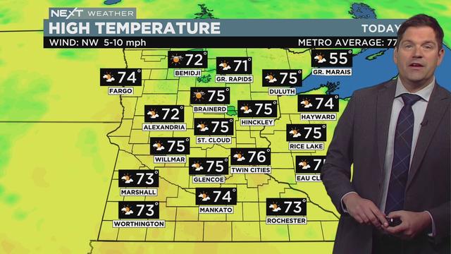
Highs will be in the mid-70s across the state on Wednesday, though the humidity will stay low.
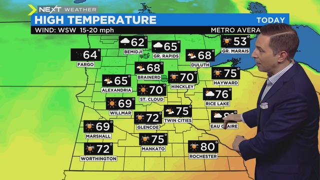
Temperatures on Saturday will top out in the mid-70s, which is above average for this time of year but still cooler than the last few days.
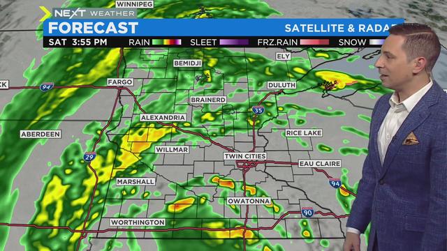
Multiple rounds of rain and thunder will make their way through the state over the weekend, though there will be pockets of dry spells.
The National Weather Service says that the severe thunderstorm watch for the eastern Twin Cities metro and parts of southeastern Minnesota has been canceled.
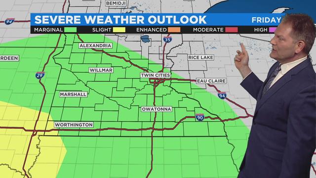
Thursday will be a lovely one, but the rains will return Friday, with a chance for some severe weather.
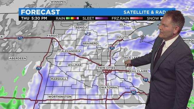
One more windy, gloomy and wet day to go before some relief this weekend.
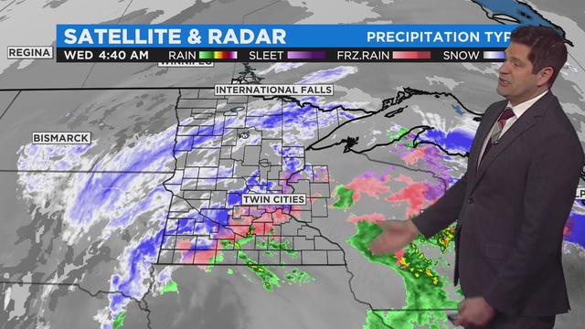
A sloppy spring storm system has swirled into Minnesota, bringing widespread precipitation ranging from snow up north to rain and rumbles of thunder down south.
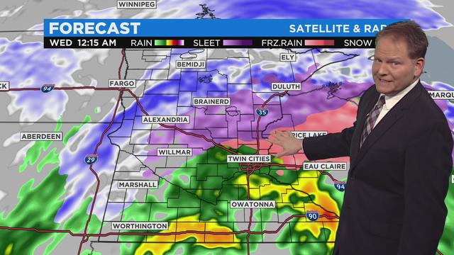
A sloppy, multi-day spring storm is on track to hit Minnesota starting midday Tuesday, with a surge of moisture that could fall as rain, sleet or snow.
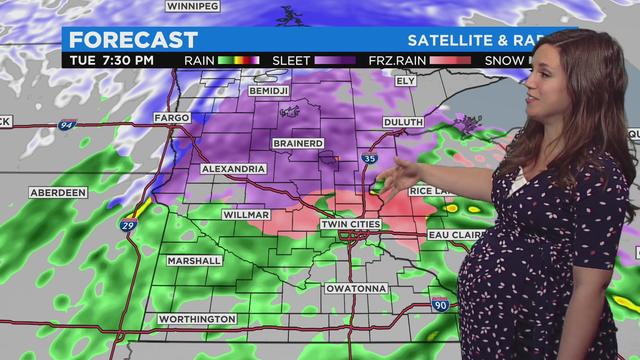
Another sloppy spring storm is on track to hit Minnesota in the coming days with a surge of moisture that could fall as rain, sleet or snow.
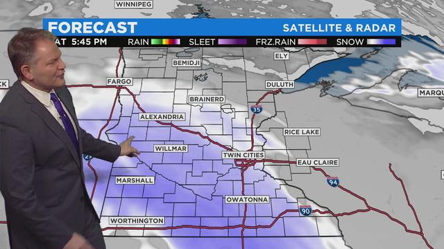
Several light snow systems are expected over the next several days.
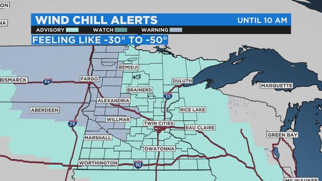
If you're heading outside Friday morning, you'll need multiple layers. Windchill alerts continue into the mid-morning hours.
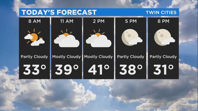
Saturday will see a brief respite from the wind, before the gusts pick back up on Sunday and bring cooler temperatures.
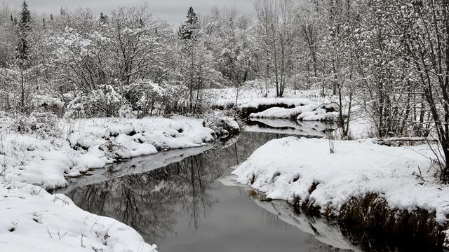
Following blustery conditions and some flurries Thursday, Minnesota during the overnight hours experienced the coldest temperatures recorded this season. Here's a look at what to expect in the coming week as we approach Thanksgiving.
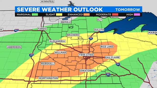
Thunderstorm development is occurring in southern Minnesota early Friday afternoon, and thunderstorm watches could be issued in the area.
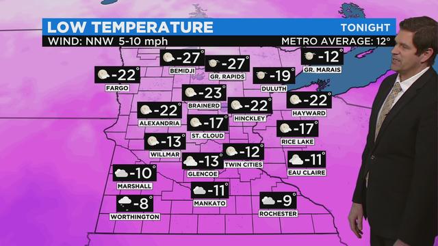
Minnesota's stretch of dangerously cold weather is continuing through the weekend, and some overnight snow is causing slick road conditions Friday morning.
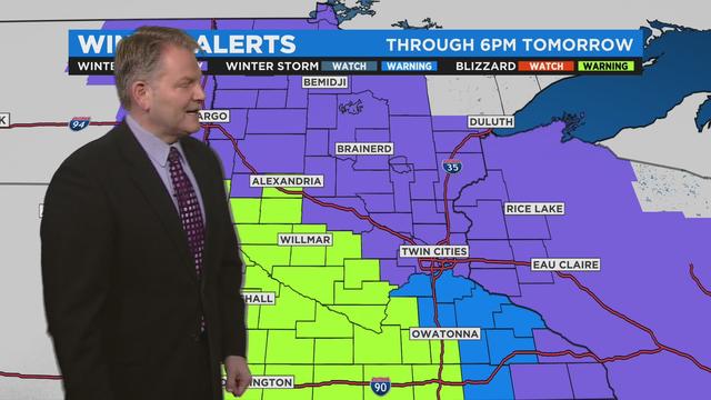
Minnesota's stretch of dry and mild weather is ending Thursday as a sloppy storm system swirls over the state, threatening blizzard conditions in southwestern Minnesota and snow accumulations as high as 7 inches in the Twin Cities.
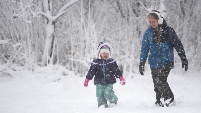
Temperatures are expected to be right at average Saturday as we prepare for more incoming snow.
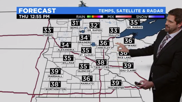
After a cloudy, somewhat gloomy Wednesday, the weather will brighten and slightly warm up for Thanksgiving.
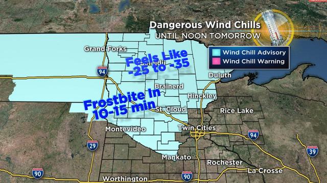
After a rather mild week, the first big cold snap of the season has arrived.
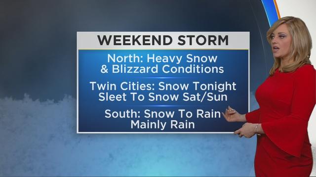
The second round of winter storms is hitting Minnesota Friday night – but this one has a twist.
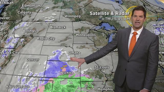
After the first major snowfall of the year affected a majority of the state Wednesday, things look a bit more calm for Thanksgiving. But more snow is possible for later in the day.
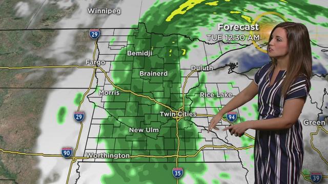
Expect a soggy start to the week with heavy rain moving northwards into the state along with strong winds Monday.
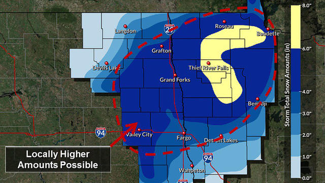
As southern Minnesota deals autumn rains this week, the northwestern corner of the state could see a blast of winter, with more than 6 inches of snow stacking up in some areas.