Showers, storms blow into Chicago area Tuesday night
A few storms could be strong, producing small hail and gusty winds.
Watch CBS News
A few storms could be strong, producing small hail and gusty winds.
A chance for showers and storms on Tuesday with highs in the upper 60s and low 70s.

The best chance for showers in the morning will be to the north near the Wisconsin Stateline. Additional widely scattered storms are in the forecast closer to Chicago in the afternoon and evening.
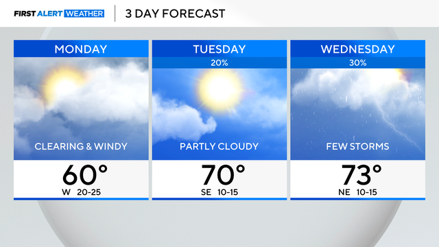
Monday's temperatures will be in the 50s.

A tornado watch was issued for much of the evening for some counties adjacent to the Chicago area, but has been dropped.

More rain and possible storms move in by late night and end early Monday morning.

Rain chances ramp up for Easter Sunday, especially by midday. Highs will only reach the lower 50s.

Meteorologist Laura Bannon has the latest First Alert Weather forecast.
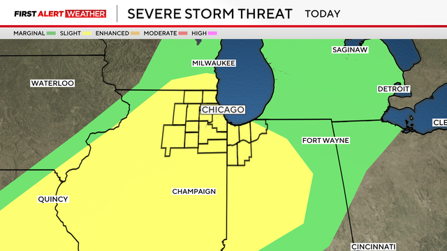
Chicago weather Friday will see temperatures soar near 80 degrees before the warm, wet air mass collides with a cold front that could produce severe thunderstorms.

Chicago weather Friday will see temperatures soar near 80 degrees before the warm, wet air mass collides with a cold front that could produce severe thunderstorms.

An isolated strong storm may wander into our area overnight tonight, mainly north of I-88, but most will remain dry, mild, and windy as south winds prime the atmosphere for Friday's storm threat.
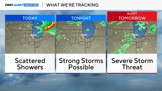
There's a chance for strong storms Thursday night, with gusty winds and small hail as the main threats.

There is a chance for strong storms Thursday night. Storms that do develop Thursday night could produce gusty winds and small hail.

A strong geomagnetic storm means the Northern Lights could be visible north of Chicago near the Illinois-Wisconsin border and in parts of Michigan Wednesday night.
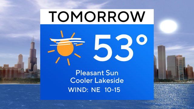
Brisk winds will make it cooler in the 40s near Lake Michigan on Wednesday.

Expect more clouds and wind for Tuesday, with a chance of rain in the morning—highs in the low 50s.
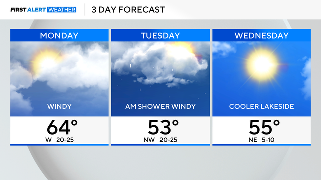
Gusty winds are expected on Monday with highs near 64 degrees.
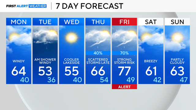
We are tracking a cold front slated to move through Tuesday morning with a few quick rain showers, then cooler breezes to follow through midweek.

Highs will range from upper 50s and low 60s near the lake, to near 70 degrees in the southwest suburbs.

In Chicago today clouds increase with highs near 60 degrees for most areas.

Dry weather mainly continues until the next chance of spring storms is late next week.

Expect 40s near the lake.

The sun returns today with milder temperatures in the lowermost 50s.

Sunshine and warmer temperatures return this weekend.

Wide temperature range today, cooler than average in the 40s in Chicago but near 60 south of I-80.