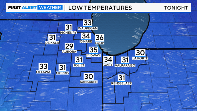
Frost likely in Chicago area Thursday morning
Skies will be mostly Wednesday night with temperatures in the 30s.
Watch CBS News
Skies will be mostly Wednesday night with temperatures in the 30s.
Patchy frost and a rural light freeze are possible on Wednesday night as winds relax.

CBS 2 Chief Meteorologist Albert Ramon has the 6 p.m. forecast for April 22, 2024.

CBS 2 Chief Meteorologist Albert Ramon has the 5 p.m. forecast for April 22, 2024.
Behind this system, a strong cold front drops low temperatures back into the 30s Tuesday and Wednesday nights, likely leading to more rural frost.

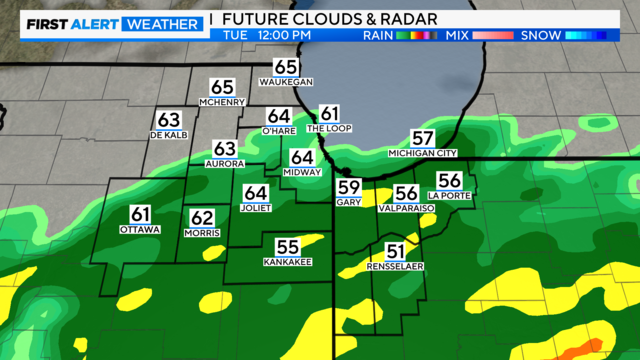
Scattered rain showers, and even a strong storm are expected in the Chicago area on Tuesday, before another round of cold air and frost blow in midweek
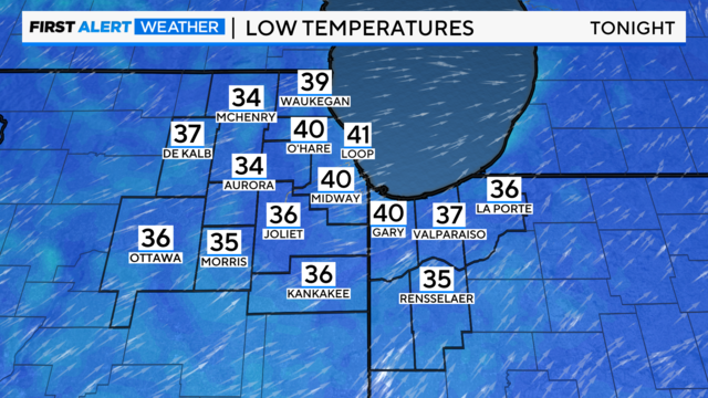
Lows in the 30s in the western suburbs, but staying in the low 40s in Chicago.

A Freeze Warning is in effect in the far west suburbs of Chicago, and a Frost Advisory for a portion of northeast Illinois & Northwest Indiana - both until 8 a.m.

Clouds are clear, and chilly breezes relax this evening. Then, temps fall quickly to the 30s by morning.

CBS 2 Meteorologist Laura Bannon has the 5 p.m. forecast for April 20, 2024.

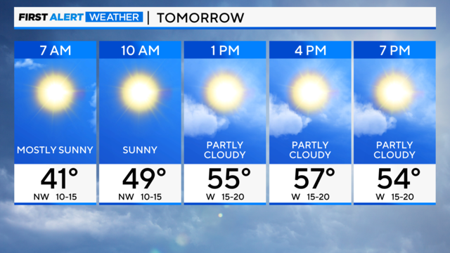
It'll stay breezy through the day as clouds increase.

Today's highs are near 50 degrees. Clouds will clear, and winds will relax tonight as temperatures crash.
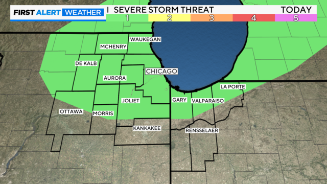
Other than a few rumbles of thunder and brief downpours, the severe weather risk is expected to remain south of the Chicago area.
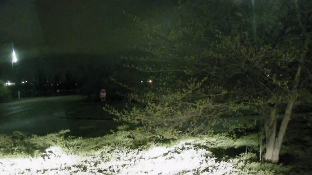
A small chance of showers and storms persists Wednesday morning.

CBS 2 Chief Meteorologist Albert Ramon has the 6 p.m. forecast for April 16, 2024.

CBS 2 Chief Meteorologist Albert Ramon had the 5 p.m. forecast for April 16, 2024.

CBS 2 Chief Meteorologist Albert Ramon has the 4 p.m. forecast for April 16, 2024.

Waves of showers and thunderstorms are possible throughout the day, but the main window for severe weather is during the evening. Large hail and damaging wind are the main threats, but there is a risk of tornadoes.

The storm threat continues into early Wednesday, and then cooler weather is expected for the end of the week.
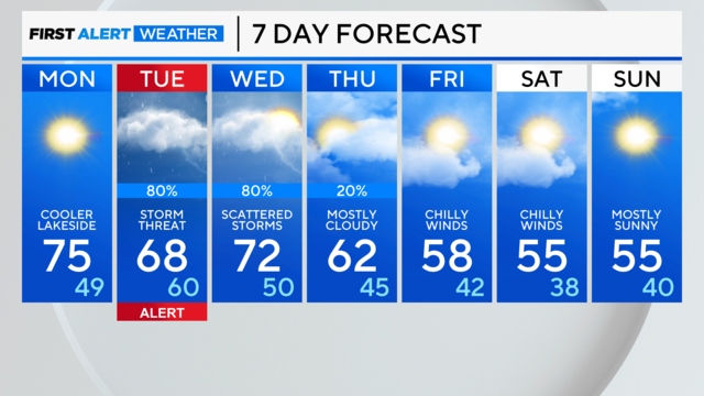
Sunday was the warmest day of the year so far for Chicago as the area reached 80 degrees for the first time this year.
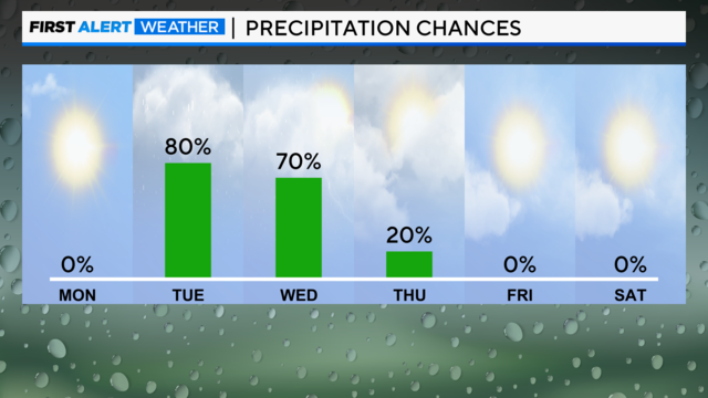
A severe storm threat arrives Tuesday afternoon and evening, and storms could linger into the Wednesday morning rush.
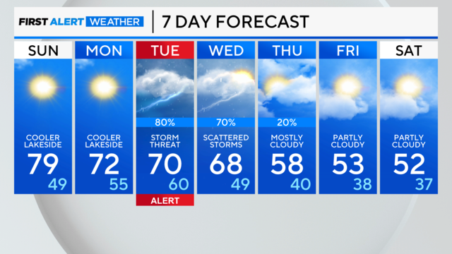
Later in the day, a lake-enhanced cold front will turn the winds off the chilly lake, and temperatures will drop.

The low for Wednesday night is 48. The high for Thursday is 52.

Highs Tuesday will be around 65.

CBS 2 Meteorologist Mary Kay Kleist tracks wet weather coming back this week.