Heat to linger, this week, intensify next week across South Florida
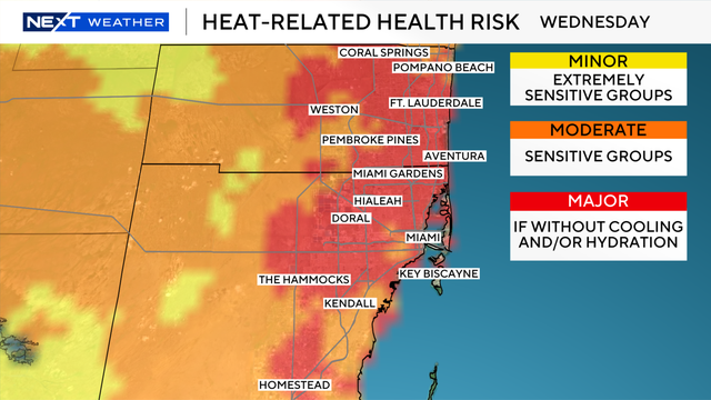
A heat advisory begins at 11 a.m. Wednesday for metro Broward and Miami-Dade counties and will last until 6 p.m.
Watch CBS News

A heat advisory begins at 11 a.m. Wednesday for metro Broward and Miami-Dade counties and will last until 6 p.m.
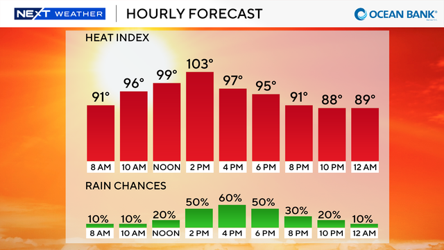
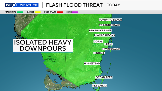
Scattered showers and storms will move across the area late morning through the early afternoon, but not as widespread as Monday.
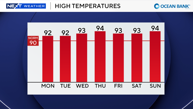
Another hot and steamy day is expected in South Florida with feels-like temperatures as high as 108 degrees Monday afternoon.

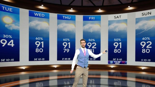
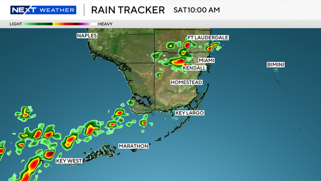
The NEXT Weather Team is monitoring several rounds of rain for the Independence Day weekend in South Florida.
Despite showers and thunderstorms, steamy conditions continue across South Florida with triple-digit feels-like temperatures.
The wet weather pattern in South Florida is expected to continue into the Fourth of July holiday weekend.
South Florida is facing multiple weather hazards this week as dangerous heat continues, heavy rain raises the risk of flooding and wildfire smoke impacts air quality.
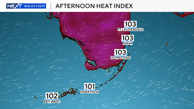
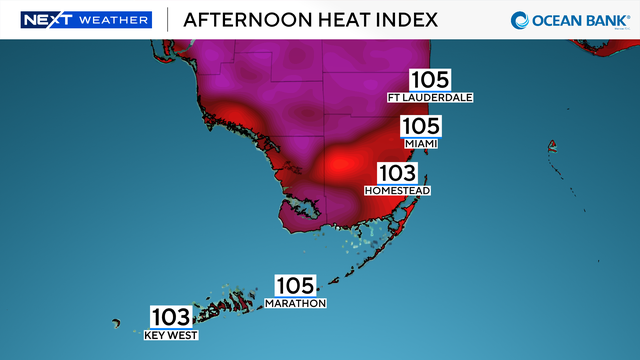
The "feels-like" temperatures are again expected to get into the triple-digits across much of the region on Monday.
The NEXT Weather Team is also monitoring tropical developments for next week.
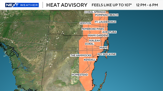
People in South Florida are being urged to stay hydrated and to wear light colors and loose-fitting clothing due to the dangerous heat.
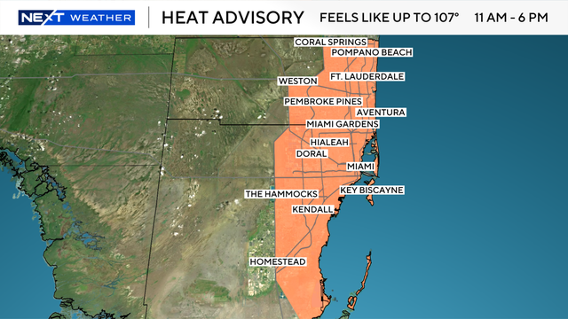
A heat advisory will be in effect from 11 a.m. until 3 p.m. Monday for metro Broward and Miami-Dade counties.
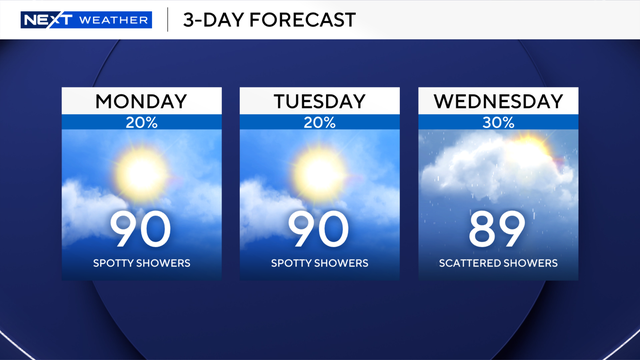
The "feels-like" temperatures will peak closer to 100 degrees in South Florida for both Monday and Tuesday afternoons.
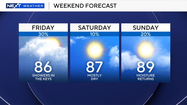
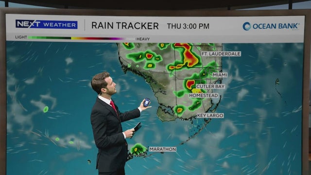
There's a chance of seeing scattered showers and thunderstorms in South Florida today, but the higher risk will be found in the Keys.
Drier air starts to arrive in South Florida on Friday and continues to move in for the weekend. Rain chances will also drop significantly.
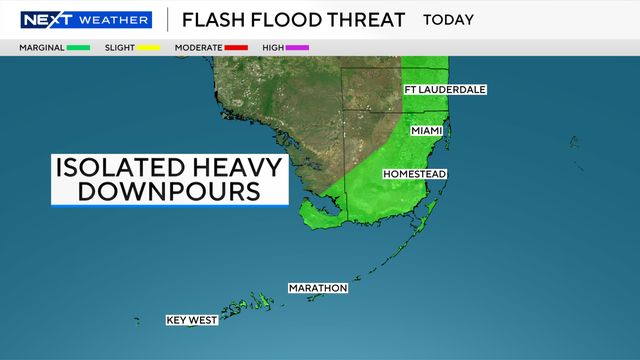
Scattered to widespread rain chances linger in the forecast for the rest of the workweek and will lower for the upcoming weekend.