Saharan dust to bring drier, hotter conditions to South Florida by midweek

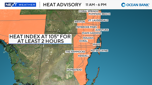
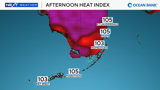
Another heat advisory will be in effect for Broward and Miami-Dade counties as "feels like" temperatures soar to around 105 Tuesday afternoon.
The advisory will be in effect from 11 a.m. until 6 p.m. Tuesday as these areas could experience these elevated heat index values for at least two hours.
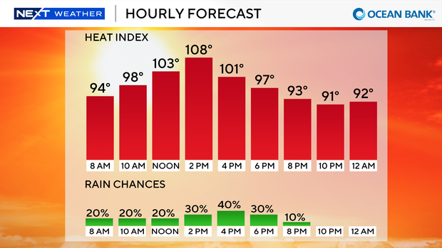
Scattered showers and storms will move across the area late morning through the early afternoon, but the rain isn't expected to be as widespread across our metro areas like it was on Monday.
The CBS News Miami NEXT Weather team will be monitoring a 40% chance through Tuesday afternoon with drier conditions just around the corner for midweek as the next wave of Saharan dust arrives in South Florida.
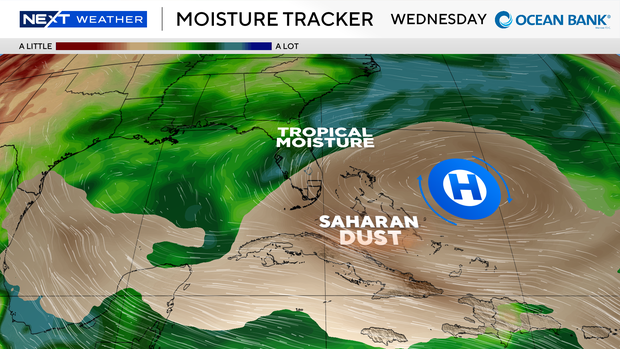
The dust will bring drier, hazier, and hotter conditions for Wednesday and Thursday as highs climb closer to the mid-90s on the thermometer.
"Feels like" temperatures will continue to stay in the triple digits for the rest of the workweek and weekend, bringing major heat risk concerns for Broward and Miami-Dade.
Some forecast models show the potential for a weak disturbance to bring scattered rain chances to South Florida late Friday into early Saturday.
There is a lot of uncertainty around these particular rain chances at this time, so our team will continue to monitor the forecast and provide updates throughout the week.
The weekend forecast will trend drier and hotter by Sunday with highs in the mid-90s and heat index values climbing closer to 110.
Unfortunately, no heat relief is in sight as temperatures will continue to climb heading into the upcoming workweek.