Threat for showers, thunderstorms rise Wednesday afternoon across South Florida

The NEXT Weather Team is tracking the potential for scattered to widespread showers and storms on Wednesday afternoon.
The day starts with warm and quiet conditions on the radar across South Florida. Ongoing smoke from the wildfire in West Broward County continues to spread across the area, bringing moderate impacts to air quality.

Improvements are expected by late morning into the afternoon.
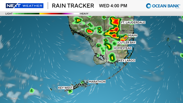
Isolated showers and storms develop around lunchtime for Broward and Miami-Dade and will continue to grow more widespread heading into the late afternoon and early evening hours.
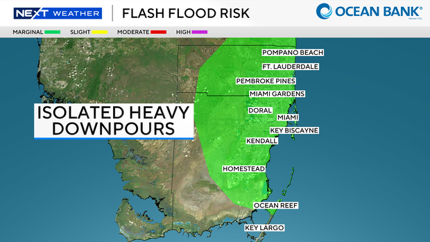
Isolated heavy downpours in addition to slow-moving showers will lead to a marginal - level 1 out of 4 - flood risk for metro Broward and Miami-Dade.
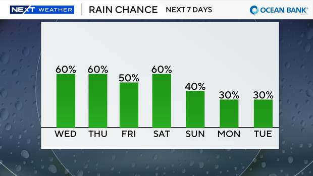
Rain chances drop during the overnight hours but then return for Thursday afternoon as a similar flood risk lingers in the area.
Ahead of the rain, expect "feels like" temperatures to peak around 103-105.
This will be the case for the rest of the workweek and upcoming holiday weekend.
The wet weather pattern is expected to continue for the 4th of July with a 40-60% chance for showers and storms Saturday and Sunday.