South Florida sees hot start to week with rain, thunderstorm chances rising into 4th of July weekend

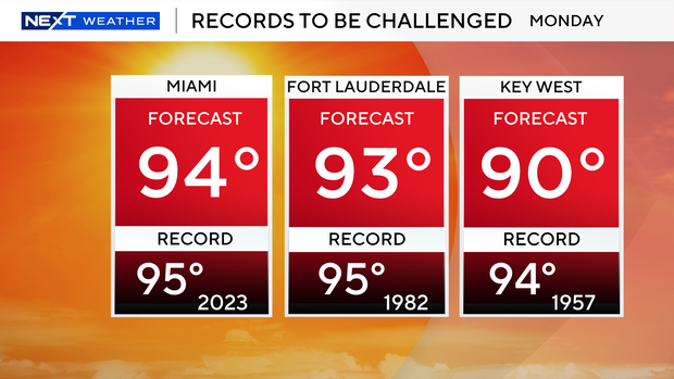
The NEXT Weather Team at CBS News Miami is tracking a hot and hazy start to the workweek with near-record afternoon highs in the forecast.
Saharan dust continues to move through South Florida, bringing mostly dry conditions to our area.
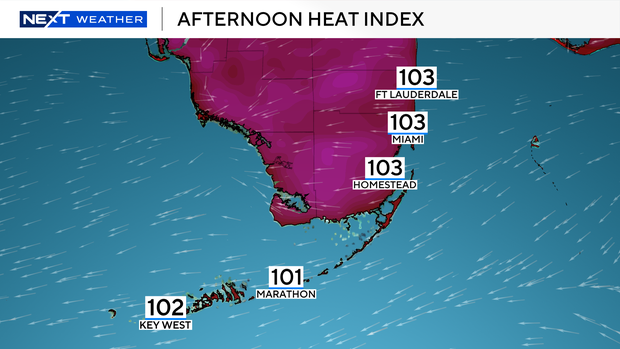
This drier air will allow temperatures to soar closer to the mid-90s for the afternoon.
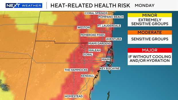
"Feels-like" temperatures up to around 105 will be possible, causing major heat-related health risks to continue for the start of the workweek.
Similar heat is expected for Tuesday.
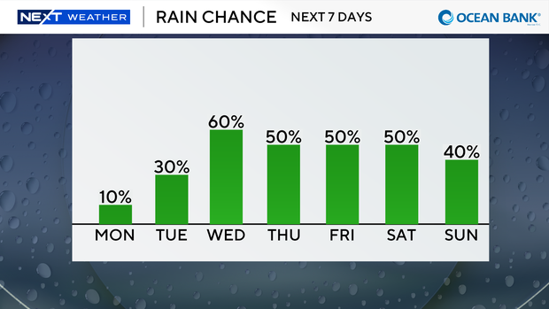
While a 10% stray shower chance is possible, most will remain dry on Monday.
Rain chances ramp up starting Tuesday afternoon and will remain elevated Wednesday into the 4th of July weekend.
A 30% scattered shower and storm chance on Tuesday will increase to 60% on Wednesday.
Despite higher rain chances, afternoon highs will still be able to make it to the lower 90s Tuesday through the weekend.
Our team is also continuing to monitor an area of potential tropical development off the coastline of the Carolinas.
The National Hurricane Center has now dropped the chances of development down to 10%.
No direct impacts from this area are expected for South Florida.