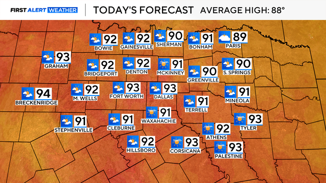
Rain chances and high pressure build as temperatures rise in North Texas
Rain chances will fade overnight as high pressure builds across Texas. Temperatures will steadily climb through the remainder of the week.
Watch CBS News

Rain chances will fade overnight as high pressure builds across Texas. Temperatures will steadily climb through the remainder of the week.
After these rain chances, DFW turns dry, and we really start to heat up.

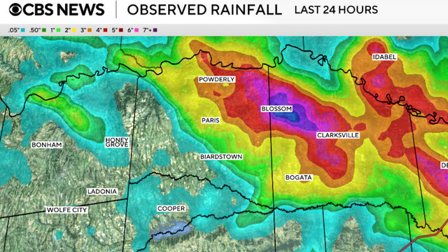
The National Weather Service allowed a flash flood warning for parts of Dallas, Collin and Denton Counties to expire at 11:45 a.m.
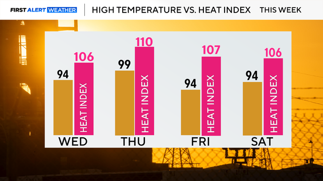
A Heat Advisory is in effect beginning at noon through 9 p.m.
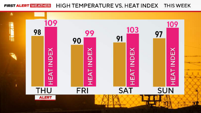
Looking ahead to Thursday, a First Alert Weather Day is in place due to extreme heat, with a heat advisory in effect at noon.
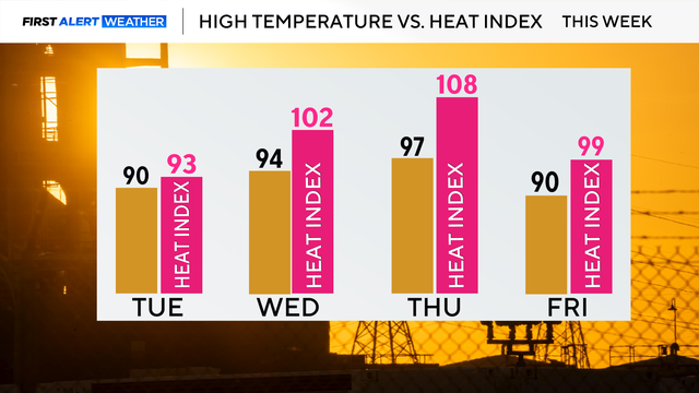
By Wednesday, feels-like temperatures reach the lower 100s and then on Thursday it may feel as hot as 108.

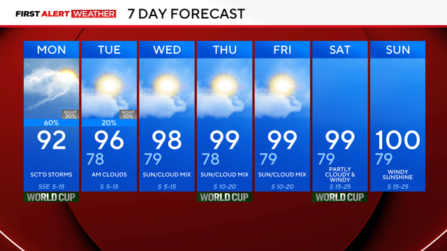
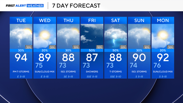
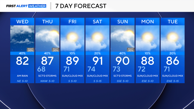
Scattered showers and thunderstorms are expected Friday, with periods of heavy rain on the way for Saturday and into Sunday morning.

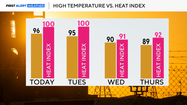
Temperatures will be right around where they should be for this time of year – in the mid to upper 80s, feeling more like 90° once you factor in the humidity.

Expect a mix of clouds and sunshine, with highs around 90° and feels-like temperatures closer to the mid-90s.
By Tuesday afternoon, a backdoor cold front (a cold front that moves in from the northeast) arrives, increasing our chances of isolated thunderstorms.
Some showers and thunderstorms will impact the afternoon commute on Tuesday. The best opportunity for widespread rain and thunderstorms currently looks to be Friday into Saturday.
Friday will be the first of five days in the 90s. Feels-like temperatures in the Dallas-Fort Worth Metroplex will be 94° on Friday afternoon.
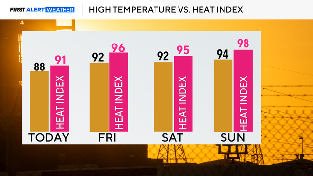
The heat index will rise every day, reaching the upper 90s on Sunday.
There's a threat of isolated thunderstorms, especially east of I-35 throughout the afternoon.
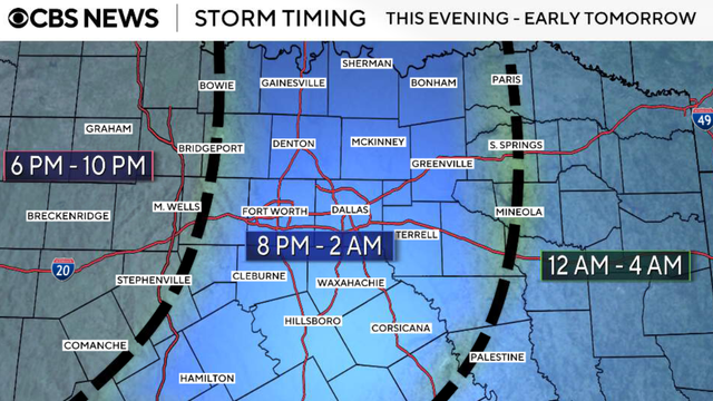
There were plenty of flooding issues across Tarrant County Monday, and DFW is under a level 2/4 risk for flooding again Tuesday into early Wednesday morning.