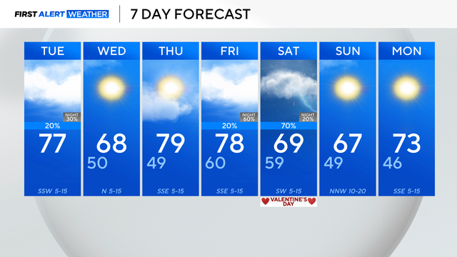
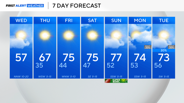
North Texas to stay breezy with temperatures in the mid-70s Tuesday
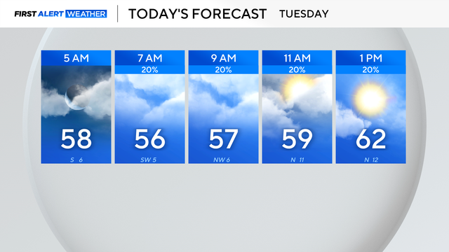
It will be partly cloudy at times throughout Tuesday, preventing DFW from reaching 80°.
Watch CBS News

It will be partly cloudy at times throughout Tuesday, preventing DFW from reaching 80°.
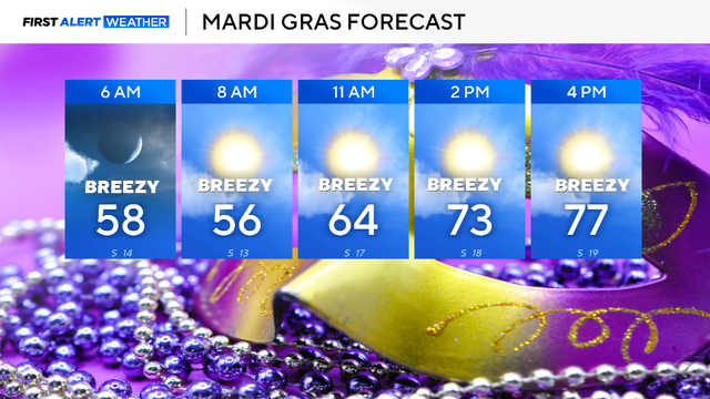
Mardi Gras, Tuesday, will start mild in the 50s and warm into the upper 70s by mid-afternoon.

Temperatures will warm into the mid-70s in the afternoon with a mix of sun and clouds.
It will be sunny, cooler and less humid Wednesday, with morning temperatures in the 40s and afternoon highs expected in the mid-60s.
Humidity has increased as an upper-level low sits to the west and a cold front approaches from the north.

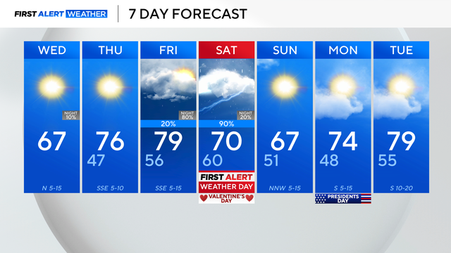
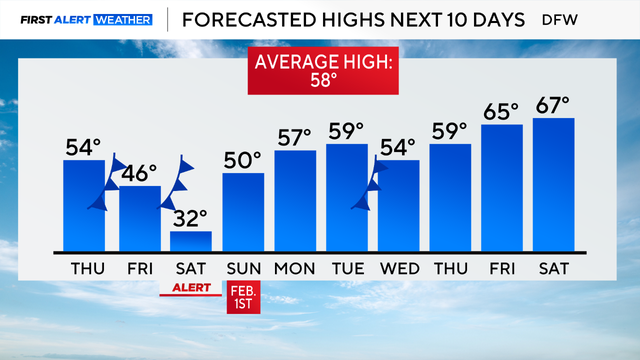
The high temperature on Saturday will dip into the upper 60s before rising back into the mid-70s on Sunday.

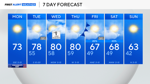
After today there are no more mornings in the 30s for at least another seven to ten days.
There is a small chance for a few sprinkles across portions of North Texas, as a weak disturbance pushes south, but most will just see clouds.
A cold front moving into the region will bring clouds and a chance for a few showers along and east of I-35 on Tuesday morning and into the afternoon.
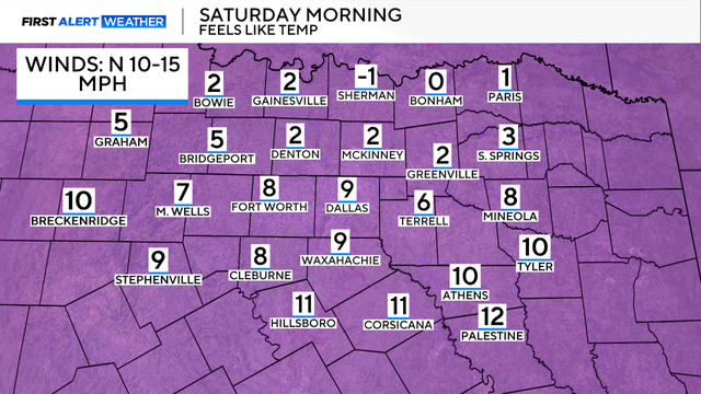
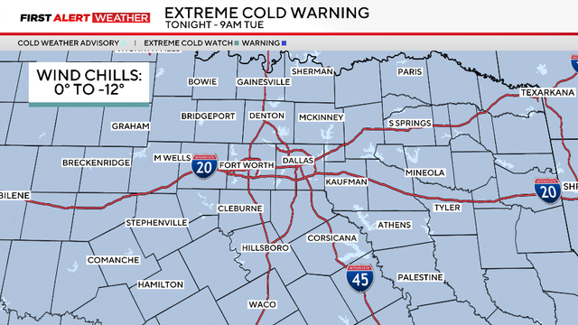
Feels-like temperatures on Saturday morning will be as cold as 0.
A First Alert Weather Day is in effect for Saturday due to extreme cold, with wind chills ranging from -5 to 15.
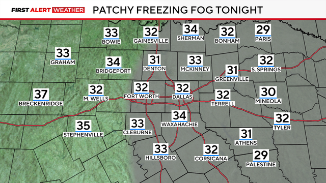
A First Alert Weather Day is in place due to the freezing fog advisory, which is in effect through 11 a.m. Wednesday, visibility will be under three miles.

A First Alert Weather Day is in effect for Wednesday morning due to the chance for freezing fog.
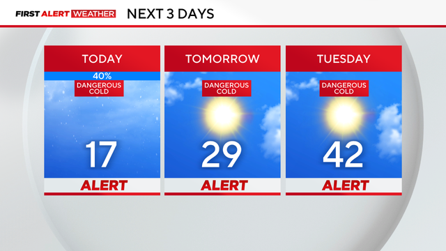
Weather Alerts are in place through Tuesday due to dangerously cold temperatures and icy roads at times.
Saturday began with rain, sleet and snow in parts of North Texas, with temperatures falling into the low 30s by 3 a.m.