Sunny skies, temperatures in the 90s continue across North Texas
The stretch of sunny days with above-average temperatures continues in North Texas.
Watch CBS News

The stretch of sunny days with above-average temperatures continues in North Texas.
It is a hot end to the month of September. Most days have been above average temperature-wise and that trend is looking to continue starting in October.

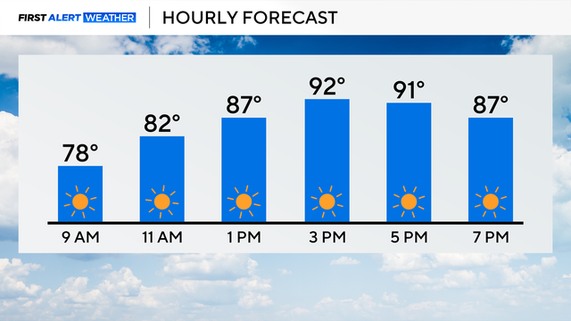
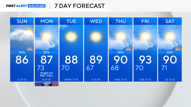
The high for Dallas-Fort Worth is expected to top out around 87 degrees and cloud cover will be increasing with dry conditions expected.

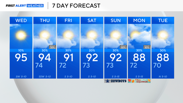
The State Fair of Texas kicks off on Friday with a high of 87 and low humidity.

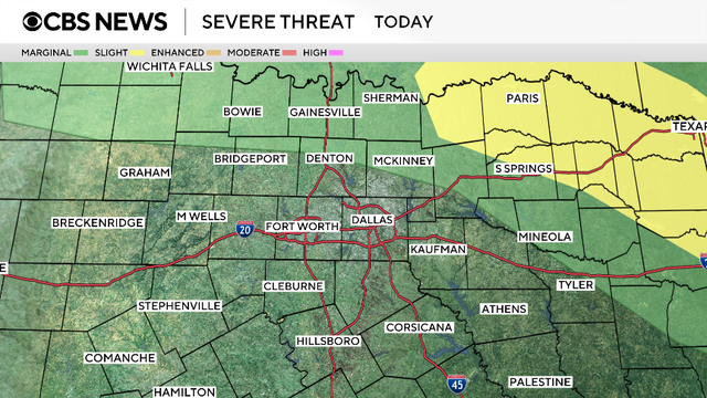
The First Alert weather team is tracking a cold front currently in the Texas and Oklahoma panhandles.
Once again, there's an Air Quality Alert in place for the Dallas-Fort Worth Metroplex and surrounding counties.
As we get through the end of the week, expect spotty shower chances that are fairly short-lived.
Tuesday morning was another crisp and cool one with the low temperatures dipping to 63 degrees.
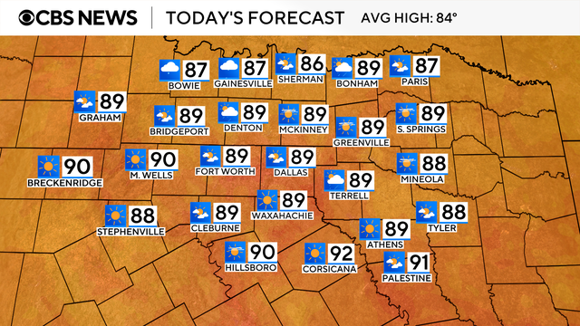
Mostly sunny skies, winds from the southeast around 5 to 10 mph and highs in the mid-80s are in the forecast today.

Scattered storms moved through along a cold front. Cooler, drier air is expected to settle in for the weekend.

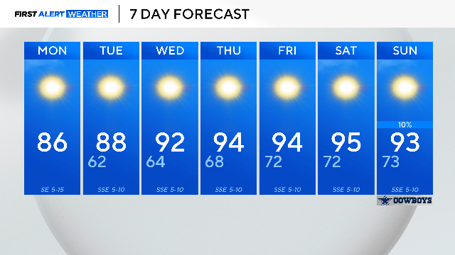
If DFW hits 100 degrees, it will only be the 7th time that has happened in 2025. The average is 20 times per year.
Storms were expected but not forecasted to move as slowly as they have been, which is leading to flooding.
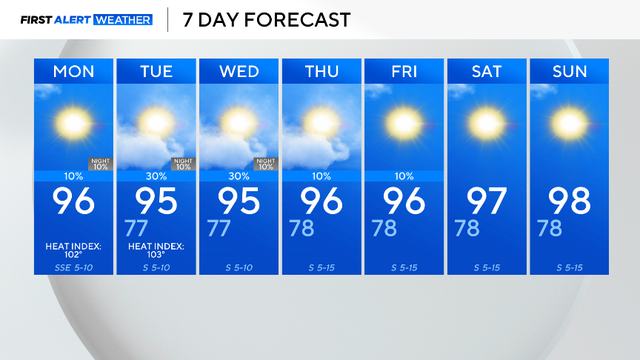
Afternoon highs will climb into the upper 90s with "feels-like" temperatures up to 104 degrees.
So far, 28% of this summer has been cooler than normal and this trend is likely to continue through the week.
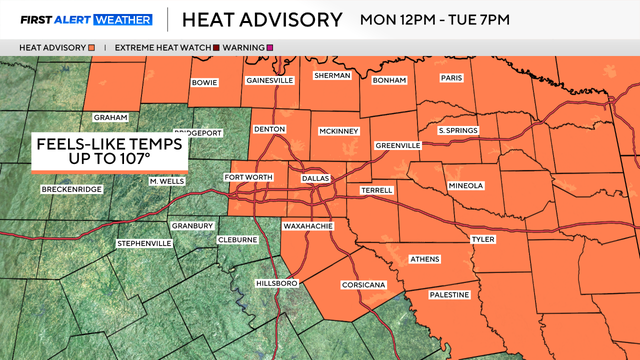
A heat advisory will go into effect starting at 12 p.m. Monday and will continue through 7 p.m. Tuesday.