
Sunny skies, temperatures above average through the weekend
For Thursday, highs will be in the lower 80s. The average high temperature for this time of year is the mid to upper 60s.
Watch CBS News

For Thursday, highs will be in the lower 80s. The average high temperature for this time of year is the mid to upper 60s.
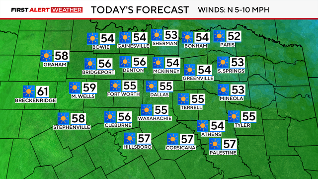
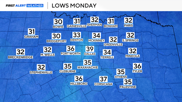
There will be plenty of sunshine on Monday with a high temperature in the mid-50s, sitting well below average.
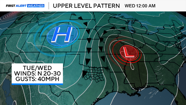
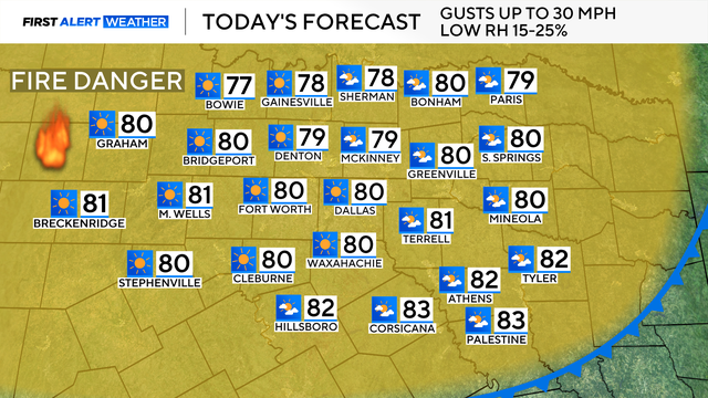
There will be plenty of sunshine, but the northerly winds will gust up to 40 mph, making it feel very chilly throughout the day.
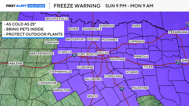
A First Alert Weather Day has been issued for Monday for temperatures in the metroplex at or near freezing, and wind chills even colder.

High pressure remains in control, so sunny skies and dry conditions are the rule for the next few days.
The warmer-than-average trend won't last too much longer as two cold fronts will move through this weekend.
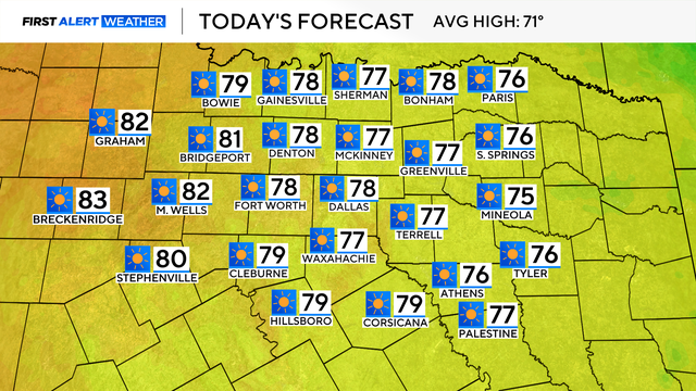
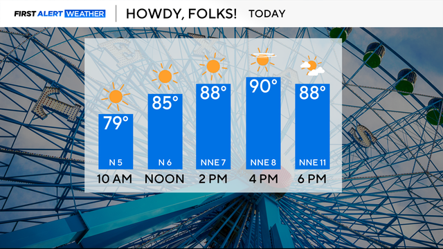
Don't let the cool morning fool you – afternoon high temperatures will reach the upper 70s. Cities to the west of I-35 could reach the 80s.
A strong cold front will bring isolated showers, powerful wind gusts, and the coldest air since early April to North Texas this week.
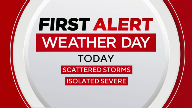
This shower activity will carry a much lower severe threat, however, we do have a 1-out-of-5 risk for strong to severe thunderstorms where these cells do develop.
A cold front moved across North Texas this morning, which brought cooler temperatures, a dry airmass and windy conditions.
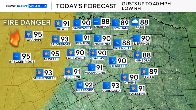
Winds could reach up to 40 mph in some parts of North Texas.

The First Alert Weather team continues to monitor the cold front arriving in North Texas on Saturday.
It has been an abnormally warm and dry first week of October.

Though most of the area will remain dry, there is a slight chance of an isolated shower for areas to the east.

This month has started dry and will likely continue to stay dry through mid-October.