Expect warm temperatures, high winds before round of storms head for DFW
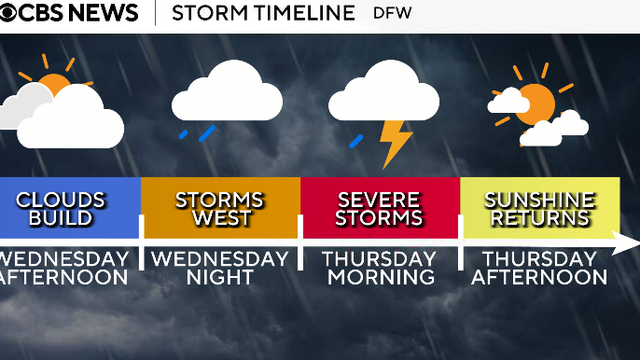
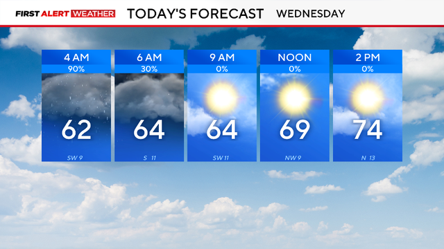
Looking ahead to Wednesday, the day will be dry throughout the day ahead of the first round of storms that move in overnight into Thursday.
Watch CBS News

Looking ahead to Wednesday, the day will be dry throughout the day ahead of the first round of storms that move in overnight into Thursday.
Expect plenty of clouds before the sunshine in the afternoon. It will be breezy at times, with some gusts up to and possibly over 20 mph.
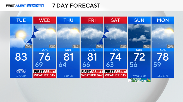
A First Alert Weather Day is in place for Wednesday morning due to the threat of flooding.

Forecasters say the timing of the front may affect morning travel and outdoor plans.

Friday has the biggest expected chance of severe weather, with most of the region under a level two (slight) risk.
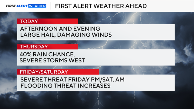
The severe weather threat begins around 5 p.m. Wednesday and continues through midnight.
Clouds will decrease throughout the afternoon, and winds will stay breezy coming from the south, gusting up to 20 mph.
Even with that record rain, though, the region is still well below normal for rainfall this winter season, with a deficit of 4.3".

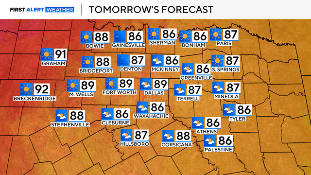
Temperatures will warm into the mid-70s in the afternoon with a mix of sun and clouds.
It will be sunny, cooler and less humid Wednesday, with morning temperatures in the 40s and afternoon highs expected in the mid-60s.

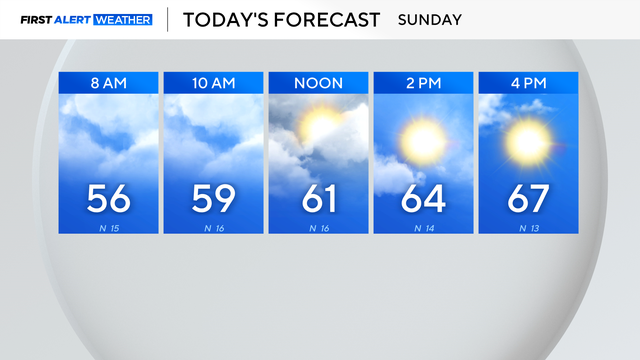
The high Monday will climb into the 70s by lunchtime and top out around 82 degrees by 4 p.m.
Following a cold weekend in North Texas, we kicked off the workweek on a warmer note, with highs near 70 for much of the metroplex.
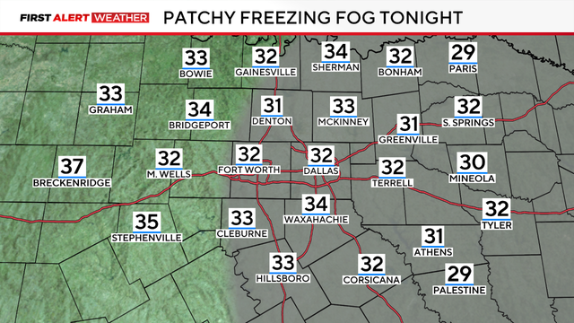
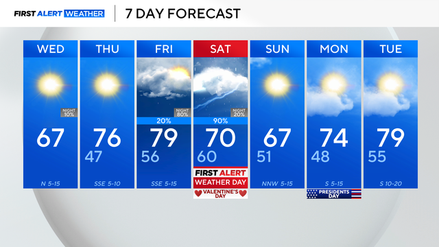
A First Alert Weather Day is in place due to the freezing fog advisory, which is in effect through 11 a.m. Wednesday, visibility will be under three miles.
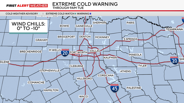
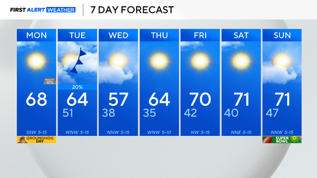
An extreme cold warning is in effect through Tuesday morning due to wind chills from 0 to -10 degrees covering the region.
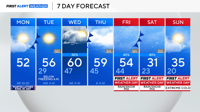
An arctic air mass is set to bring dangerously cold air and wintry precipitation to North Texas this weekend. We have issued First Alert Weather Days for Friday through Sunday for all of this.