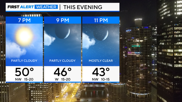
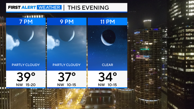
Northwesterly winds, mixed skies in Chicago Saturday evening
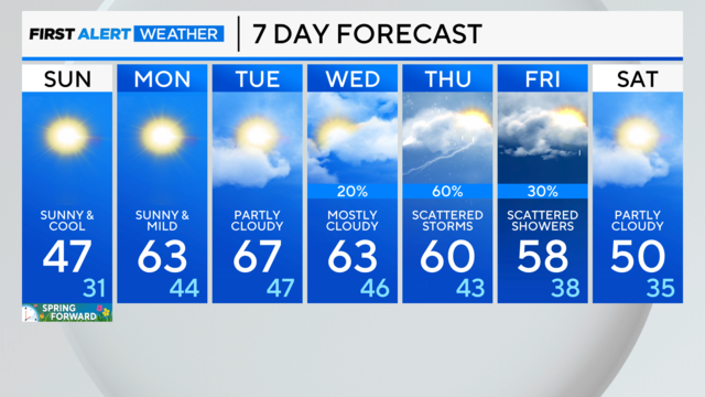
Chilly northwest flow for the second half of the weekend.
Watch CBS News

Chilly northwest flow for the second half of the weekend.
Southwest winds this morning become northwesterly and gust to 40 mph.
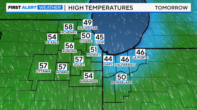
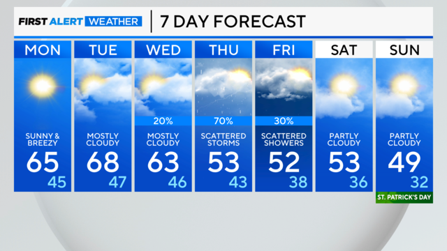
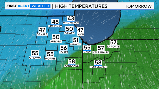
Skies will clear by Friday, leaving cloudy skies and temperatures in the 50s inland and the 40s lakeside. Skies will turn cloudy by Sunday.
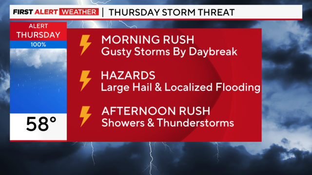
If clouds and showers linger into the early afternoon, that would keep stable air in place and prevent a second round from forming.
These gusty storms could contain large hail and bring localized flooding problems due to their expected "training" effect.
Some models hint at a few unstable showers in the afternoon.
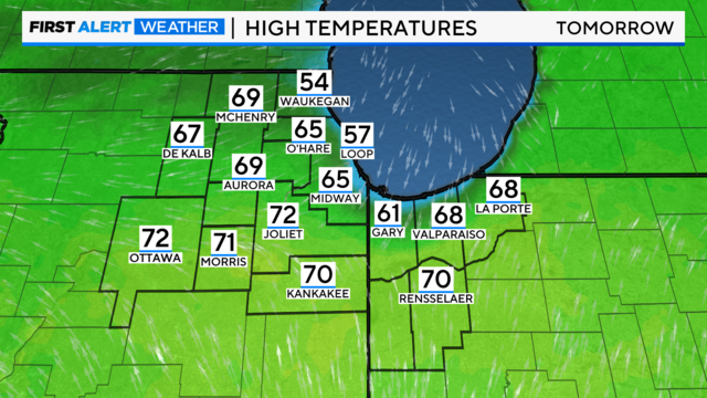
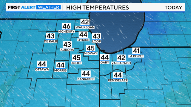
The normal high is 45 degrees, but the Chicago area should easily reach the middle 60s.
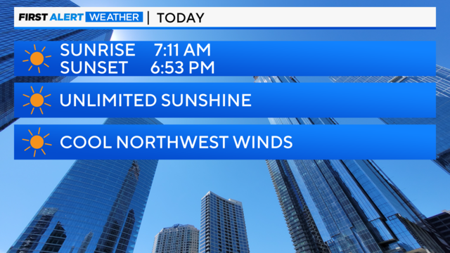
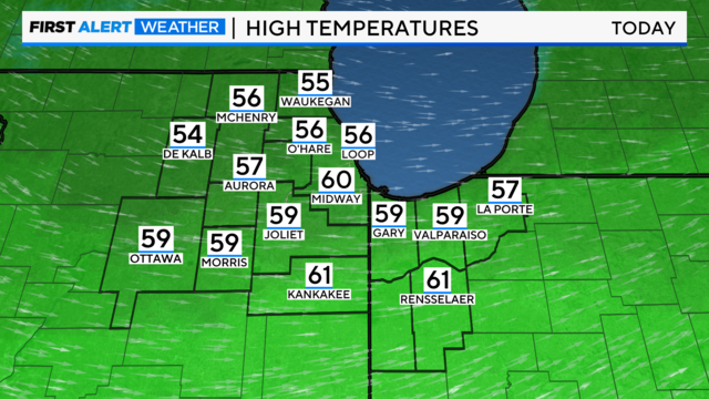
With high pressure in control, we expect sunny skies today and a cool northwest wind flow.
Temperatures will top out 20 degrees above average Monday.
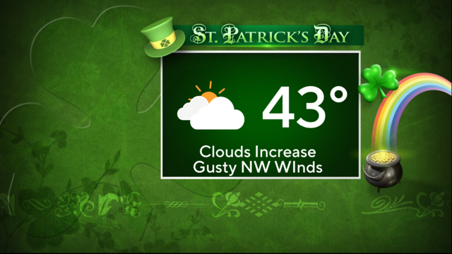
The chilly northwest wind flow stays in place for the rest of the weekend.
Breezy northwest wind flow ushers in cooler air.
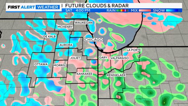
Once the cold front crosses our area, a dry slot forms into Saturday morning.
Remember to "spring forward" at 2 a.m. Sunday, as a mild trend goes into next week.
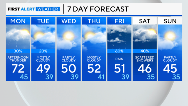
There is a chance of storms later in the day Monday.

Warm winds today will carry temps into the low 70s.