
Dangerously low wind chills ahead, light snow possible in North Texas
Monday and Tuesday are First Alert Weather Days for the cold and the chance for a hint of snow.
Watch CBS News

Monday and Tuesday are First Alert Weather Days for the cold and the chance for a hint of snow.
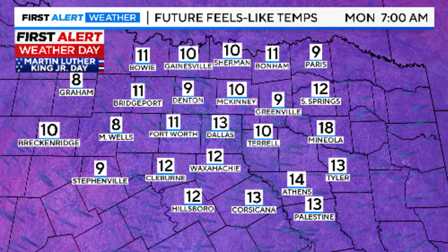
Sunday morning, wind chills will be in the single digits, and temperatures will feel below freezing for the next three days.
This week will be mild and pleasant before a new arctic blast cools things down.

While temperatures will warm up by mid-morning, refreezing remains a concern, particularly north of the Metroplex.
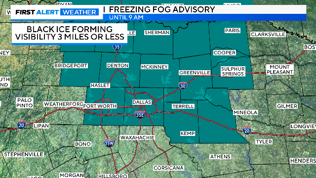
Road melt and snow/slush that survived the afternoon heating has also started to freeze on the roadways.
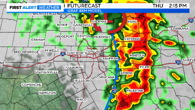
Cold weather continues ahead of a wintery mix of precipitation Thursday morning and snow Thursday night.

Accumulating snow is forecast everywhere north of the ice event.
Once the fog clears, fine weather is expected to set in to close the week and continue into the weekend.
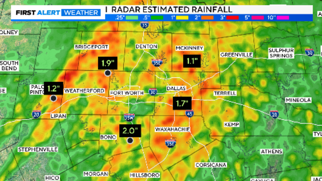
Storms are expected to cover the Metroplex by mid-morning. Large hail and damaging winds are the main threats.
Christmas Day travel looks much better if driving out of this area in any direction.

It will warm back into the upper 50s on Saturday, another typical winter day to start the season.

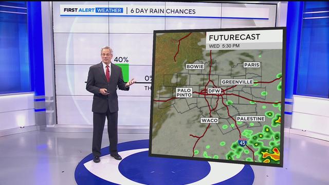
A First Alert Weather Day is issued for Wednesday morning as gusty winds and rain could impact the morning commute.
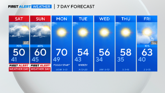
Numerous holiday festivals are taking place across North Texas this weekend, and residents should prepare for light to moderate rain.

Temperatures are expected to hit freezing on Friday across the metroplex.
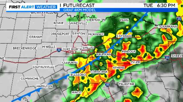
Another cold start to the morning on Tuesday. Rain chances return to North Texas on Wednesday and again at the end of the week.