Dangerously low wind chills ahead, light snow possible in North Texas

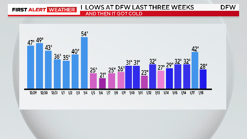
NORTH TEXAS — Sunday was the coldest high of the season so far. DFW only spent two hours above freezing. There has been only one other morning that has been colder than Sunday.
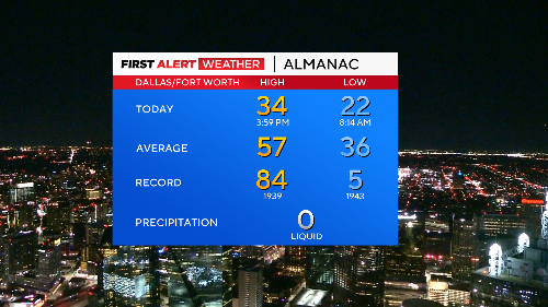
Temperatures got down to the low 20s across the metroplex and it'll be even colder Sunday night. It's been exactly a year since DFW had a temperature down in the teens (19° on 1/29/24). We might get that cold by Monday morning.
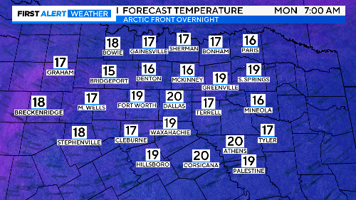
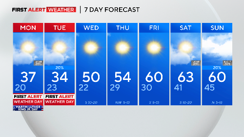
Wind chills will be in the single digits again for a very cold start to Martin Luther King Jr. Day, one of the coldest ever in the DFW area.
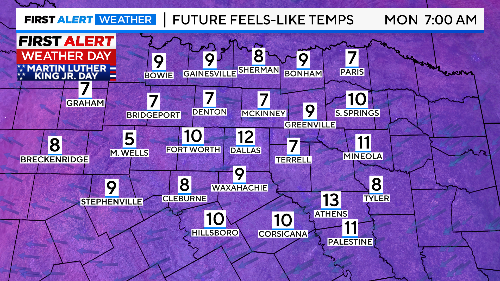
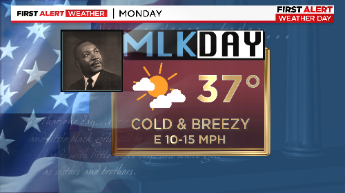
Monday and Tuesday are First Alert Weather Days for the cold and the chance for a hint of snow.
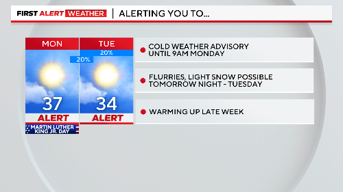
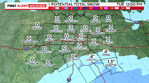
Snowfall amounts will be highest across our southern counties. There might be enough snow for the metroplex to cover some grassy spots and windshields. This will fall Monday night into the start of Tuesday.
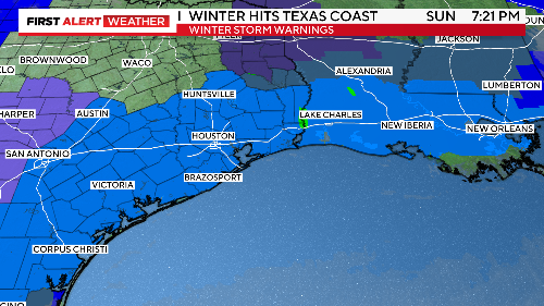
The bigger snow amounts will be along the Texas coastline and into southern Louisiana. This storm could be close to record snow for Houston (the current record is 4.8") and New Orleans (3").
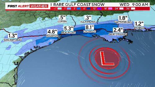
Winter storm warnings stretch along I-10 from San Antonio to New Orleans making for difficult travel on Monday and Tuesday.
Over the last two weeks, winter has shown up in North Texas. Almost every night has seen lows at freezing or below.
We are climbing out of this cold later in the week. Next weekend we'll have above-normal highs and small rain chances.