
Wonderful weather for the end of the weekend in North Texas
Expect high clouds to dissipate throughout the day, mild winds from the southeast, and temperatures to top out in the low 70s in the afternoon.
Watch CBS News
Expect high clouds to dissipate throughout the day, mild winds from the southeast, and temperatures to top out in the low 70s in the afternoon.
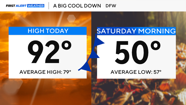
The timing of the front looks to be speeding up, with it moving in late Thursday and pushing south of us on Friday.

North Texas will stay dry with above-average temperatures through midweek.
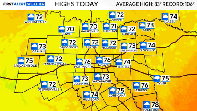
Sunshine returns next week, with high temperatures expected in the mid-80s.
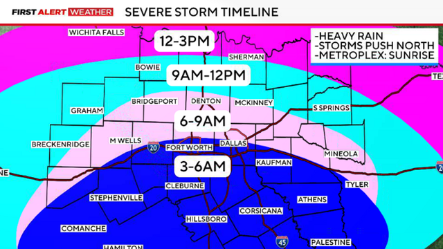
Friday's storms will move in from the south, crossing the I-20 corridor around sunrise.

Though conditions will be dry during the majority of the day, there is still a chance for an isolated shower or storm later in the afternoon through the evening.

A few lingering storm chances move east of I-35.

Meteorologists warn that hail may damage vehicles, while strong winds could bring down tree limbs and cause damage to roofs and siding.

Rain chances rise to 30% in DFW and increase to 40% by Thursday night.

Record-challenging temperatures are also in the cards next week.
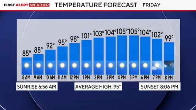
By Friday afternoon, it will be sunny, hot and breezy under an excessive heat warning. Highs are expected to climb above 105 degrees.
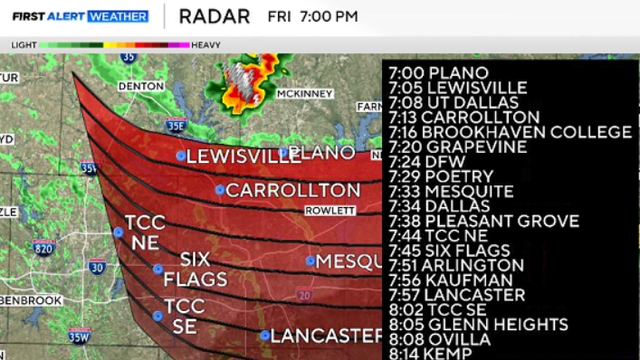
Small hail and strong winds remain possible as the storms track southeast toward the Metroplex.

Moisture will return by mid-week, so the feels like temps will jump back to the 105° - 110° range starting Tuesday-Wednesday.

Temperatures will quickly climb into the 90s by lunch and reach 100+ degrees by the late afternoon.
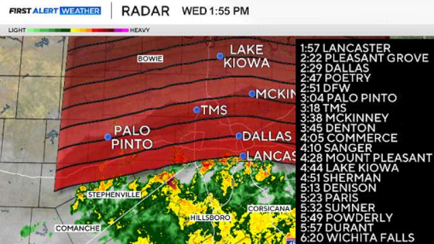
We'll see our storm chances continue on Thursday, and some showers and rumbles may build in as early as the back half of the morning commute.