Storms threaten World Cup plans as North Texas braces for Sunday rain
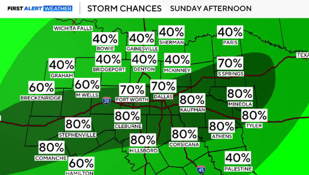
North Texas is gearing up for a messy stretch of weather, and Sunday afternoon is shaping up to be the biggest trouble spot. A First Alert Weather Day is in effect, with heavy rain expected to disrupt afternoon plans – including World Cup events.
The weekend starts quietly enough. Saturday night stays mild and muggy, with lows settling into the 70s. But storms will begin firing up overnight and are expected to cross the Red River around sunrise.
Sunday brings a little bit of everything. It'll turn hot and stormy, with temperatures climbing into the 90s before the rain really gets going. It'll feel more like the 100s. Storms move in by midday. The overall severe threat is low, but a few stronger storms can't be ruled out. The bigger concern is heavy rain and the possibility of isolated flooding.
Monday offers a brief break from the heat, with highs dipping into the 80s and another round of heavy rain possible. The worst of it should move out by noon, though scattered showers may linger into the afternoon.
After that, the pattern flips. The rest of next week turns hot, and by Thursday, North Texas could see the hottest temperatures of the season, with some spots pushing into the triple digits.


