Sunny, warm Monday in Philly with even warmer temps in sight
Sunday, we return to seasonable temperatures in the upper 70s under mostly sunny skies.
Watch CBS News

Sunday, we return to seasonable temperatures in the upper 70s under mostly sunny skies.
Sunday, we return to seasonable temperatures in the upper 70s under mostly sunny skies.
Scattered showers are possible Monday in the Philadelphia area, and warmer temperatures are in sight.
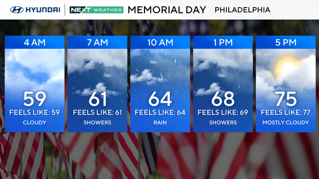
Expect more rain throughout the weekend, with a few spots that may see a little clearing by late in the day on Monday, Memorial Day.
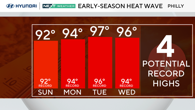
Philadelphia hit 96 degrees on Monday, breaking the previous high of 94 degrees set on May 18, 1962.
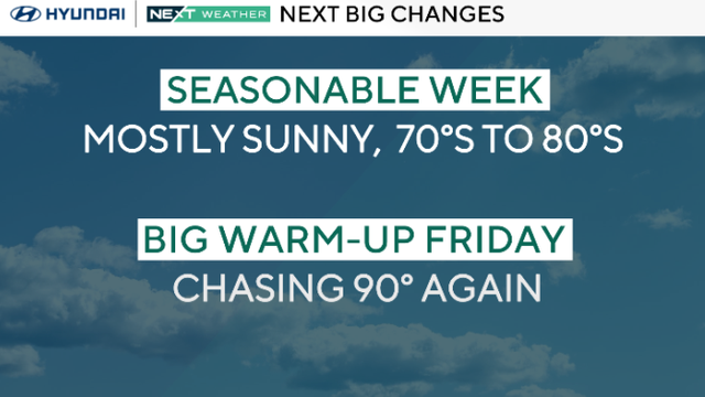
The Philadelphia region is chasing 90 degrees with mostly sunny skies on Sunday.
Plan on not seeing much sunshine on Monday in the Philadelphia region, with just a few leftover sprinkles and showers from Sunday sneaking into the morning hours.
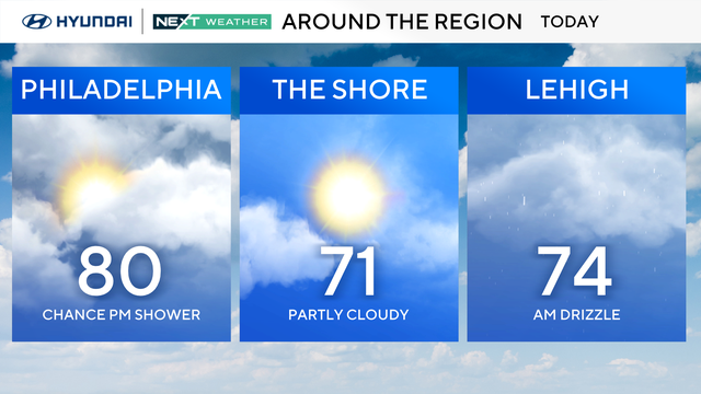
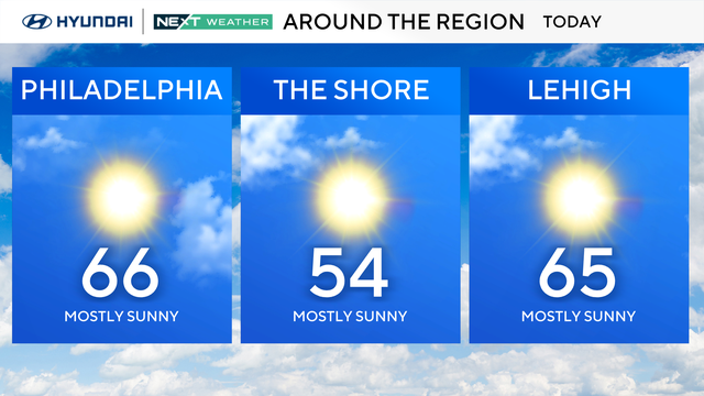
After a foggy and cloudy morning, plan on summer-like conditions by midday with above-average temperatures and highs near 80 across the Delaware Valley.

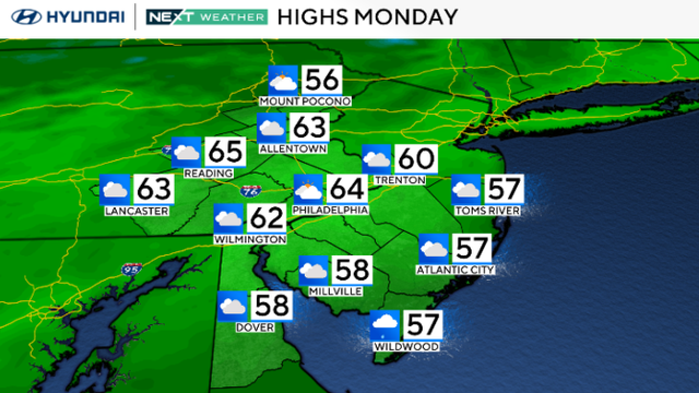
Monday in the Philadelphia region was a spectacular way to start the week, and Tuesday will be even warmer with highs 10-15 degrees above normal in the mid-80s.
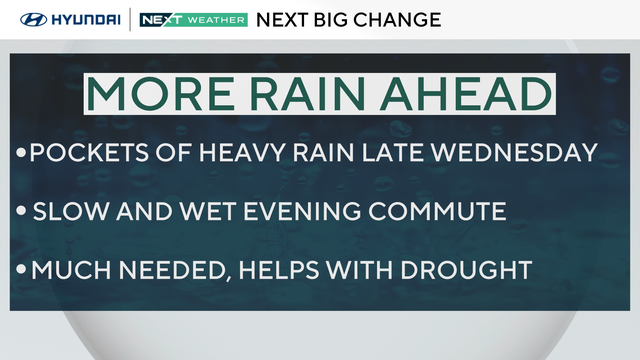
The Philadelphia area can expect warmer temperatures Monday before rain moves through later this week.
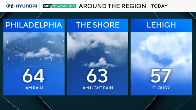
Rain moved out of the Delaware Valley Sunday morning, but skies will stay cloudy and gray for most of the day before some late-afternoon sunshine.
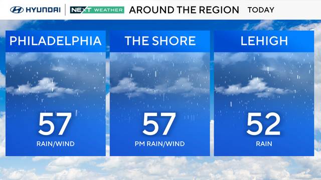
Periods of rain will continue throughout the early and mid afternoon Sunday with high temperatures only reaching the mid-50s.

Communities across the Midwest were starting the cleanup process Saturday after multiple tornadoes touched down and severe weather struck areas from the Great Lakes to Texas.
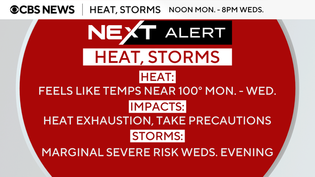
The last of the average temperature days are now behind us for the foreseeable future, with a huge push of summer-like air heading to the Philadelphia region starting Monday.
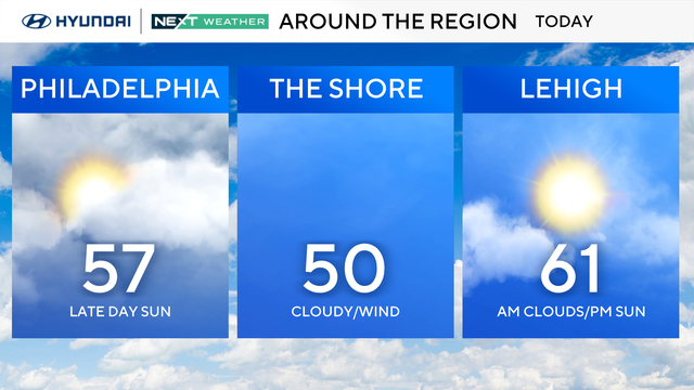
High temperatures will climb into the mid-60s Sunday under mostly sunny skies before potentially record-breaking heat moves in this week.