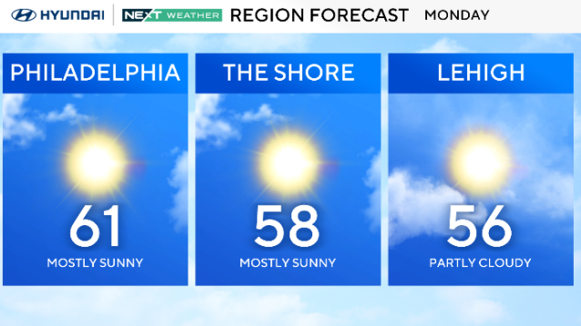
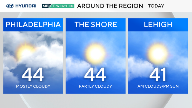
Cooler, sunny Monday in Philadelphia region, quiet week ahead
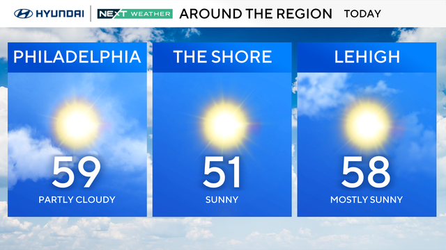
Monday in the Philadelphia region will see mostly sunny skies now that the front that brought Easter rain has passed.
Watch CBS News

Monday in the Philadelphia region will see mostly sunny skies now that the front that brought Easter rain has passed.
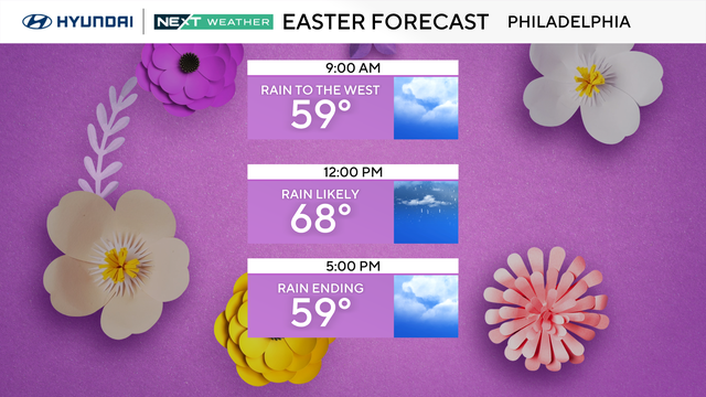
Have your umbrella ready on Easter Sunday as a cold front moving through the area will bring widespread showers to the region.
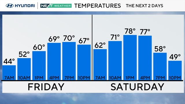
Prepare for another massive change with temps jumping again in the Philadelphia region. It will be roughly 30 degrees warmer on Friday afternoon than on Thursday.
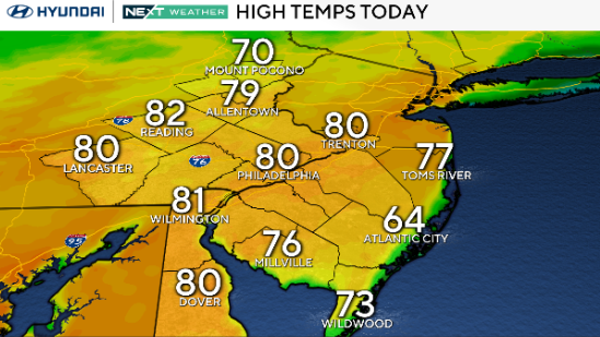
People in the Philadelphia region will be able to wear shorts and T-shirts Tuesday, days after we had to wear winter coats.
While Monday in the Philadelphia region may give us a slight chance of a scattered shower or two in spots, most areas will remain dry.
After a chilly start, there will be plenty of sunshine Sunday before a few more scattered clouds develop through the afternoon.
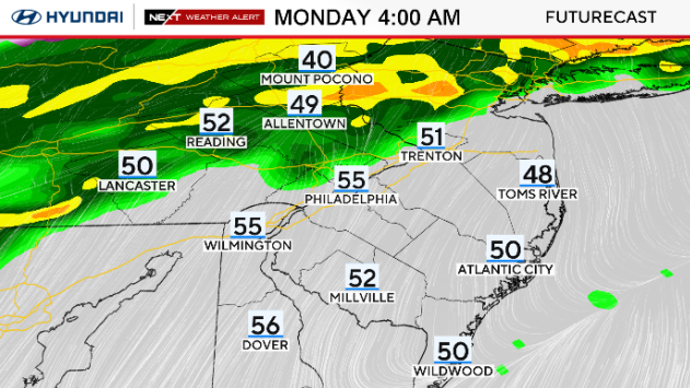
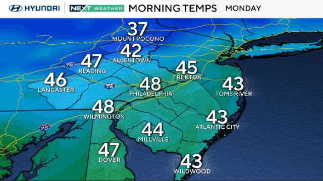
Monday in the Philadelphia region started milder with a few early showers, but things are drying out pretty quickly from west to east.

The main threats from potentially severe storms Sunday evening are damaging wind gusts, heavy rain and some large hail.
Strong storms caused power outages in some parts of the Philadelphia region Tuesday night.
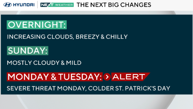
It will be a pleasant Sunday with mild temperatures in the Delaware Valley before severe storms arrive Monday, the NEXT Weather team says.
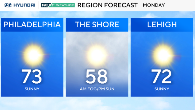
Monday will be a gorgeous day in the Philadelphia region with mostly clear skies and sunny skies throughout the day.
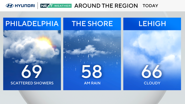
Patchy dense fog and cloudy skies rule the day Sunday with the chance for spotty showers, but temperatures will be warmer with highs in the mid and upper 60s.
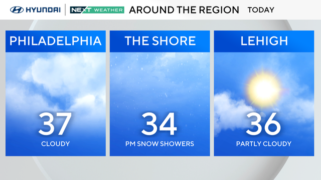
Temperatures will only reach the 30s on Monday around the Delaware Valley, but by midweek, it'll feel more like spring with highs in the 50s and 60s.
Some late-day sunshine is possible Sunday, but another blast of Arctic air pushes in this evening. Temperatures Monday morning will feel like the teens and low 20s.
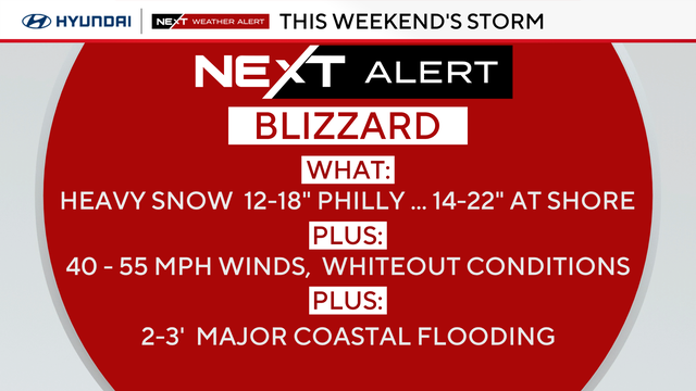
A blizzard warning is in effect for the I-95 corridor, the Poconos and all of New Jersey and Delaware as a potentially record-breaking snow storm bears down on the region.