Scattered showers Monday in Philadelphia area, warmer temperatures on the way. Here's the weather forecast.


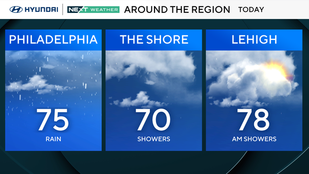
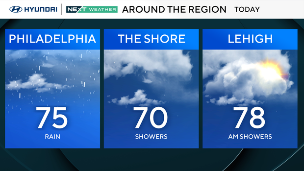
Showers, but slightly warmer conditions will take us through the first part of our Memorial Day as a series of fronts move through the region.
That said, once a cold front pushes to the east, the morning showers should begin to taper off and could give way to a few peeks of sunshine, especially across the Lehigh Valley.
In the meantime, temperatures will hang out in the mid-upper 60s through the middle of the day, but with some late-day peeks of sun, temperatures will jump into the low-middle 70s, with even a few places to the west approaching the upper 70s.
NEXT big weather changes
Temperatures bounce back into the low-to-middle-80s with a nice mix of sun and clouds through the middle of the week.
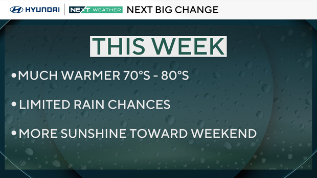
But there will be a small chance for some showers Wednesday.
Next weekend is trending dry, a nice change from our current washout.
High rip current risk at Jersey Shore, Delaware beaches
If you are braving the weather and headed down the Shore anyway, beware of rip currents and follow the directions of lifeguards. There is a high risk of rip currents at the beaches in both New Jersey and Delaware this weekend. Swimming can be dangerous, especially if unsupervised.
Another risk is the chilly water temperature of 55. Hypothermia can set in quickly.
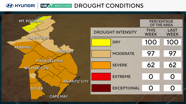
Rain is needed to curb drought in Philadelphia region
Rainfall totals through the Memorial Day weekend will range from 1 to 3 inches, which will certainly prove beneficial given the ongoing drought.
Here's your 7-day forecast:
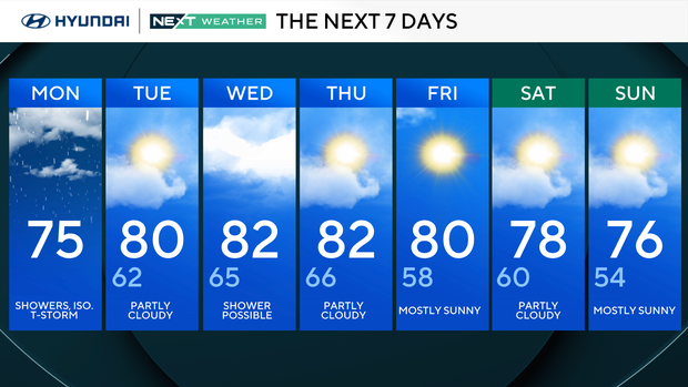
Monday: Showers and isolated thunderstorms. High 75.
Tuesday: Partly cloudy. High 80, low 62.
Wednesday: Possible shower. High 82, low 65.
Thursday: Partly cloudy. High 82, low 66.
Friday: Mostly sunny. High 80, low 58.
Saturday: Partly cloudy. High 78, low 60.
Sunday: Mostly sunny. High 76, low 54.


