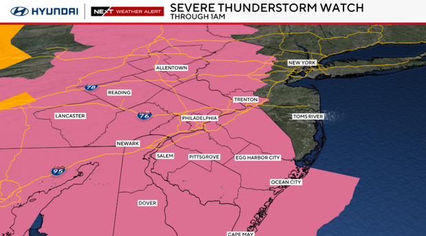
Severe thunderstorm watch in effect for Philadelphia region Sunday, tracking potentially strong storms


A severe thunderstorm watch is in effect for the entire Philadelphia region until 1 a.m. Monday, the National Weather Service said.
A flash flood warning is in effect until early Monday morning for Camden County, Burlington County, Mercer County, Salem County, Ocean County, Chester County, Delaware County, Montgomery County, Philadelphia County and New Castle County.
NEXT big weather change
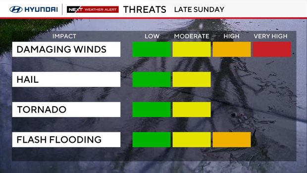
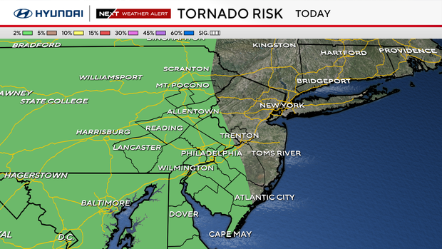
A NEXT Weather Alert is in effect Sunday night for damaging winds, hail and flash flooding. The chance of a tornado is low, but it cannot be ruled out.
Storms are likely to develop between 9 and 10 p.m. and continue through 1 a.m. for much of the Delaware Valley.
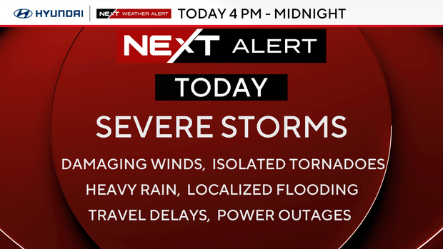
Damaging winds, frequent lightning and isolated tornadoes are possible with heavy downpours that could lead to localized flooding.
Have a backup plan to seek shelter indoors this evening.
People leaving the World Cup match at Philadelphia Stadium, also known as Lincoln Financial Field, could be affected.
Air travel at Philadelphia International Airport on Sunday evening could be impacted by delays and cancellations.
Power outages are also possible, so make sure phones and other devices are charged.
Cooler start to the week
We start the week with a refreshing change as cooler and drier conditions arrive with highs in the upper 70s under sunny skies.
By Wednesday and Thursday, another NEXT Weather Alert may be issued as a strong storm system crosses the area, bringing another chance of severe weather, especially Thursday night.
Summer officially begins in a week on Sunday, June 21, at 4:24 a.m.
7-day forecast
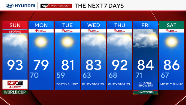
Sunday: NEXT Weather Alert. High 92.
Monday: Sunny and cooler. High 80, low 66.
Tuesday: Partly cloudy. High 81, low 61.
Wednesday: A few storms. High 83, low 63.
Thursday: Scattered storms. High 93, low 68.
Friday: Rain likely. High 87, low 72.
Saturday: Back to sunshine. High 87, low 67.


