Clouds and lots of fog in the weekend forecast
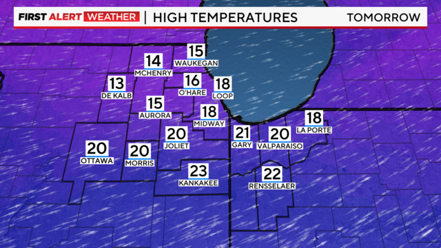
Temperatures hold steady in the mid-30s.
Watch CBS News

Temperatures hold steady in the mid-30s.
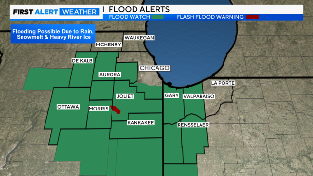
The National Weather Service is warning of potential flooding of roads and buildings along the Kankakee River between Wilmington and Phelan Acres.
Rain is likely Wednesday, with a slow decrease in coverage by the early afternoon.
Ice amounts will be up to a quarter of an inch of accumulation, but perhaps as high as 0.30" in the southern suburbs.
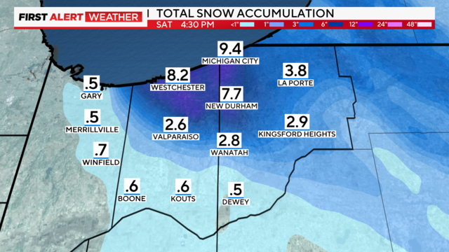
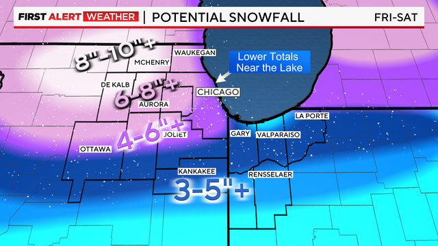
An additional 2 to 6 inches of snow will be possible through Saturday midday in Northwest Indiana.
Near-blizzard conditions are possible along the Indiana Lakeshore, with gusts up to 40 mph.
Gusty northwest winds behind the system into Friday will lead to areas of blowing and drifting snow as well, further impacting travel.
Total accumulations of 1-3 inches are anticipated through the morning commute on Thursday, which could lead to slick travel conditions.
According to CBS 2 Chief Meteorologist Albert Ramon, snow is possible Wednesday evening and there are additional snow chances Thursday into Friday.
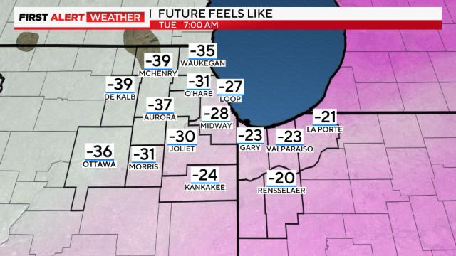
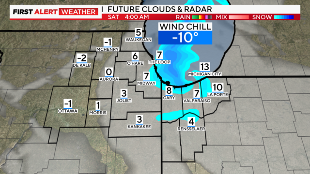
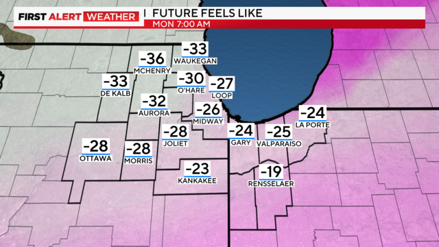
Dangerously cold conditions continue through mid-week.
Gusty winds and blowing snow are expected overnight into Saturday, which could cause near-blizzard conditions in open areas.
The storm will be creating hazardous conditions again into Saturday morning.
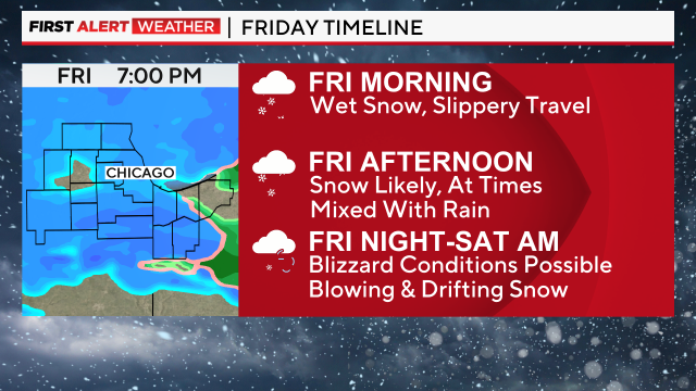
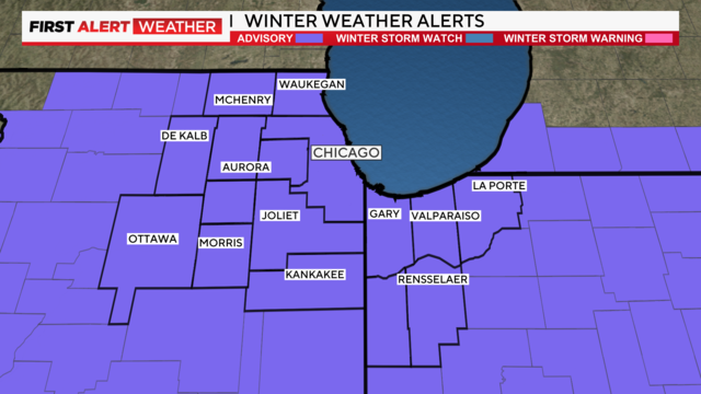
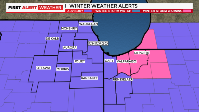
A winter storm warning has been issued for most of the CBS 2 viewing area from 3 a.m. Friday until noon Saturday.
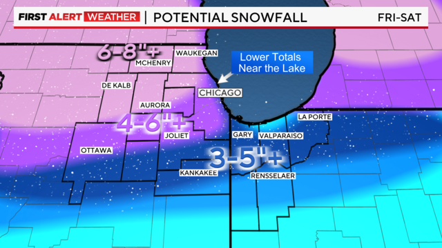
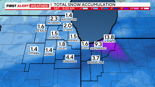
Total accumulations could reach 10 inches or greater for parts of the Chicago area on Friday, with wind gusts as high as 45 to 50 mph.
The official reading at O'Hare International Airport was 3.2 inches Tuesday evening.