Major winter storm hits Chicago with 6 to 12" of snow in some areas


CHICAGO (CBS)-- The rain and snow line lifted north Friday afternoon, allowing for wet conditions in Chicago.
Meanwhile, light snow continued northwest of a line from Mendota to Schaumburg late Friday afternoon, but additional snow accumulation was to be low for the afternoon with above-freezing temperatures.
But the worst is not over.
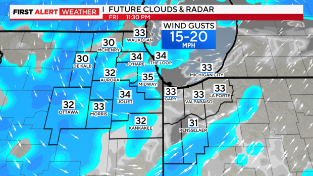
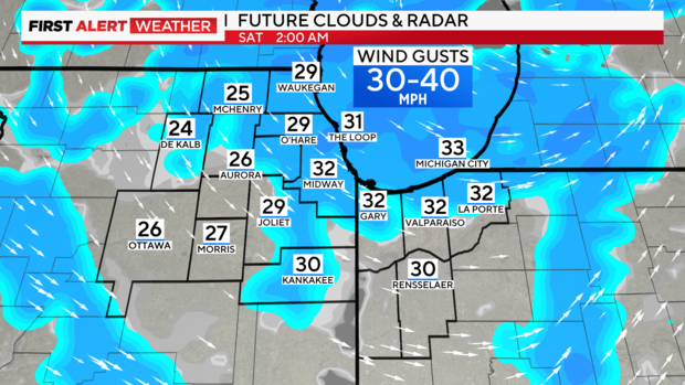
Overnight, snow returns along with strong winds gusting 40-45 mph as temperatures plummet into the 20s.
This will lead to hazardous travel with near-blizzard conditions after midnight into early Saturday morning. Snow tapers off Saturday morning but gusty winds and blowing snow continue through the day.
An additional 1 to 3 inches of snow accumulation is possible overnight, with highest totals in the northwestern suburbs.
While the snow will taper off by daybreak Saturday, snow showers and blustery winds will continue to cause blowing snow in particular in rural/open areas.
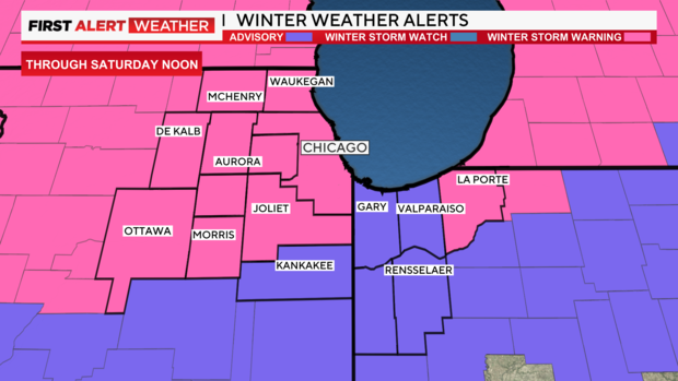
A Winter Storm Warning is still in effect until noon Saturday.
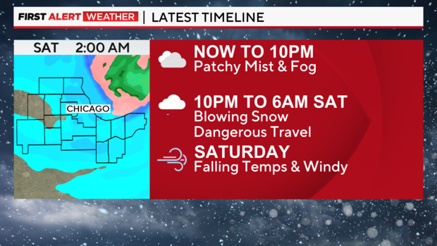
Now to 10 p.m.: Mainly dry.
10 p.m. to 6 a.m. Saturday: Snow returns, blowing likely overnight. Near Blizzard conditions in open areas. Temps fall.
6 a.m. to Noon Saturday: Blowing snow, but no additional accumulation.
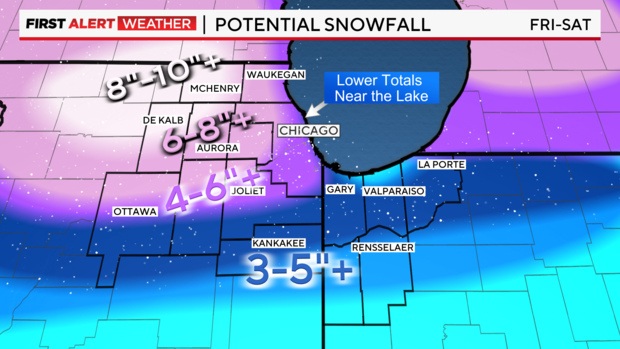
Storm total snowfall will be 6-12 inches, possibly higher across the northern counties (McHenry, Lake (Illinois) and DeKalb County) is expected with the highest amounts north of I-88 where mainly snow is expected. Areas south of the city can expect several inches of snow.
Several inches of snow already overnight in parts of the Chicago area with a clap of thunder even involved, before a changeover to rain for a few hours late Friday morning and early Friday afternoon.
This graphic represents total potential snowfall for this winter storm:
This map represents additional snowfall expected Friday night into Saturday morning.

Amid the coming second round, blowing and drifting of the snow will arrive overnight into Saturday morning as strong northwest winds develop in the wake of the storm system. CBS 2 Meteorologist Albert Ramon says there's still potential for overnight blizzard conditions for areas west of the city as visibilities can be greatly reduced.
Additional snowfall through Saturday morning could add up to another 6 inches in the far northwestern suburbs. Chicago will range from lighter amounts near the lake to 3 to 5 inches to the west. Lower amounts are expected for most areas south of I-80.
Behind the storm, bitterly cold arctic air will spill into the region this weekend into early next week.
Falling temperatures throughout the day on Saturday into Sunday morning with dangerous wind chills expected, and subzero readings of -20 to -25 degrees.
The colder weather pattern lasts through Tuesday.
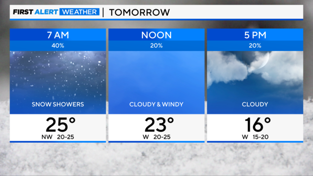
Friday Night: Snow showers after 10pm, gusty winds. Low: 23°
Saturday: Cloudy with snow showers ending, windy with blowing snow. High: 26°
Sunday: Partly sunny, very cold. High: 3°


