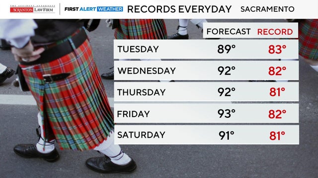
Sacramento could hit 90 degree this week for first time on record in March
A high-pressure system moving into the region will bring above-average temperatures and is expected to set record highs for the month of March in Sacramento.
Watch CBS News
A high-pressure system moving into the region will bring above-average temperatures and is expected to set record highs for the month of March in Sacramento.
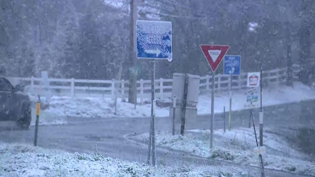
The coldest system of the season is bringing heavy rain to Northern California and snow to higher elevations, with Sierra foothill communities also bracing for a chill.
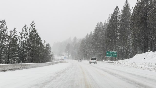
A flood watch and winter storm warning are in effect this weekend as the first major storm of 2026 is expected to bring rain and snow across Northern California.
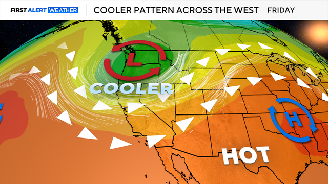
Triple-digit heat returns to Northern California Wednesday before wind increases bringing a cooler weekend, with high fire danger.

The ups and downs of spring continue this week in Northern California with above-average temperatures and a cooler finish to the weekend.
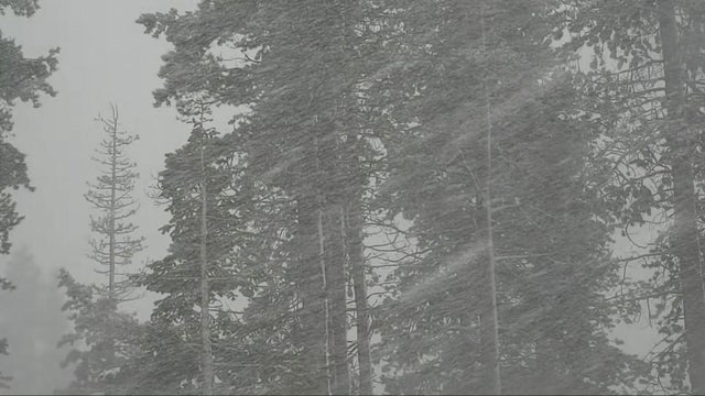
A significant winter storm will impact the Northern California area Sunday through Tuesday, bringing widespread rain, gusty winds and heavy mountain snow that could possibly impact the A's home opener.
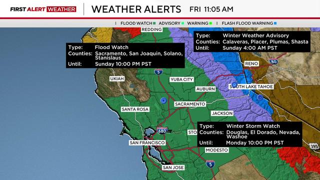
A flood watch was issued until 10 p.m. Sunday for Sacramento, San Joaquin, Solano and Stanislaus counties.
Northern California will see another triple threat of rain, snow and wind before 2024 comes to an end.
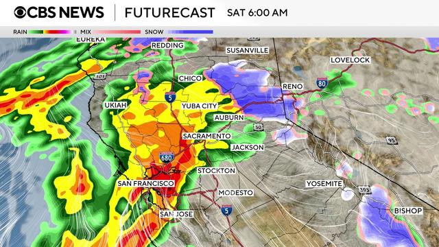
The wettest of the two storm systems of the week in the Sacramento Valley and in the Sierra arrived on Friday with the main event expected to arrive Friday night.
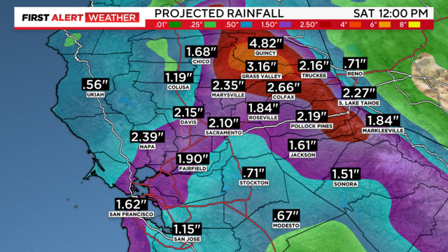
Sacramento and Stockton received record rainfall on Friday. Showers continue through the weekend with more rain and snow through early next week.

Wet weather has returned to Northern California for Veterans Day, with snow also expected to fall in the Sierra.
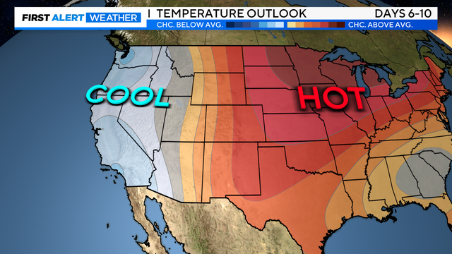
After a hot weekend in Northern California, more relief is on the way this week. Here's when you'll notice the cooler air.
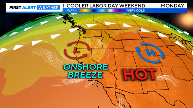
The summer heat has returned leaving temperatures above average to end the week. Heading into Labor Day weekend, expect a bit of a cool-down. The changes your First Alert Weather team is tracking for your holiday weekend.
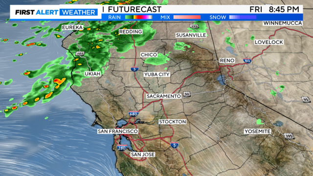
A taste of fall in August? Over the next few days, Northern California is set to get cooler temperatures, gusty winds, and showers. Here's what our First Alert Weather team is watching.
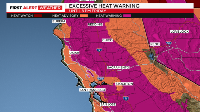
One final boost of heat from a long-duration heatwave before more relief returns this weekend.
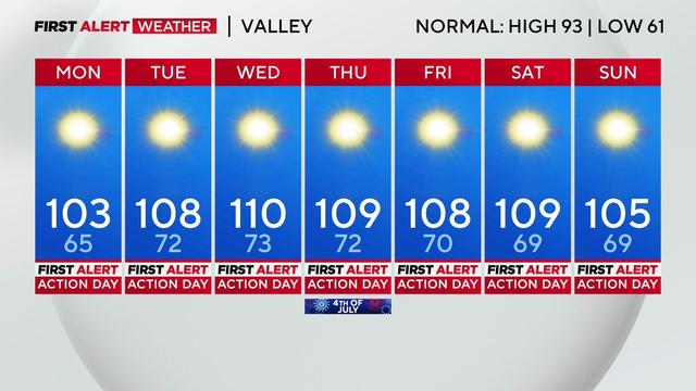
A long-duration heat wave begins on Monday with valley highs soaring above 100 degrees through the upcoming weekend. These will be some of the hottest temperatures we've seen not only this year but since 2022 for most of Northern California.
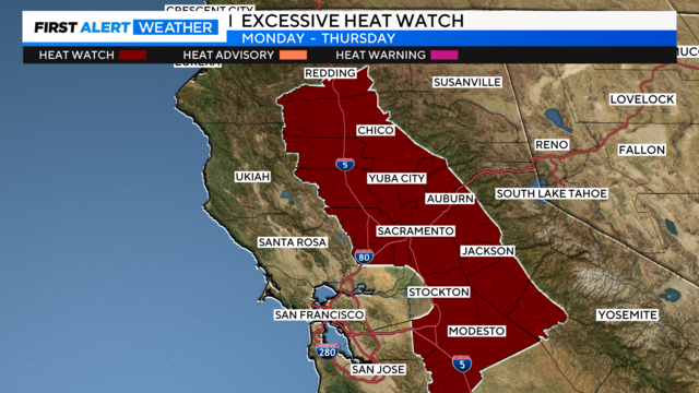
A major heat event is on the way to the West Coast next week. The First Alert Weather team is tracking multiple days of triple-digit heat and debunking why your weather app may be misleading.
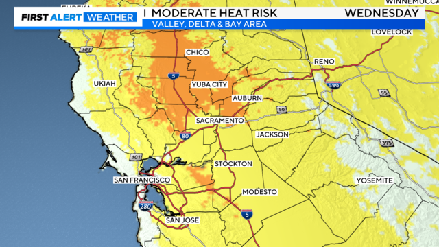
For some, Wednesday will be the hottest day of the year so far as highs reach for the mid to upper 90s. Many in the valley will be under a moderate heat risk. But a change in our weather pattern is on the way this weekend bringing some relief to the valley.
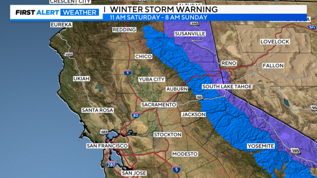
A fast-moving storm from the north will bring rain, thunderstorms, gusty winds, high-elevation mountain snow, and much cooler temperatures around the Northern California area this weekend. Saturday will be a First Alert Action Day as it arrives.
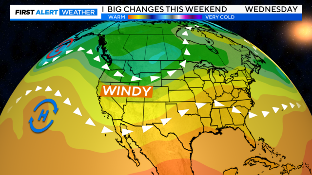
The wind picks up through the day on Wednesday with gusts up to 45 mph across portions of Northern California. Expect a bigger change to our forecast this weekend as cooler and unsettled weather moves back in.
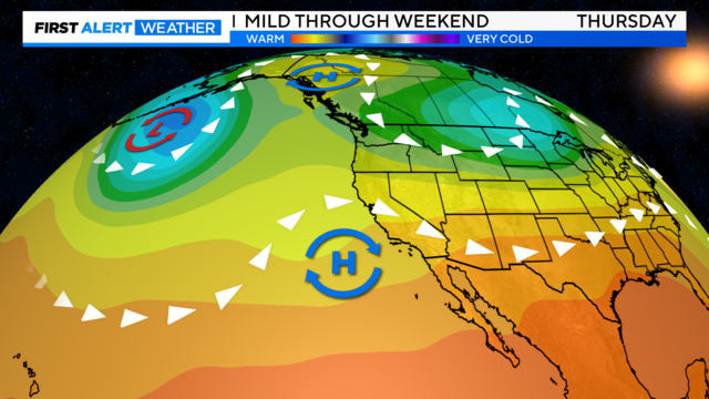
We've been under a quiet weather pattern the last few days and it's going to continue as we look ahead to the weekend. Next week we may see more changes with the return of a colder pattern.
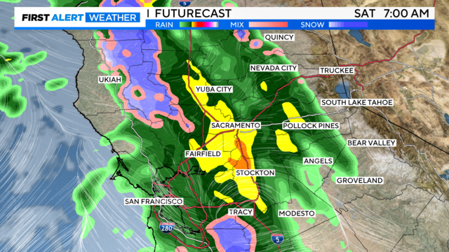
Widespread rain and possible thunderstorms for the valley and some snow in the Sierra are on the way after a warm week in Northern California.
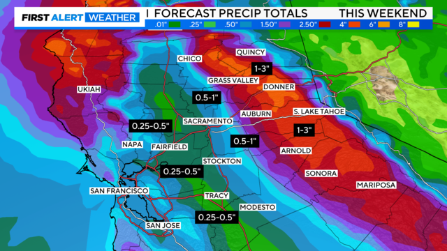
A cool, stormy weather pattern is set to return to Northern California after days of warm, sunny weather. The new pattern will bring rain, breezy south winds, isolated thunderstorms and heavy snow to the Sierra.
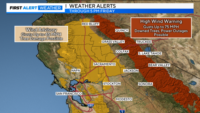
Strong, gusty winds continue across the region as we finish the workweek. Heading into the weekend expect sunny skies and warming temperatures just in time for St. Patrick's Day.
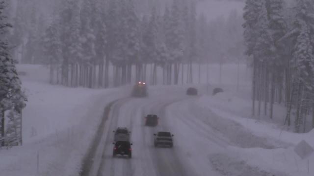
A storm system that began moving in this weekend brought heavy snow and rain to Northern California on Monday and is expected to linger through much of the week.