Wind, fire danger and brief shower Thursday in Minnesota
A weak boundary will increase clouds and wind on Thursday afternoon in the Twin Cities.
Watch CBS News

A weak boundary will increase clouds and wind on Thursday afternoon in the Twin Cities.

Wednesday is a #Top10WxDay in Minnesota thanks to sunshine, lighter winds and highs in the 70s.

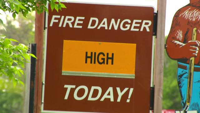
Expect breezy winds, highs in the 70s and sunshine in the Twin Cities on Tuesday, with fire danger out west.

Highs will reach into the mid-70s Monday in the Twin Cities. It will also be dry and sunny — with a risk of wildfires to the west.

Spring warmth takes over Friday in the Twin Cities, with a quiet and seasonable Mother's Day on tap.

Warmth arrives Thursday in the Twin Cities after the last few chilly days.

Wednesday will be cold and breezy in Minnesota, with frost and freeze alerts in place for parts of the state in the morning.

The Twin Cities are under a frost advisory and other parts of Minnesota are under a freeze warning overnight Thursday due to temperatures that could fall enough to harm sensitive plants.

Expect dry and quiet weather this week in the Twin Cities, with more frost and freeze threats ahead.

A freeze warning will be in effect in parts of central and southern Minnesota on Saturday from 1 a.m. to 8 a.m., according to the National Weather Service.
Thursday will be chilly in the Twin Cities, with areas of frost early and again in the evening hours.

Wednesday will start out chilly in the Twin Cities before temperatures end up in the mid to upper 50s.
Highs on Tuesday will reach the mid-50s, with decreasing winds but some breezy moments. It will be mainly dry with sunnier skies.

Wednesday will be hot, windy and very dry in Minnesota, prompting critical fire danger for much of the state.
Tuesday will be warm and dry in the Twin Cities, with lighter winds.