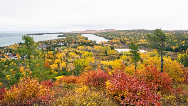
Michigan DNR warns of wildfire risk due to weather conditions in Upper Peninsula
Dry weather and windy conditions have increased the wildfire risk in the Upper Peninsula, the Michigan Department of Natural Resources says.
Watch CBS News
Dry weather and windy conditions have increased the wildfire risk in the Upper Peninsula, the Michigan Department of Natural Resources says.
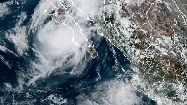
Hurricane Polo made landfall in Baja California Sur, Mexico, bringing "damaging winds and life-threatening flash flooding," and is expected hit the Southwest U.S. with heavy rain and flooding.

The National Weather Service will have a crew in Detroit on Friday to survey damage from a suspected tornado that caused significant damage Thursday afternoon on the east side of Detroit.
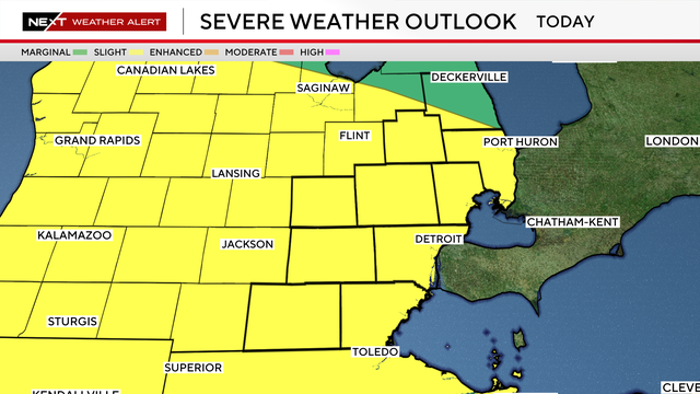
Tornado warnings were issued for most of Southeast Michigan on Thursday, late afternoon and evening, as strong storms moved through the area.
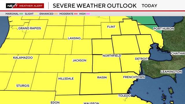
Metro Detroit is in a slight risk area for severe weather on Thursday, following up on a stormy Wednesday.
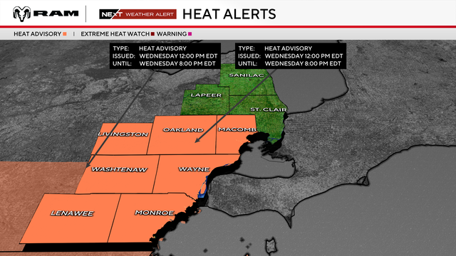
Much of Metro Detroit will be under a heat advisory on Wednesday afternoon and evening, with severe weather also possible.
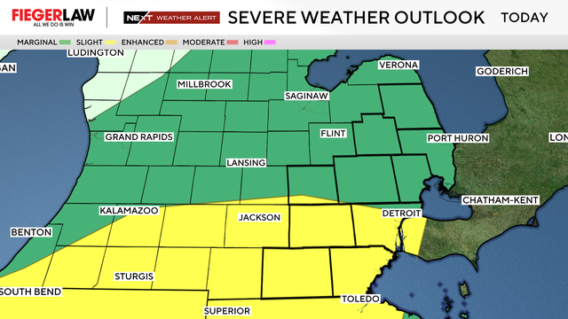
Severe thunderstorms are expected to develop on Wednesday afternoon and evening as a cold front moves through Southeast Michigan.
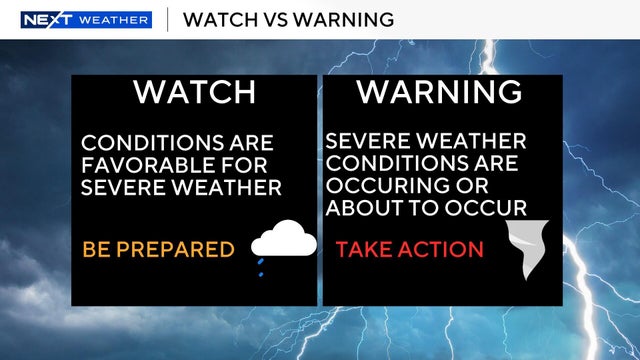
Severe weather is possible across much of Michigan on Monday, with the National Weather Service issuing a series of severe thunderstorm watches.

The National Weather Service in Marquette has confirmed three tornadoes from the July 20 severe weather outbreak in Michigan's Upper Peninsula.
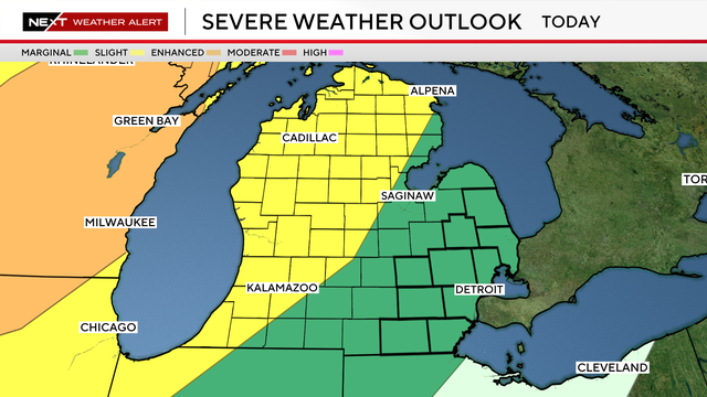
A line of storms will move through the Great Lakes region, approaching Metro Detroit overnight Monday into early Tuesday.
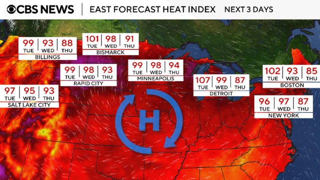
Heat alerts were issued for millions across parts of the western U.S. Sunday due to an unusually prolonged heat dome, which is starting to move east.
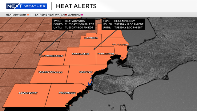
Extreme heat will move into southeast Michigan this week, with temperatures climbing into the 90s and humidity making it feel even hotter.
Officials say the "weak" tornado was recorded south of Trenary, Michigan, in Delta County, crossing Alger Delta 43rd Road before dissipating.
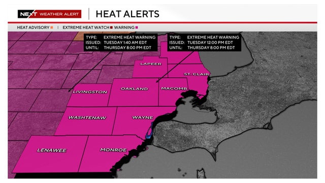
An extreme heat warning for Southeast Michigan takes effect at noon today. Here's what you need to know about dealing with such conditions.
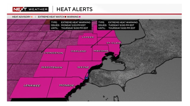
A heat wave will hit its peak in Metro Detroit from Tuesday through Thursday, the National Weather Service says.
The National Weather Service confirmed a tornadic waterspout over Otsego Lake on Tuesday, bringing the state's 2026 tornado count to 22.
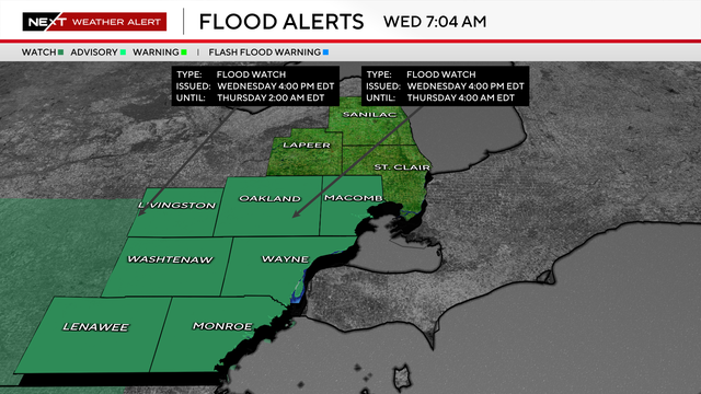
Thunderstorms could produce 1 to 2 inches of rainfall across Metro Detroit on Wednesday, with localized amounts approaching 3 inches.
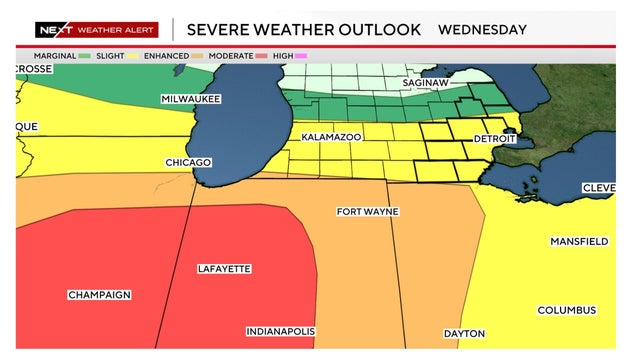
Metro Detroit is considered to be at a slight risk for severe weather on Wednesday. Here's a look at the forecast.
Another tornado was confirmed from a severe weather outbreak last week, bringing Michigan's total number of twisters so far this year to 21.
The National Weather Service has confirmed two EF-0 tornadoes touched down in West Michigan as severe storms swept through the Midwest on Thursday night.
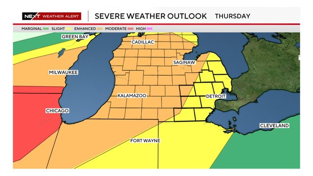
The threat of severe weather continues into Thursday for much of the Great Lakes and Midwest, including in Metro Detroit.
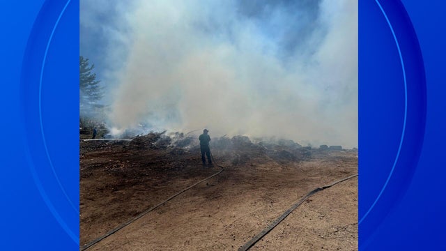
Late April through early June is historically the worst time of year for wildfires in Michigan, and there have been multiple wildfires this week.

Officials say a tornadic waterspout briefly touched down on Big Bradford Lake in Waters in southern Otsego County.
Officials say the EF-0 tornado on April 24 lasted 1 minute at 65 mph and traveled 0.1 miles.

NWS says the EF-1 tornado touched down where Jackson Avenue and I-94 meet before continuing east on a 1.7-mile-long path of destruction.