
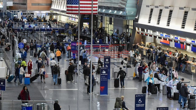
Keidel: Is Super Bowl XLVI A Stairway To Canton For Eli?
Laugh if you like. Eli won't tell you to stop. He'll just show you why you should.
Watch CBS News
Laugh if you like. Eli won't tell you to stop. He'll just show you why you should.

Will the Patriots manage to exact revenge in Super Bowl XLVI? Let's try to surmise by taking a position-by-position look at the game's participants.

Bright sunshine for Sunday with weak high pressure. Breezy west winds have been supplying cooler air this morning behind a departing front which moved through last night. This will make highs today a bit cooler from Saturday with temps this afternoon able to climb into the Lwr 40's. Still very nice for this time of year with temps running about 5-8 degrees above normal
A gorgeous Saturday morning will see increasing cloudiness by afternoon. Temps have started in the 30's and will be climbing into the mid-upper 40's by this afternoon with a mild west wind. Weak high pressure over us this morning will give way to an approaching front for the evening hours.

Despite the substantial turnover in lineups for this Super Bowl, the quarterbacks for both teams remain the same. I'll rephrase. The quarterbacks are the same, yet, Eli Manning is in no way the same quarterback.


Cold high pressure sits over this morning with clear skies and frigid early morning temperatures Below zero in the northern valleys, single digits in the suburbs, and teens and 20's at the coast. Ocean effect clouds remain in place across SE MA. High pressure sits over us today providing calm conditions, but as it pulls off shore this afternoon, light east winds at the surface may begin to direct some of this low cloudiness in land. These low clouds may deposit a few flurries in spots this afternoon
So far this winter most of our snow has been light or has occurred overnight, but this next round of snow will likely be our most substantial plowable snowfall we have seen since the October Nor'easter. Still, this will be no Nor'easter. Not even close.
Big blue high pressure sitting over us is providing a calmer day with less of a wind chill factor. This high will be pulling off the coast and begin to wrap in warmer SW during the afternoon. This will allow temps to continue to rise through the day...but it will be a slow warming. In fact it will take the entire day of warming just to reach 32 degrees. But this will feel a whole lot better than yesterday! High clouds will continue to increase making for filtered sunshine this afternoon

Maybe it is time that you explored new winter activities.
The rest of us are seeing a brilliant, blustery and very cold day with the heart of the Arctic air settling over us today. Highs will only be able to climb into the teens today. Winds will start to die down this afternoon, but wind chills will remain in the single digits...despite near 100% of the sun.
Temps are starting off in the 20's this morning with a west wind, and will have a tough time going much further today. Highs will climb into the Lwr 30's by midday into the afternoon...even climb into the Mid 30's for the south coast to the Cape. Temps will hold in the 20's across NH. Sunshine this morning will give way to some increasing cloudiness as clouds from the N & W will be pushing towards the coastal plain along with an Arctic front. Temps are below zero this morning across the Canadian border. This is the airmass which will be over us for the next 24-48 hours.

You aren't the only one experiencing cabin fever this winter -- your dog is too. Lucky for both of you, the Boston area has several solutions for beating the winter blues, both indoors and out.
Cooler air will continue to push into New England today from North to south. A cold front currently in place across the north will take much of the day to finally push off the coast. Temps will struggle to warm in this cold air advection, but downsloping winds along with plenty of sunshine will allow temps to eventually climb into the lwr-mid 40's for most by this afternoon
Today we will see temps around 10-20 degrees above normal. Highs will be climbing into the 50's south of the MA Pike...Some areas may approach 60 near RI this afternoon. Holding near 50-52 for SNH.

Start the New Year off on the right, well-rested, foot at any of these top-notch New England spas.
Light SW winds will bring in unseasonal warmth into the 40's to near 50 this afternoon. Some cloudiness may try to sneak back in later this afternoon ahead of an approaching cold front which is currently back through the Great Lakes. This front will push through tonight with a few showers between 8 PM and 1 AM.
Scattered Showers will be taper off this afternoon as a cold front pushes off the coast. The cloud deck will lift and begin to break to partly cloudy skies by midnight tonight. Temps will be in the 40's for evening festivities and then fall to the upper 30's around midnight as skies begin to clear.
There are plenty of left over clouds this morning in SNH, western and central MA. Some of these clouds will push to the coast around lunch time along with the cold front. Winds will shift and pick up from the WNW this afternoon and temperatures will continue to free fall right through the evening with colder air draining in from Canada. Increasing sunshine later this afternoon with temps falling into the 30's.
Cool filtered sunshine this morning with increasing high altitude clouds will give way to mostly cloudy skies this afternoon and warming temperatures into the 40's. High pressure off the coast will wrap in warming SW winds...but the lack of sunshine will make it feel cooler. Keep a close eye on the radar today because we have quite a bit of rain just to our SW which is heading right to us for tonight. Clouds will thicken in advance of the rain this afternoon with showers arriving in western New England around sunset. Showers will be reaching the coast between 6-8 PM...
Skies will start out bright with sunshine in the early morning. Clouds will be on the increase through the day. Mostly cloudy skies by the afternoon. There is a risk of a few scattered snow showers and flurries forming in northern and western New England.
High pressure builds in over us Saturday supplying dry cold air with winds out of the North. Highs will be in the upper 20's and Lwr 30's in the sunshine. Ocean effect clouds and flurries will hang tough at the coast from Boston to the Cape.

Whether you celebrate the holiday or not; you don't have to sit around the open fire roasting chestnuts. Here are some fun ways to spend the day.
Partly sunny skies this morning will give way to increasing cloudiness as the front pushes through this afternoon. This front may even trigger a brief rain or snow shower...but there is plenty of dry air in the low levels to keep today mostly dry. Highs will climb into the upper 30's and lwr 40's by midday before falling this afternoon behind the front.

A man charged with a murder near Boston Common is due in court Thursday.

Police in Canton, Massachusetts, have charged a man with opening a bedroom window and grabbing a sleeping woman's ankle in the middle of the night.

The Baltimore Orioles ended Boston's franchise record-tying 15-game winning streak, defeating the Red Sox 5-1 in the nightcap of a doubleheader on Wednesday.

Cybersecurity experts are raising concerns about the growing capabilities of artificial intelligence after an AI agent developed by OpenAI carried out a cyberattack.

The jury in Lindsay Clancy's murder trial has reached 17 people. Following a final day of jury selection, the judge is targeting Friday for opening statements.
A man charged with a murder near Boston Common is due in court Thursday.

Boston police are warning that there's been an increase in cellphone robberies downtown.
The Baltimore Orioles ended Boston's franchise record-tying 15-game winning streak in the nightcap of a doubleheader on Wednesday.
The jury in Lindsay Clancy's murder trial has reached 17 people. Following a final day of jury selection, the judge is targeting Friday for opening statements.
Police in Canton, Massachusetts, have charged a man with opening a bedroom window and grabbing a sleeping woman's ankle in the middle of the night.

Taylor Farms said none of its branded salads or kits contain the iceberg lettuce associated with the outbreak.

A lettuce supplier to fast-food giant Taco Bell has been linked to a nationwide cyclosporiasis outbreak that has sickened thousands of people, the CDC said.

Massachusetts is reporting cases of cyclosporiasis, a disease caused by a stomach parasite that can lead to "explosive" diarrhea.

Many people fear that a family history of dementia dooms them to inevitably suffer the condition themselves. But a new tool, the Brain Care Score, shows how lifestyle changes can be beneficial, cutting the risk of dementia.
There was a possible measles exposure at Logan Airport in Boston last week, Massachusetts health officials say.

With the Brigham and Women's Hospital nurses strike looming, some parents of newborns in the NICU are sounding the alarm.

A Malden, Massachusetts woman said National Grid took more than $28,000 out of her bank account for a gas bill that she didn't owe.

A Massachusetts family thought their Vrbo stay would be protected after they had to cancel their trip to Hawaii due to severe weather. Now they're out $12,000.

A driver from Southboro, Massachusetts struggled for months to unravel a frustrating mix up with his E-ZPass account.

The gunman who allegedly opened fire on passing cars on Memorial Drive in Cambridge, Massachusetts is 46-year-old Tyler Brown from Boston.

Barney Frank, a Democrat who represented Massachusetts in Congress for 32 years, has died. He was 86 years old.

Both the Trump and Healey administrations are using government websites to blame each other for the shutdown.

Which party stands to take more of the blame from voters for the government shutdown? Here's what a new poll says.

A UNH Survey Center/Granite State poll shows John Sununu crushing Scott Brown by 23 points among likely primary voters in New Hampshire.

Seth Moulton said he's running against Sen. Ed Markey because "our party leaders are clinging to that old playbook."

Breaking Grounds Cafe, a Peabody, Massachusetts coffee shop known for employing people with disabilities, is closing.
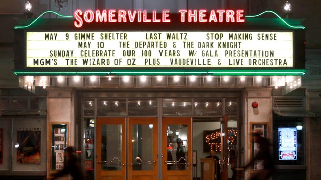
The buildings that house the Somerville Theatre and the Capitol Theatre in Arlington, Massachusetts are for sale.

Golden Temple and Party Favors in Brookline are closing after a combined 100 years in business.

There are no more Hooters restaurants left in Massachusetts.
There's a proposal in Cambridge to limit customers at bars and restaurants to one drink every 30 minutes.

Beauport, the Sleeper-McCann House has become one of New England's most imaginative seaside estates.

Blending clean modern lines with the warmth of a classic seaside retreat, this stunning North Shore coastal home was designed to feel both elevated and inviting.
Set across thirty acres of rolling lawns, wooded trails, and contemporary outdoor art, deCordova Sculpture Park and Museum invites visitors to experience art in the landscape.

James Beard Award-winning chef and restaurateur Karen Akunowicz has become known for her bold, Italian-inspired cooking and unmistakable culinary voice.

Just a short drive from Newport, the Norman Bird Sanctuary spans 300 acres of fields, forests, and coastal trails with sweeping views and more than six miles of hiking paths.
The Baltimore Orioles ended Boston's franchise record-tying 15-game winning streak, defeating the Red Sox 5-1 in the nightcap of a doubleheader on Wednesday.
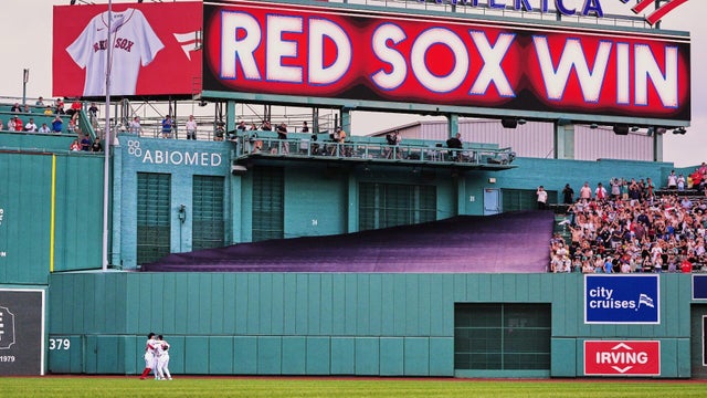
The Boston Red Sox tied a franchise record in the first game of a doubleheader, beating the Baltimore Orioles for their 15th straight win.
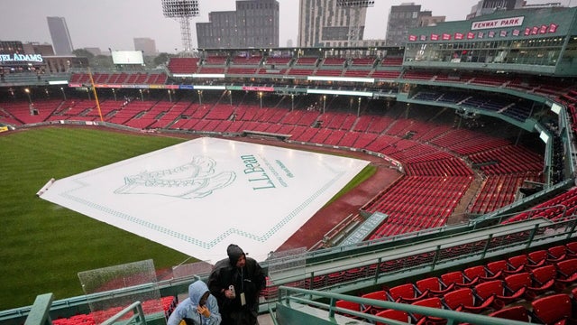
The Red Sox and Orioles will play a doubleheader on Wednesday after their Tuesday night came was postponed due to rain.

The Red Sox are approaching franchise history as they're on a 14-game winning streak, and their fans can't get enough of the action.

Caleb Durbin hit a tiebreaking homer over the Green Monster and the Boston Red Sox beat the Baltimore Orioles Monday for their 14th straight win.

After marrying Taylor Swift and Travis Kelce, Adam Sandler went to Nantucket in search of a basketball court.

An injured hiker had to be carried off a New Hampshire mountain on a stretcher, but that didn't stop her from getting engaged.

A seal pup was spotted hanging ten on a boogie board off the cost of Maine this Fourth of July.

Avi Loeb, a Harvard astronomer who has made headlines with his theories about alien encounters, will lead a White House scientific advisory council on UFOs.

Haggis is not on the menu in Boston for the World Cup, despite what Gov. Healey told Scotland supporters in a lighthearted social media video.