
Money Matters - Retirement Truths: Moving Far Away
Sounds so good, retire somewhere warm, or exotic or really cheap or all of the above.
Watch CBS News
Sounds so good, retire somewhere warm, or exotic or really cheap or all of the above.

Mexico's only tall ship is now docked in Boston. It arrived at the Seaport World Trade Center Sunday morning, and will be open for public tours today through Thursday.

There are three questions every Boomer needs to be thinking about.
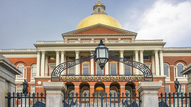
Massachusetts voters will face a long list of ballot questions on the November 2026 ballot.

Two men died early Tuesday morning after a fire broke out at an apartment in Nashua, New Hampshire.

A group of state senators are rolling out a "fun agenda" for Massachusetts.

A pet owner says her dog died after going into the water at a West Roxbury park and she suspects an algae bloom is to blame.

Caleb Durbin hit a tiebreaking homer over the Green Monster and the Boston Red Sox beat the Baltimore Orioles Monday for their 14th straight win.

The weather forecast shows a risk of heavy rain and isolated severe thunderstorms in the Boston area Tuesday.
Massachusetts voters will face a long list of ballot questions on the November 2026 ballot.
Two men died early Tuesday morning after a fire broke out at an apartment in Nashua, New Hampshire.
A group of state senators are rolling out a "fun agenda" for Massachusetts.
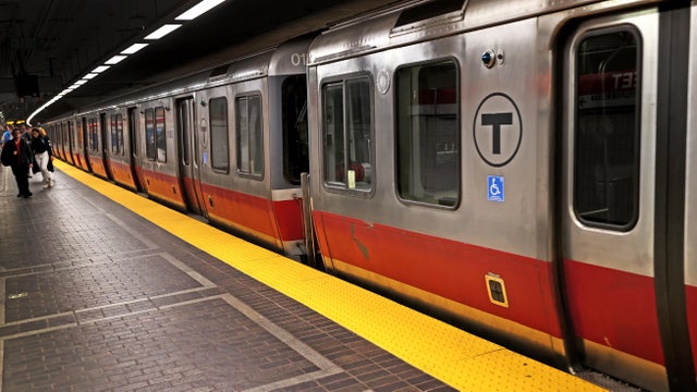
A partial Red Line shutdown will affect eight MBTA stations in the Boston area during the 10-day closure.
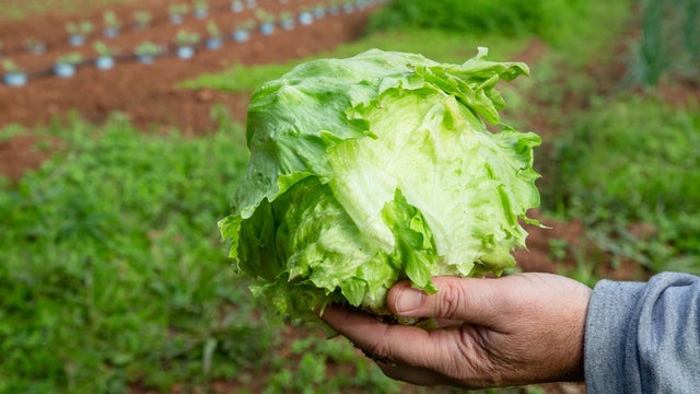
Taylor Farms said none of its branded salads or kits contain the iceberg lettuce associated with the outbreak.

A lettuce supplier to fast-food giant Taco Bell has been linked to a nationwide cyclosporiasis outbreak that has sickened thousands of people, the CDC said.

Massachusetts is reporting cases of cyclosporiasis, a disease caused by a stomach parasite that can lead to "explosive" diarrhea.

Many people fear that a family history of dementia dooms them to inevitably suffer the condition themselves. But a new tool, the Brain Care Score, shows how lifestyle changes can be beneficial, cutting the risk of dementia.
There was a possible measles exposure at Logan Airport in Boston last week, Massachusetts health officials say.

With the Brigham and Women's Hospital nurses strike looming, some parents of newborns in the NICU are sounding the alarm.

A Malden, Massachusetts woman said National Grid took more than $28,000 out of her bank account for a gas bill that she didn't owe.

A Massachusetts family thought their Vrbo stay would be protected after they had to cancel their trip to Hawaii due to severe weather. Now they're out $12,000.

A driver from Southboro, Massachusetts struggled for months to unravel a frustrating mix up with his E-ZPass account.

The gunman who allegedly opened fire on passing cars on Memorial Drive in Cambridge, Massachusetts is 46-year-old Tyler Brown from Boston.

Barney Frank, a Democrat who represented Massachusetts in Congress for 32 years, has died. He was 86 years old.

Both the Trump and Healey administrations are using government websites to blame each other for the shutdown.

Which party stands to take more of the blame from voters for the government shutdown? Here's what a new poll says.

A UNH Survey Center/Granite State poll shows John Sununu crushing Scott Brown by 23 points among likely primary voters in New Hampshire.

Seth Moulton said he's running against Sen. Ed Markey because "our party leaders are clinging to that old playbook."
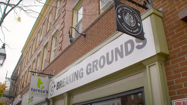
Breaking Grounds Cafe, a Peabody, Massachusetts coffee shop known for employing people with disabilities, is closing.

The buildings that house the Somerville Theatre and the Capitol Theatre in Arlington, Massachusetts are for sale.

Golden Temple and Party Favors in Brookline are closing after a combined 100 years in business.
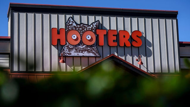
There are no more Hooters restaurants left in Massachusetts.
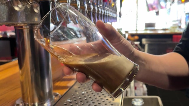
There's a proposal in Cambridge to limit customers at bars and restaurants to one drink every 30 minutes.

Beauport, the Sleeper-McCann House has become one of New England's most imaginative seaside estates.

Blending clean modern lines with the warmth of a classic seaside retreat, this stunning North Shore coastal home was designed to feel both elevated and inviting.
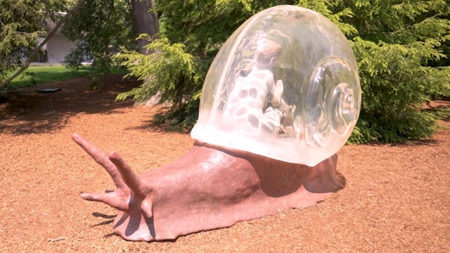
Set across thirty acres of rolling lawns, wooded trails, and contemporary outdoor art, deCordova Sculpture Park and Museum invites visitors to experience art in the landscape.

James Beard Award-winning chef and restaurateur Karen Akunowicz has become known for her bold, Italian-inspired cooking and unmistakable culinary voice.

Just a short drive from Newport, the Norman Bird Sanctuary spans 300 acres of fields, forests, and coastal trails with sweeping views and more than six miles of hiking paths.
Caleb Durbin hit a tiebreaking homer over the Green Monster and the Boston Red Sox beat the Baltimore Orioles Monday for their 14th straight win.

The Boston Red Sox have now won 13 games in a row after completing a 4-game sweep of the Tampa Bay Rays at Fenway Park.

Spain dominated the match, outshooting Argentina 20-3, but couldn't manage a goal in regulation — finally scoring in the second period of extra time.

The Boston Red Sox rallied for a 7-6 victory over the Tampa Bay Rays Saturday to extend their winning streak to 12 games.

Wilyer Abreu homered twice, All-Star Willson Contreras went deep in his first game back from a five-game suspension, and the Boston Red Sox extended their winning streak to 11 games with a 5-3 victory over the Tampa Bay Rays on Friday night to sweep a doubleheader.

After marrying Taylor Swift and Travis Kelce, Adam Sandler went to Nantucket in search of a basketball court.
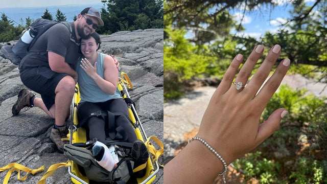
An injured hiker had to be carried off a New Hampshire mountain on a stretcher, but that didn't stop her from getting engaged.

A seal pup was spotted hanging ten on a boogie board off the cost of Maine this Fourth of July.

Avi Loeb, a Harvard astronomer who has made headlines with his theories about alien encounters, will lead a White House scientific advisory council on UFOs.
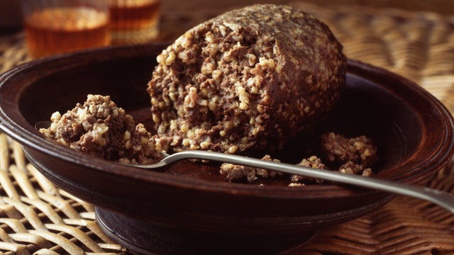
Haggis is not on the menu in Boston for the World Cup, despite what Gov. Healey told Scotland supporters in a lighthearted social media video.