ByHeart says all its baby formula could be tainted with botulism
ByHeart said it can't rule out that all of its baby formula across all product lots could be contaminated, citing recent test results.
Watch CBS News
ByHeart said it can't rule out that all of its baby formula across all product lots could be contaminated, citing recent test results.

"There is nothing worse than the flu spreading through a family gathering," said Dr. Laura Romano, a pediatric hospitalist with Cook Children's Medical Center.
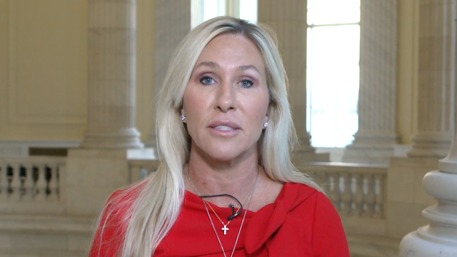
House Democratic Leader Hakeem Jeffries called GOP Rep. Marjorie Taylor Greene an ally during the shutdown for joining Democrats in demanding that Congress address high health care costs.
The 22-year-old suffers from a rare condition called Complex Regional Pain Syndrome, first diagnosed after a minor sports injury as a child.
In the wake of Marshawn Kneeland's death, Dr. Jaya Mathew said talking about suicide can help people who are struggling.

Children's Health specialists recommend adjusting bedtime routines and limiting electronics to ease the transition.

At least 11 people have contracted Salmonella linked to powder supplements sold at Sam's Club stores nationwide, health authorities said.

In Texas, where the number of dialysis centers is higher than in any other state, the I-Team discovered that the problem is especially severe.

The LEAP Gala is LEAP Global Mission's biggest annual fundraiser.

With open enrollment starting soon, employees could get sticker shock, with their costs expected to rise 6% to 7% for 2026, a new study says.
It's the viral video seen across the country showing a 10-year-old Lavon girl saving her choking brother.
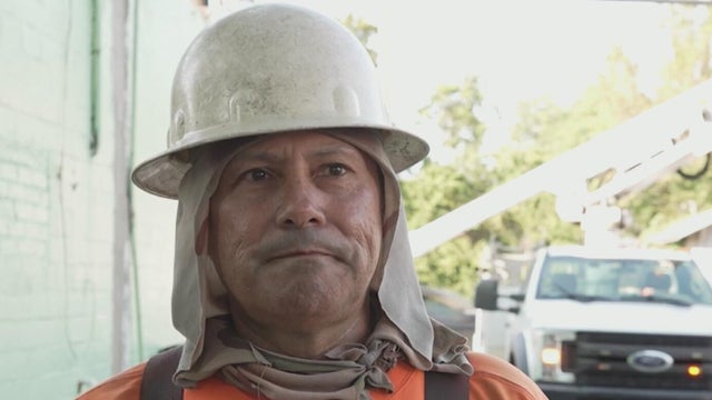
Lineman Brian Abalos is used to danger. Every day, he is up in the air working on power lines.
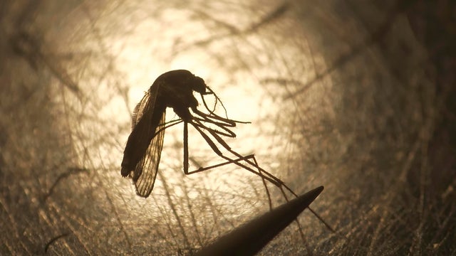
A 70-year-old Dallas County man has died from the West Nile virus, DCHHS said Monday, marking the first reported West Nile death in the county this season.
Pfizer is the first of many drug makers President Trump claimed has agreed to offer steep drug discounts to all Americans through TrumpRx, in line with the lowest prices paid by Europeans.

Shep, 11, has the fatal disease, but isn't letting it stop him from living his life.
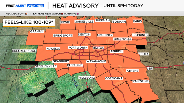
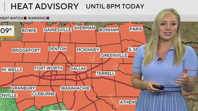
Temperatures will quickly climb into the 90s by lunch and reach 100+ degrees by the late afternoon.
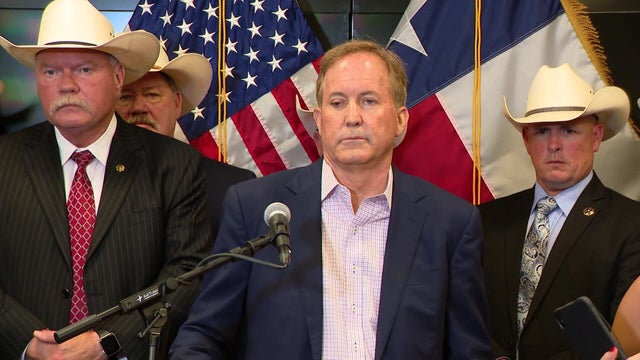
Texas Senate candidate Ken Paxton's refusal to answer questions about his property acquisitions and voting residence went viral last week.
Talarico told reporters Monday night what his $25 million pledge will look like.
Public outrage grows after viral video shows a woman taken into custody at a Colorado gate as supporters rally behind her pending immigration case.

Police say the suspect, whose original offense was sexual assault of a minor, had removed an ankle monitor before fleeing from officers.

A phone call from jail raised further suspicions that Carney targeted other girls.

More than 40 years after helping catch an ice cream truck driver who exposed himself to her, an Oklahoma woman testified against him in a Texas trial, helping secure a life sentence.

In 1991, a Plano girl was kidnapped and sexually assaulted. The same thing happened 8 years later in Dallas. Investigators found the same DNA on both victims.
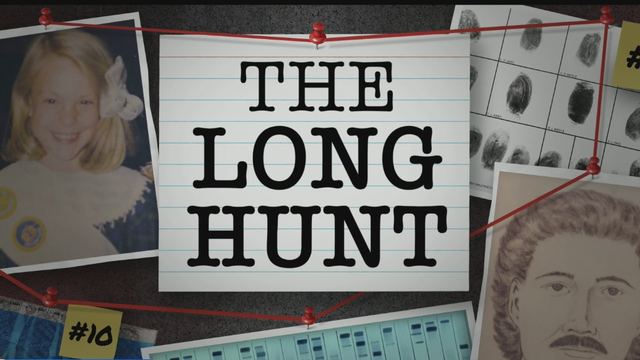
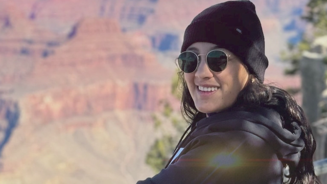
Ashley Keith sat down with CBS News Texas for an exclusive interview, her first ever about her 1991 kidnapping.

A growing number of solar customers across the country have been left in limbo following a company's closure or bankruptcy.
Texas Senate candidate Ken Paxton's refusal to answer questions about his property acquisitions and voting residence went viral last week.
Talarico told reporters Monday night what his $25 million pledge will look like.

Ukrainian President Volodymyr Zelenskyy's accusations of Russia helping Iran target U.S. troops are not the first.
SMU Political Science Professor Matthew Wilson discusses AG Ken Paxton's refusal to answer reporter questions. Jack asks Wilson whether it will hurt Paxton's efforts in the November U.S. Senate election.
Jane Hope Hamilton, former Texas statewide director for President Joe Biden's 2020 campaign, discusses the U.S. Senate race. According to the polls, the race between Rep. James Talarico and AG Ken Paxton is at a dead heat. "You have this group of people who are unaligned, like they're not necessarily Republican, and maybe that not necessarily Democrat, but they tend to default when they get into those voting booths to Republican, unless there's a reason not to."

Target, which embarked on a turnaround plan under its new CEO earlier this year, reported an increase in first-quarter sales Wednesday.

During the program's first year, it will be offered at about 65 to 75 hospitals that handle about a quarter of births in the state and largely serve low-income patients, Newsom's office said.

Bimbo Bakeries USA employs over 20,000 people and has been headquartered in Horsham, Pennsylvania, for the past 17 years.

This explosion is among several similar incidents across North Texas that raise questions about why hazardous natural gas leaks keep happening

Zoox, owned by Amazon, produces its own autonomous vehicles that it says are built for passengers, not drivers.

The illness may take up to 14 days to incubate.

Dangerous heat is sending more people to the ER. Here's where North Texas outdoor workers can get free hydration kits.
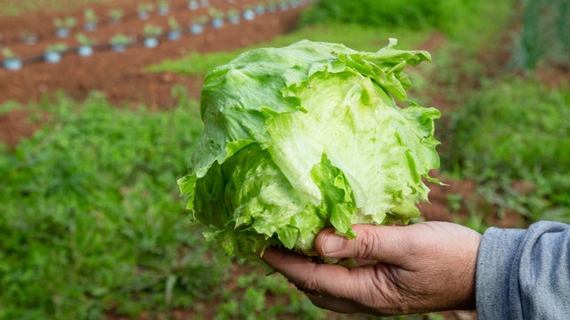
Taylor Farms said none of its branded salads or kits contain the iceberg lettuce associated with the outbreak.

A lettuce supplier to fast-food giant Taco Bell has been linked to a nationwide cyclosporiasis outbreak that has sickened thousands of people, the CDC said.

Texas health officials are urging families to safely wash, handle and cook produce as Cyclospora cases rise.
A fairly new entertainment and food venue in Allen surprised a lot of people last week by suddenly shutting down.

The future of AI technology manufacturing has landed in North Texas.

Mayor Jim Ross said hotel revenue in the city was a record $31 million in June, smashing the previous mark of $23 million.
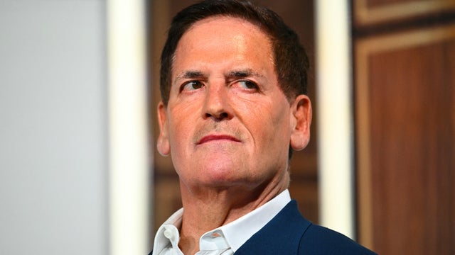
Cuban alleges Patrick Dumont has engaged in "adversarial business practices."
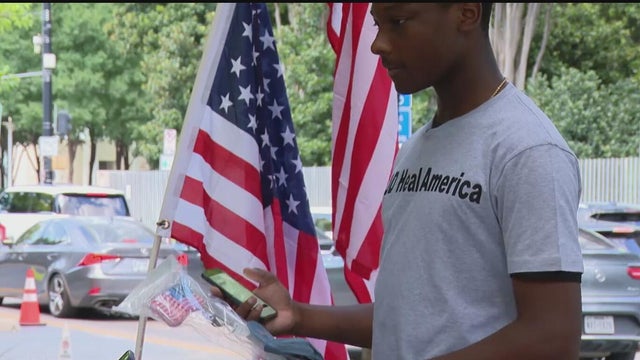
During every U.S. World Cup match, 18-year-old Aaron Dotson was selling patriotic gear in downtown Dallas.
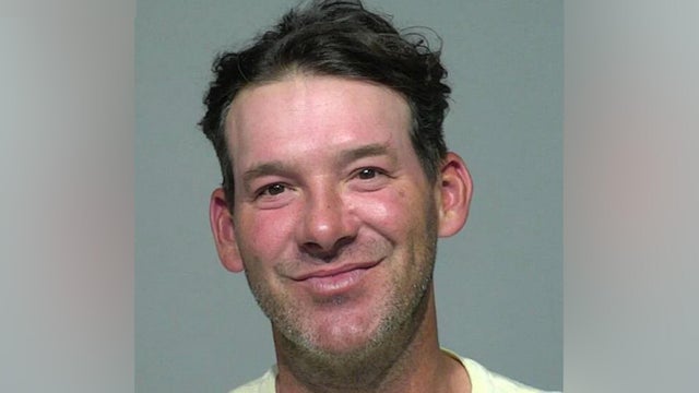
The Milwaukee County Sheriff's Office said Romo was pulled over around 6 p.m. on Thursday.

The Sixers' wild offseason continued Friday when they added four-time NBA champion LeBron James.

Arike Ogunbowale had 24 points and Paige Bueckers added 21 for the Wings.

Chase Meidroth went 4 for 4 while he and Andrew Benintendi had a pair of run-scoring singles apiece and Anthony Kay pushed through five innings for his first win in more than a month as the Chicago White Sox beat the Texas Rangers 4-2.

Fudd is the only rookie participating and currently ranks 10th in the WNBA with 50 made triples so far this season – the most among all rookies.

Kaylee Hottle, an Atlanta-born actress known for her role in the "Godzilla" film franchise, has died following a crash in Maryland.

The ruling comes after a coalition of 12 states sued to block the deal, arguing it would harm consumers and the entertainment industry.
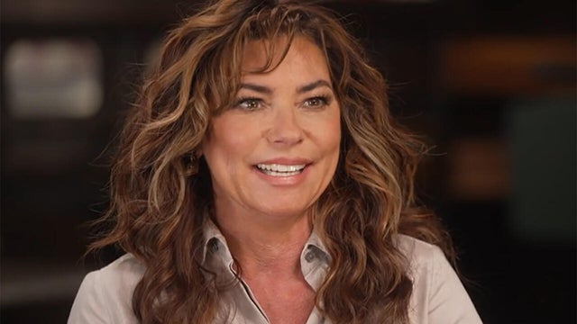
Throughout family hardships, divorce, and losing her voice to Lyme disease, Shania Twain became the top-selling female country artist of all time. She talks about her biographical new album, "Little Miss Twain," in which she reflects on her life with a smile.
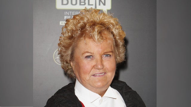
Brenda Fricker won an Academy Award for 1989's "My Left Foot," played the Pigeon Lady in "Home Alone 2" and appeared in "A Time to Kill" and "So I Married an Axe Murderer."

New Zealand actor Sam Neill, known for "Jurassic Park" and "The Piano," died Monday at 78, his family says.

The Red Bull Flugtag Airshow returned to Las Colinas on Saturday after a 12-year hiatus. Teams are tasked with constructing a flying machine and putting it to the test. It's estimated that around 25,000 people attended the event.
A suspect was taken into custody after an attack on Pearl Street Mall in Boulder on June 1 in which there were 15 people and a dog who were victims. The suspect threw Molotov cocktails that burned some of the victims, who were part of a march for Israeli hostages.

The Neonatal Intensive Care Unit babies at Texas Health locations across North Texas celebrated Valentine's Day.

As Anthony Davis prepared for his debut game at the AAC, Dallas Mavericks fans took to the arena to protest the controversial trade.

A look back at the esteemed personalities who've left us this year, who'd touched us with their innovation, creativity and humanity.