Pittsburgh Weather: Last 80-degree day for a while
If you've been enjoying the 80-degree days, they're coming to an end.
Watch CBS News

If you've been enjoying the 80-degree days, they're coming to an end.

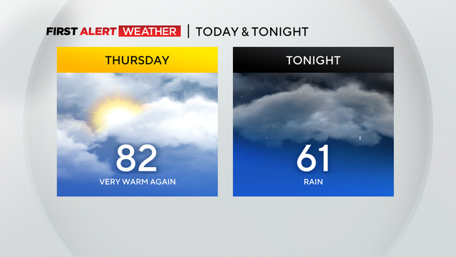
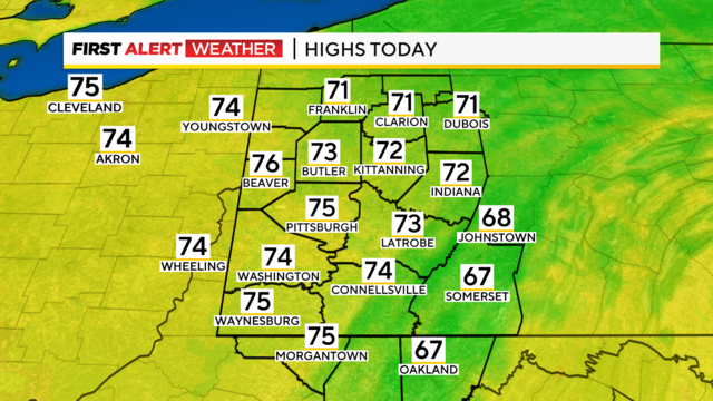
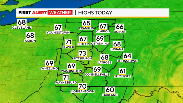
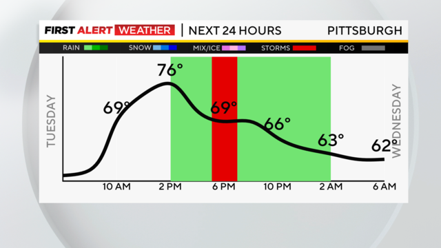
The warm October start continues today with similar temperatures.

We will truly be making an about-face this weekend with our weather.

Sunny skies will be around after patchy fog clears out by 10 a.m.
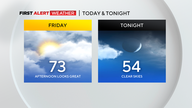
We'll see some seasonal temperatures and sunshine this weekend!

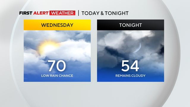
While we'll still have pleasant conditions, we could see some light rain.
It's going to be another day with cloudy skies with some breaks in the afternoon.

Morning conditions will be cloudy with some pockets of drizzle in spots.
We're in for a stellar afternoon with sunshine and warmer temperatures!
We certainly could use some rain, but there is little to no rain in the forecast over the next week.
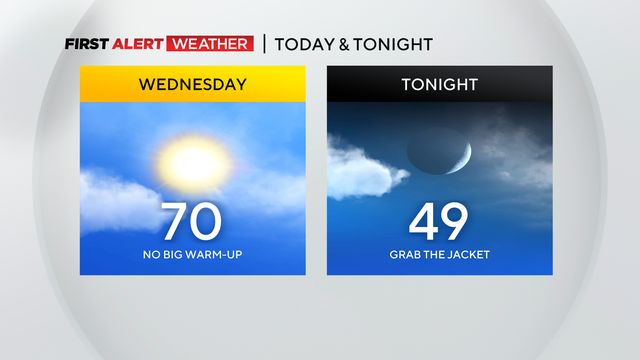
Highs today should be near 70° with morning lows down near 50°.
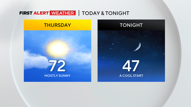
The comfortable and "boring" weather continues today!
Cooler air is in place and while we aren't quite to fall yet, it's going to feel a lot like it.
Here we go. Break out the sweatpants and pumpkin-spiced-smelling candles with cooler air set to arrive this afternoon.
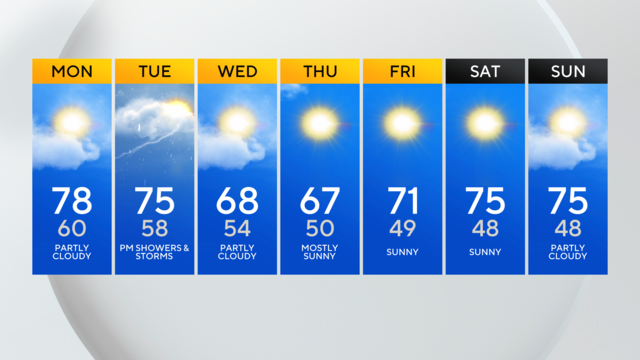
Break out the long sleeves and jackets, cooler air is heading our way.