North Texas gets one last summer push this week

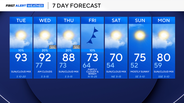
North Texas is noticeably more humid outside this morning, with temperatures in the 70s area-wide. Expect more heat and humidity into this afternoon with highs in the lower 90s. There is a slim 10% chance of an isolated shower or thunderstorm, mainly east of I-35, this afternoon.
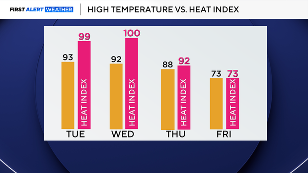
Summer makes one final push as we see feels-like temperatures close to 100° through Wednesday. The cooldown begins on Thursday as temperatures fall into the 80s, and then we really see the cooler air on Friday.
A cold front moves through Friday morning, and as it passes, we will see winds gusting up to 40 mph. There isn't much moisture associated with this front, so rain chances stay between 10-20% at best. Temperatures will be noticeably cooler, with highs falling into the lower 70s.
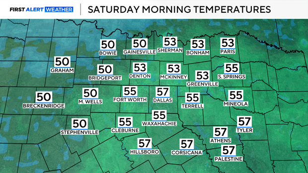
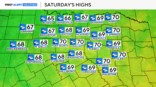
Temperatures on Saturday morning will be in the 50s, and highs will struggle to escape the 60s for many locations by the afternoon. On Sunday morning, a few of our Red River counties may wake up in the 40s, with afternoon highs in the 70s. Temperatures start to heat back up, and our humidity makes a comeback by the middle of next week.