Fall-like weather conditions are back in North Texas

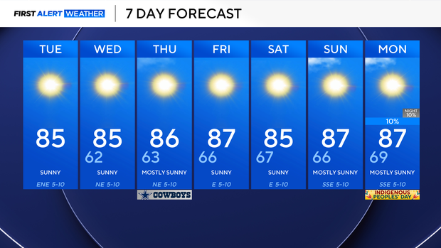
It finally feels like fall in North Texas this morning with temperatures in the 50s and 60s and low humidity. Expect more of these cool starts over the next couple of days, along with warm afternoons in the 80s.
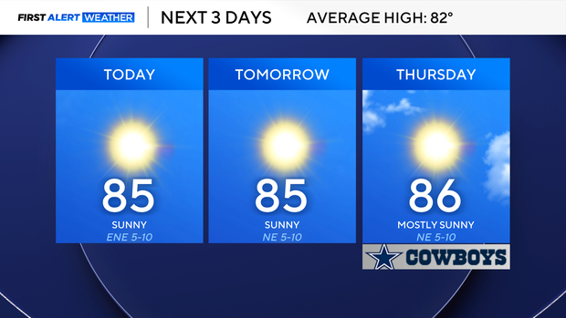
Our humidity stays low throughout the week and will become more noticeable late weekend into next week, where our overnight lows start to return to the middle to upper 60s, and then into the lower 70s. Our highs will remain above average in the middle to upper 80s. Expect our dry stretch to continue as well.
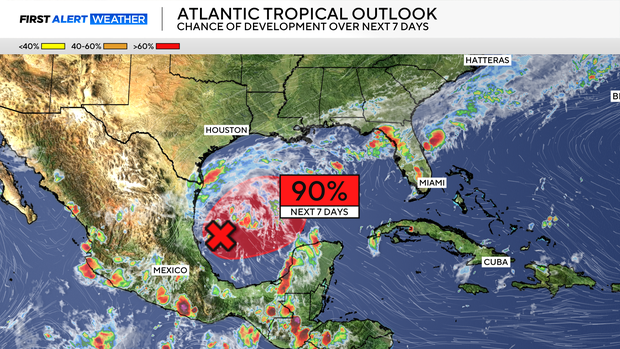
Looking towards the tropics, this is an important weather story, as the National Hurricane Center has highlighted an area east of Mexico with a 90% chance of tropical cyclone formation over the next seven days.
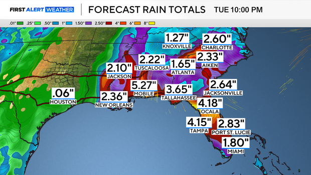
The next name on the list is Isaias. Expect Invest 92-L to become the next named storm in the coming days, which will bring impacts from southern Louisiana all the way to the Florida panhandle. While it's still too soon to predict exact impacts, a strong tropical storm or a category 1 hurricane looks possible, along with flooding rainfall and severe weather for the Gulf Coast. Here at home in DFW, we stay quiet and enjoy sunshine and plenty of days in the 80s.