Chicago First Alert Weather: A cold start to the weekend before warm-up
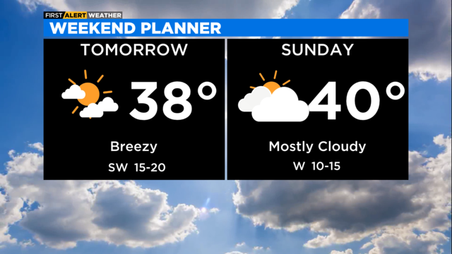
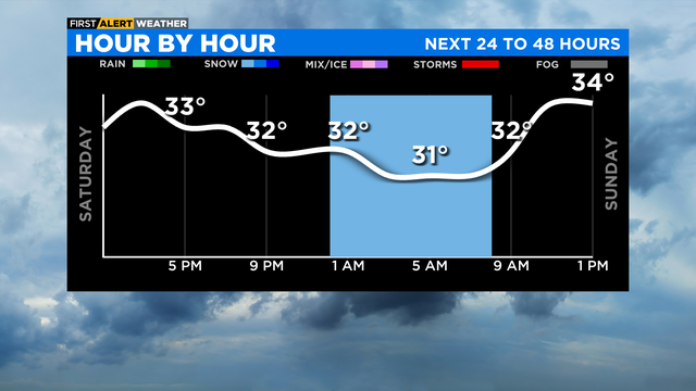
Southwest winds increase throughout the day tomorrow helping to pull a milder air mass in our direction.
Watch CBS News

Southwest winds increase throughout the day tomorrow helping to pull a milder air mass in our direction.
According to CBS 2 meteorologist Mary Kay Kleist, the bitter cold air mass moves out Friday night as a milder, southwest wind flow develops for Saturday.
According to CBS 2 meteorologist Mary Kay Kleist, an Arctic blast is on the way. As the front passes late Thursday afternoon, winds become northwesterly and open the door for the Arctic air mass to intrude.
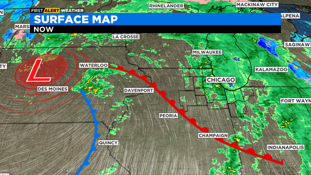
Once the front passes, a gusty northwest flow develops pulling in the Arctic air mass.
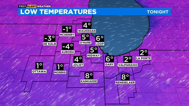
According to CBS 2 meteorologist Mary Kay Kleist, cold high pressure will hold temperatures in the single digits Tuesday night.
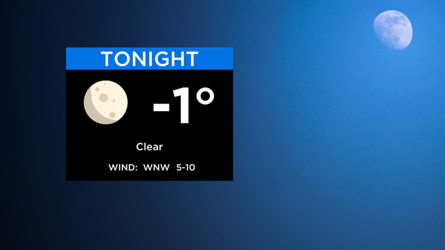
Clearing skies tonight as temperatures drop to zero. Wind chills in the morning -5 to -15.
We expect snow showers to be around Sunday morning before the system departs.
Cold air aloft is bringing wet snow showers into the backside of the system.
According to CBS 2 meteorologist Mary Kay Kleist, wet snow showers may mix into the picture near the Wisconsin line.
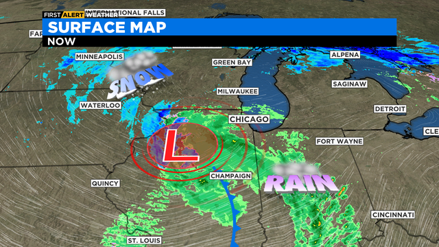
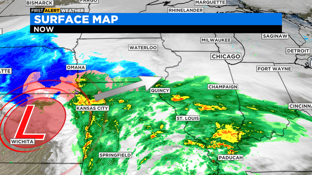
The storm system for tomorrow is expected to track from Kansas City to Milwaukee.
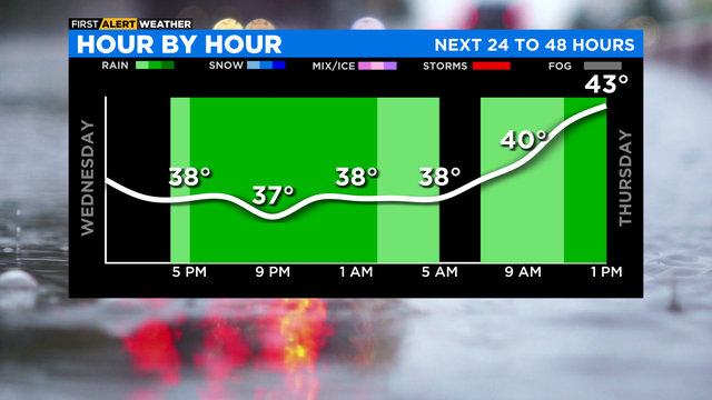
We will have rising temperatures through this evening and waves of rain.
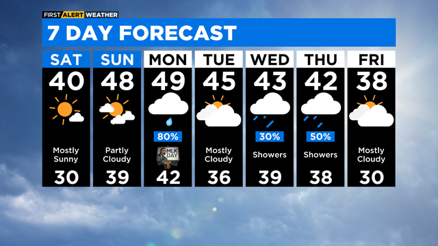
Dry this weekend with temperatures warmer than normal. Average high is 31 degrees.
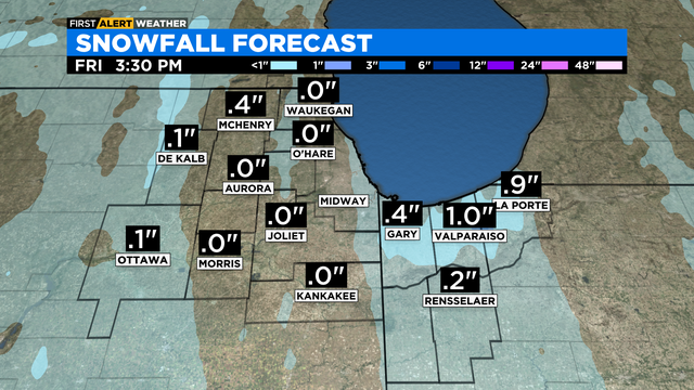
Northwest Indiana may have lake effect snow showers tomorrow morning with minor amounts of less than 1 inch.
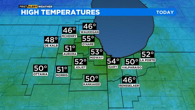
Temps reached into the 50s. Normal high is 32 degrees around this time of year.
Rain is likely Thursday as our next system moves through our region.